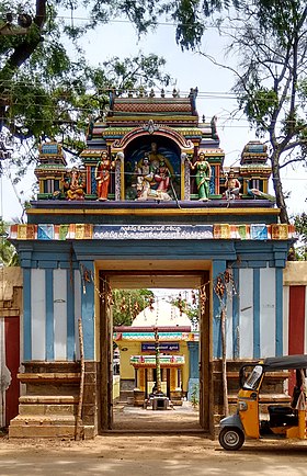
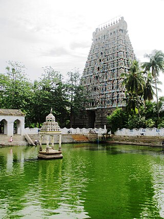
Kumbakonam, or Kudanthai, is a city municipal corporation in the Thanjavur district in the Indian state of Tamil Nadu. It is located 40 km (25 mi) from Thanjavur and 282 km (175 mi) from Chennai and is the headquarters of the Kumbakonam taluk of Thanjavur district. It is the second largest city in the district after Thanjavur. The city is bounded by two rivers, the Kaveri River to the north and Arasalar River to the south. Kumbakonam is known as a "Temple town" due to the prevalence of a number of temples here and is noted for its Mahamaham festival, which happens once in 12 years, attracting people from all over the country.
Mayiladuthurai is a Municipality and district headquarter of Mayiladuthurai district in Tamil Nadu, India. The town is located at a distance of 256 km (159 mi) from the state capital, Chennai.

Thiruvaiyaru is a panchayat town in Thanjavur District in the Indian state of Tamil Nadu.
Cholapuram is a panchayat town in the Thanjavur district of the state of Tamil Nadu, India.In ancient time, it's called as Bhairavapuram.

Jayankondam is a First Grade Municipality in Ariyalur district of Tamil Nadu in India. As of 2023, the town had a population of 46,000.

Needamangalam (Nidamangalam) formerly Yamunambalpuram, is a town panchayat in Thiruvarur district in the Cauvery Delta of Indian state of Tamil Nadu. Needamangalam was originally part of the composite Tanjore Dist during British Raj until 1997 AD. In the 18th and 19th century, it was also called Yamunambalpuram. Needamangalam is the headquarters of the Needamangalam Taluk. The town is located 20 km east of Thanjavur, 80 km east of Tiruchirappalli and 318 km south of Chennai. Needamangalam is a junction for two busy highways, (i) National Highway 67 is a National Highway in Southern Indian states of Tamil Nadu and Karnataka that runs from Nagapattinam, a sea-side town in Tamil Nadu to Gundlupet, Karnataka (ii) State Highway SH-66 connecting Kumbakonam with Adirampattinam via Mannargudi in Cauvery Delta.

Papanasam is a panchayat town in Thanjavur district in the Indian state of Tamil Nadu. It is located 25 kilometres (16 mi) from Thanjavur and 15 kilometres (9.3 mi) from Kumbakonam. The name literally translates to "Destruction of Sins" in the Tamil language. It is the suburban region of Kumbakonam.
Thiruverumbur is a neighbourhood in the city of Tiruchirapalli in the Indian state of Tamil Nadu. It was merged with the Tiruchirappalli Corporation in 2011.

Udayarpalayam is a panchayat town in the Ariyalur district of the Indian state of Tamil Nadu, near Jayankondam.

Ayyampettai is a panchayat town in Thanjavur district in the state of Tamil Nadu, India. It is located 15 km from Thanjavur and 24 km from Kumbakonam.
Valuthoor or Valathur is a small panchayat village located at papanasam taluk in Thanjavur district in the Indian state of Tamil Nadu. It is 18 km from Tanjore and 22 km from Kumbakonam. The river Kudamurutti passes through this village. In the 2011 census it had a population of 5161 in 1222 households.
Athiyur is a village in the Kumbakonam taluk of Thanjavur district, Tamil Nadu India. It is located 44 km north of the district headquarters in Thanjavur. Agriculture is the basis of the economy. Almost every job and/or occupation is in some way or another agriculturally related.
Devanancheri is a village in the Kumbakonam taluk of Thanjavur district, Tamil Nadu. It is located 42 km north of the district headquarters in Thanjavur, 8 km from Kumbakonam, and 286 km from the state capital, Chennai. The local language is Tamil.
Pandaravadai is a village in the Papanasam taluk of Thanjavur district, Tamil Nadu, India. It is located 22 km from Tanjore and 18 km from Kumbakonam. There is a river Kudamurutti helping the farmers to cultivate grains. There is also a railway station.
Mannankadu is a village in the Pattukkottai taluk of Thanjavur district, Tamil Nadu, India. It is one of the 32 villages falls under the Musugundan Nadu in the district. Mannangadu is one of the revenue village in its taluk. It is located on state highway Adirampattinam-Mannargudi-Kumbakonam, between Adirampattinam and Madukkur. It is the fourth largest village in Pattukkottai taluk, after Thamarankottai, Thambikottai and Aalathur. Total geographical area of the Village is 1002.02 hectares. The main income source of this village is Agriculture.

Thanjavur has a well-developed transport infrastructure. Thanjavur is well connected by Road, and Rail with most cities and towns in India
Maruthuvakudi, also known as Aduthurai is a small panchayat town situated near Kumbakonam,in the Thanjavur District in the Indian state of Tamil Nadu. It is the sub urban region of business city of Kumbakonam.
Rajagiri is a panchayat village in the Papanasam taluk of Thanjavur district, Tamil Nadu, India.
Palaiyur is a village within the Indian state of Tamil Nadu. Palaiyur is located 282 kilometers from Chennai, in Kuttalam Taluk, which is in the Mayiladuthurai district and shares close border with the Thanjavur district. The current population is just under 2,000. Nearby villages include: Peravoor, Nakkambadi,S.Pudur, Kokkur, and Srikandapuram.

Kalathur is a panchayat village in Peravurani panchayat Union of Thanjavur district in the Indian state of Tamil Nadu. Kalathur is a part of the Pattukkottai taluk of Thanjavur district and located 67 kilometres (42 mi) south of Thanjavur connected via State Highway 29.