Related Research Articles

The Arctic Archipelago, also known as the Canadian Arctic Archipelago, is an archipelago lying to the north of the Canadian continental mainland, excluding Greenland and Iceland.

A moulin is a roughly circular, vertical well-like shaft formed where a surface meltstream exploits a weakness in the ice. The term is derived from the French word for mill.
Wolstenholme Fjord is a fjord in Avannaata municipality, Northwest Greenland. It is located to the north of the Thule Air Base and adjacent to the abandoned Inuit settlement of Narsaarsuk.
The Salisbury Glacier is a glacier in Greenland.
The Knud Rasmussen Glacier is located in the far northwest of Greenland, to the north of the Thule Air Base. It is one of four large glaciers which feeds the Wolstenholme Fjord. The other glaciers are the Salisbury Glacier, the Chamberlin Glacier, and the Harald Moltke Glacier. The Knud Rasmussen Glacier is over 3 kilometres (1.9 mi) in length and is approximately 900 metres (3,000 ft) in width.
The Harald Moltke Glacier is a glacier in Greenland.

Harald Viggo Moltke was a Danish painter, author and explorer. As an explorer he acted as draftsman in four Arctic expeditions.

Carl Emil Hansen Ostenfeld was a Danish systematic botanist. He graduated from the University of Copenhagen under professor Eugenius Warming. He was a keeper at the Botanical Museum 1900–1918, when he became professor of botany at the Royal Veterinary and Agricultural University. In 1923, by the early retirement of Raunkiær's, Ostenfeld became professor of botany at the University of Copenhagen and director of the Copenhagen Botanical Garden, both positions held until his death in 1931. He was a member of the Royal Danish Academy of Sciences and Letters and served on the board of directors of the Carlsberg Foundation.
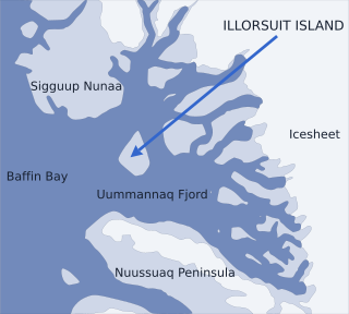
Nunavik Peninsula is a large peninsula in northwestern Greenland. It separates two cultural and geographical regions of northwestern Greenland: Uummannaq Fjord region in the southeast, and Upernavik Archipelago in the north.

Bluie was the United States military code name for Greenland during World War II. It is remembered by the numbered sequence of base locations identified by the 1941 United States Coast Guard South Greenland Survey Expedition, and subsequently used in radio communications by airmen unfamiliar with pronunciation of the Greenlandic Inuit and Danish names of those locations. These were typically spoken BLUIE (direction) (number), with direction being east or west along the Greenland coast from Cape Farewell.
Neptune Glacier is a glacier on the east coast of Alexander Island, Antarctica, 12 nautical miles (22 km) long and 4 nautical miles (7 km) wide, flowing east into George VI Sound and the George VI Ice Shelf to the south of Triton Point. Although Neptune Glacier is not located within the mountain range Planet Heights, the glaciers name derives from the mountain range along with many other nearby glaciers named after planets of the Solar System. There are also other nearby landforms named in association with these glaciers. The glacier was first sighted from the air by Lincoln Ellsworth on November 23, 1935, and roughly mapped from photos obtained on that flight by W.L.G. Joerg. The mouth of the glacier was positioned in 1936 by the British Graham Land Expedition (BGLE). Named by the United Kingdom Antarctic Place-Names Committee (UK-APC) for the planet Neptune following a Falkland Islands Dependencies Survey (FIDS) survey in 1949. The head of the glacier was mapped from air photos taken by the Ronne Antarctic Research Expedition (RARE), 1947–48, by Searle of the FIDS in 1960.
Planet Heights is a series of summits running along an ice-free ridge, extending 24 nautical miles (44 km) in a north-south direction between the southernmost extremity of the LeMay Range and George VI Sound in the east part of Alexander Island, Antarctica. Many landforms and nearby features are named in association with this mountain range; some of these include landforms named after astronomers, satellites, planets and other things related to astrology and astrophysics. The mountain range was first mapped from air photos taken by the Ronne Antarctic Research Expedition (RARE), 1947–48, by Searle of the Falkland Islands Dependencies Survey (FIDS) in 1960. Named by the United Kingdom Antarctic Place-Names Committee (UK-APC) from association with the nearby glaciers named for planets of the Solar System. The only planet that is not featured in any of these glaciers is the planet Earth, as there are no glaciers named "Earth Glacier" and this glacier does not exist.
Camp TUTO was a major U.S. Army operated research camp at the foot of the Greenland ice cap, 18 miles (29 km) east of Thule Air Base. It operated from 1954 to 1966, with revisits for follow-up research.

The Lemon Range or Lemon Mountains is a mountain range in King Christian IX Land, eastern Greenland. Administratively this range is part of the Sermersooq Municipality.
Borgtinderne, meaning 'Castle Pinnacles' in the Danish language, is a mountain range in King Christian IX Land, eastern Greenland. Administratively this range is part of the Sermersooq Municipality.
Ejnar Mikkelsen Range is a mountain range in King Christian IX Land, eastern Greenland. Administratively it is part of the Sermersooq Municipality.
The Lindbergh Range or Lindbergh Nunataks is a mountain range in King Christian IX Land, eastern Greenland. Administratively the range is part of the Sermersooq Municipality.
Karrat Fjord is a fjord in Avannaata municipality in western Greenland.

The Danish Expedition to Queen Louise Land, also known as the Danish expedition to Queen Louise Land and straight through Greenland’s ice sheet, as well as Danish North Greenland Expedition, was an expedition to northeastern Greenland and across the Greenland ice sheet in 1912–1913. It was the first such venture that went across the broad central part of Greenland. The expedition was led by Johan Peter Koch (1870–1928). Its purpose was to study the vast ice sheet, making glaciological and meteorological observations. Instead of sled dogs, sixteen Icelandic ponies were chosen for transporting 20 tons of materials, including 6 t of compressed hay to feed the ponies.
References
76°43′N68°26′W / 76.71°N 68.44°W
| | This Greenland location article is a stub. You can help Wikipedia by expanding it. |