Knud Johan Victor Rasmussen was a Greenlandic-Danish polar explorer and anthropologist. He has been called the "father of Eskimology" and was the first European to cross the Northwest Passage via dog sled. He remains well known in Greenland, Denmark and among Canadian Inuit.

Ilulissat, formerly Jakobshavn or Jacobshaven, is the municipal seat and largest town of the Avannaata municipality in western Greenland, located approximately 350 km (220 mi) north of the Arctic Circle. With a population of 4,670 as of 2020, it is the third-largest city in Greenland, after Nuuk and Sisimiut. The city is home to almost as many sled-dogs as people.

Ludvig Mylius-Erichsen was a Danish author, ethnologist, and explorer, from Ringkøbing. He was most notably an explorer of Greenland.
Jørgen Brønlund Fjord or Bronlund Fjord is a fjord in southern Peary Land, northern Greenland.

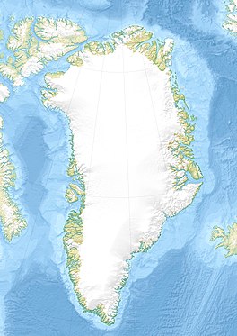
Peary Land is a peninsula in northern Greenland, extending into the Arctic Ocean. It reaches from Victoria Fjord in the west to Independence Fjord in the south and southeast, and to the Arctic Ocean in the north, with Cape Morris Jesup, the northernmost point of Greenland's mainland, and Cape Bridgman in the northeast.
Wolstenholme Fjord is a fjord in Avannaata municipality, Northwest Greenland. It is located to the north of the Thule Air Base and adjacent to the abandoned Inuit settlement of Narsaarsuk.
The Salisbury Glacier is a glacier in Greenland.
The Chamberlin Glacier is located in the far northwest of Greenland, to the north of the Thule Air Base. It is one of four large glaciers which feeds the Wolstenholme Fjord. The other glaciers are the Salisbury Glacier, the Knud Rasmussen Glacier, and the Harald Moltke Glacier. The Chamberlin Glacier is the longest of the four glaciers and is approximately 800 metres (2,600 ft) in width.
The Knud Rasmussen Glacier is located in the far northwest of Greenland, to the north of the Thule Air Base. It is one of four large glaciers which feeds the Wolstenholme Fjord. The other glaciers are the Salisbury Glacier, the Chamberlin Glacier, and the Harald Moltke Glacier. The Knud Rasmussen Glacier is over 3 kilometres (1.9 mi) in length and is approximately 900 metres (3,000 ft) in width.

Harald Viggo Moltke was a Danish painter, author and explorer. As an explorer he acted as draftsman in four Arctic expeditions.
Brønlundhus, on some maps also Brønlundfjord, is a former research station and radio station located on the western shore of Jørgen Brønlund Fjord in southern Peary Land, in northern Greenland. It is named after Greenlandic Arctic researcher Jørgen Brønlund, or after the namesake fjord on which it is located. It is close to the mouth of Jørgen Brønlund Fjord where it opens into Independence Fjord.

Nuuk Art Museum is a local museum in Greenland, located in Nuuk, the capital. The museum contains a notable collection of paintings, watercolors, drawings, graphics, figures in soapstone, ivory, and wood, with many items collected by the businessman Svend Junge. Of particular note is a collection of over 150 paintings by Emanuel A. Petersen.
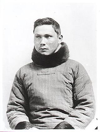
Jørgen Brønlund was a Greenlandic polar explorer, educator, and catechist. He participated in two Danish expeditions to Greenland in the early 20th century.
Events from the year 1851 in Denmark.
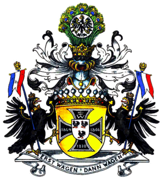
The Moltke family is an old German noble family. The family was originally from Mecklenburg, but apart from Germany, some of the family branches also resided throughout Scandinavia. Members of the family have been noted as statesmen, high-ranking military officers and major landowners in Denmark and Prussia.
Saunders Island is an island in North Star Bay, Baffin Bay in the Avannaata municipality of northwest Greenland. The island is named after Commander James Saunders of the British Royal Navy.

Bernstorff Fjord is a fjord in King Frederick VI Coast, eastern Greenland.
Thorland is a peninsula in the King Frederick VI Coast, southeastern Greenland. It is a part of the Sermersooq municipality.

Cape Harald Moltke is a headland in Peary Land, North Greenland. Administratively it is part of the Northeast Greenland National Park.