Related Research Articles

A ghost town, deserted city, extinct town, or abandoned city is an abandoned settlement, usually one that contains substantial visible remaining buildings and infrastructure such as roads. A town often becomes a ghost town because the economic activity that supported it has failed or ended for any reason. The town may have also declined because of natural or human-caused disasters such as floods, prolonged droughts, extreme heat or extreme cold, government actions, uncontrolled lawlessness, war, pollution, or nuclear and radiation-related accidents and incidents. The term can sometimes refer to cities, towns, and neighborhoods that, though still populated, are significantly less so than in past years; for example, those affected by high levels of unemployment and dereliction.

The Doukhobors or Dukhobors are a Spiritual Christian ethnoreligious group of Russian origin. They are known for their pacifism and tradition of oral history, hymn-singing, and verse. They reject the Russian Orthodox priesthood and associated rituals, believing that personal revelation is more important than the Bible. Facing persecution by the Russian government for their nonorthodox beliefs, many migrated to Canada between 1899 and 1938, where most currently reside.

Veregin is a special service area in Saskatchewan, Canada. It is located 50 kilometres northeast of Yorkton, and 10 km to the west of Kamsack.

The Kootenay River or Kootenai River is a major river of the Northwest Plateau in southeastern British Columbia, Canada, and northern Montana and Idaho in the United States. It is one of the uppermost major tributaries of the Columbia River, the largest North American river that empties into the Pacific Ocean. The Kootenay River runs 781 kilometres (485 mi) from its headwaters in the Kootenay Ranges of the Canadian Rockies, flowing from British Columbia's East Kootenay region into northwestern Montana, then west into the northernmost Idaho Panhandle and returning to British Columbia in the West Kootenay region, where it joins the Columbia at Castlegar.

New Denver is a village in the Central Kootenay region of British Columbia, Canada at the mouth of Carpenter Creek, on the east shore of Slocan Lake, in the West Kootenay region of southeastern British Columbia. The village is 47 kilometres (29 mi) west of Kaslo on Highway 31A, and 47 kilometres (29 mi) southeast of Nakusp and 32 kilometres (20 mi) northeast of Slocan on Highway 6.

Salmo is a village in the West Kootenay region of southeastern British Columbia. It is mostly on the north side of Erie Creek at the confluence with the Salmo River. The place lies largely east of the junction of BC Highway 3, and BC Highway 6.
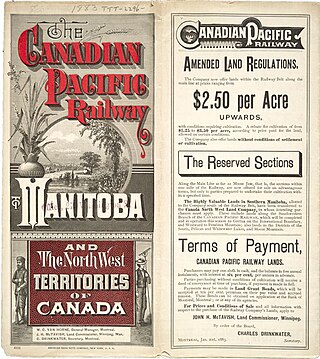
A block settlement is a particular type of land distribution which allows settlers with the same ethnicity to form small colonies. This settlement type was used throughout western Canada between the late 19th and early 20th centuries. Some were planned and others were spontaneously created by the settlers themselves. As a legacy of the block settlements, the three Prairie Provinces have several regions where ancestries other than British are the largest, unlike the norm in surrounding regions.

Del Bonita is a hamlet in southern Alberta, Canada within Cardston County. It is located approximately 49 km (30 mi) south of Magrath at the junction of Highway 62 and Highway 501. Due to its location near the Canada–United States border, it serves as a port of entry into the U.S. state of Montana at the nearby Del Bonita Border Crossing which is located 3 km (1.9 mi) to the south. Del Bonita is a name derived from Spanish meaning "of the pretty".
Raspberry is an unincorporated community in the West Kootenay region of southeastern British Columbia. On the northeast side of the Columbia River adjacent to the mouth of Norns Creek, the residential area is part of Greater Castlegar.
Ootischenia is south of Castlegar on the east side of the Columbia River in the West Kootenay region of southern British Columbia.
Brilliant is in the West Kootenay region of southeastern British Columbia. The locality is on the northeast side of the Columbia River, and on the west shore at the mouth of the Kootenay River. This minor residential area, west of Highway 3A, is part of Greater Castlegar.
Burton is a settlement on the east shore of Lower Arrow Lake in the West Kootenay region of southeastern British Columbia.

Piikani 147, formerly Peigan 147, is an Indian reserve of the Piikani Nation in Alberta. It is located 61 km (38 mi) west of the City of Lethbridge. It has a land area of 426.992 km2 (164.863 sq mi), making it the fourth-largest Indian reserve in Canada, and lies at an elevation of 1,046 m (3,432 ft). The Canada 2011 Census reported a population of 1,217 inhabitants. It is bordered by the Municipal District of Willow Creek No. 26 on its north and east, and by the Municipal District of Pincher Creek No. 9 on its west and south. The nearest outside communities are Fort Macleod and Pincher Creek.
Pass Creek is an unincorporated community on the east side of Norns Creek in the West Kootenay region of southeastern British Columbia. The rural neighbourhood on Pass Creek Rd is about 11 kilometres (7 mi) north of Castlegar.

Quartz Creek is a creek in Selkirk Mountains in the West Kootenay region of the Regional District of Central Kootenay in British Columbia, Canada. This short creek flows into the Salmo River in Ymir, British Columbia. The source of the creek is just to the west of the Ymir townsite a few kilometres up Round Mountain. Quartz creek was mined for gold in the 1860s. The creek is the source of drinking water in the town of Ymir. The Regional District of Central Kootenay added a filtration system in the early 2010s for the community.
Columbia Gardens is in the West Kootenay region of southern British Columbia. The locality is east of Trail, and near the Boundary-Waneta Border Crossing.
Hardy Mountain Doukhobor Village is in the Boundary region of south central British Columbia. The former Doukhobor community is about 4.3 kilometres (2.7 mi) northwest of Grand Forks on Hardy Mountain Rd.
Gold Creek is a creek in Stevens County, Washington. Gold Creek flows into Sheep Creek, a tributary of the Columbia. The Gold Creek Basin is located around Gold Creek.
Lemon Creek is an unincorporated community on the east side of the Slocan River in the West Kootenay region of southeastern British Columbia. The locality is on BC Highway 6 about 8 kilometres (5 mi) south of Slocan, and 62 kilometres (39 mi) north of Castlegar.
South Slocan is an unincorporated community in rural British Columbia with a population of approximately 100 people, many of whom are followers of the Doukhobors religion. It is located on the northwest shore of the Kootenay River in the West Kootenay region of southeastern British Columbia. The village comprises 51 households. A former railway junction on BC Highway 6, it is approximately 24 kilometres (15 mi) northeast of Castlegar, and 20 kilometres (12 mi) southwest of Nelson. Its postal category is Rural Route One.
References
- ↑ "Champion Creek Settlement". BCGNIS. Retrieved 8 January 2012.
- ↑ Basque Garnet (1982), British Columbia Ghost Town Atlas, Sunfire Publications Limited
- ↑ Kalmakoff, Jonathan J. "Doukhobor Historical Maps". Doukhobor.org. Doukhobor Genealogy Website. Archived from the original on February 4, 2012. Retrieved January 8, 2012.