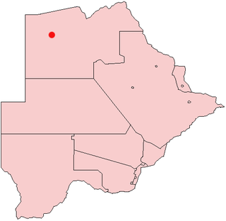
Changate is a village in Central District of Botswana.
Changate is a village in Central District of Botswana.
It is located close to the border with Zimbabwe.
It has a primary school.
It has a clinic.

Demographic features of the population of Botswana include population density, ethnicity, education level, health of the populace, economic status, religious affiliations and other aspects.
Cherrywood Village is a neighborhood and former city in Jefferson County, Kentucky, United States. Cherrywood Village was annexed by the City of St. Matthews in 2001. The population was 327 at the 2000 census.
Hukuntsi is a village in Kgalagadi District (Kalahari) in Botswana.

Gumare or Gomare is a rural village located in the North-West District of Botswana, near the Okavango Delta. The population of Gumare was 6,067 in 2001 census, but had risen to 8,532 iby the 2011 census.
Shoshong is a town in Botswana, formerly the chief settlement of the eastern Bamangwato.

Shakawe is a village located in the northwest corner of Botswana at the beginning of the Okavango Delta, close to Namibia and Angola. Shakawe is awakening from its former status as a sleepy little outpost on the Okavango. For travellers, Shakawe means a Botswana entry or exit stamp or a staging post for a visit to the Tsodilo Hills, 40 km away. For Southern African holiday-makers, it is most often the start of a fishing trip in the Okavango Panhandle. It also provides access to the Caprivi Strip. The record high temperature ever registered in Shakawe was 39.6 °C (103.3 °F). The lowest temperature registered in Shakawe was −6.1 °C (21.0 °F).
Khuis is a village in Kgalagadi District of Botswana. It is located close to the border with South Africa. Khuis has a primary school, and the population was 897 in 2011 census.
Kolonkwaneng is a village in Kgalagadi District of Botswana. It is located close to the border with South Africa and it has a primary school. The population was 599 in 2011 census.
Khawa is a village in Kgalagadi District of Botswana. It is located in the southern part of the district and has a primary school. It has a Christian church and a primitive clinic. The annual Khawa desert challenge is held here. The people speak Setswana as well as Afrikaans, English is understood. The vegetation in and around the village is highly overgrazed and it may seem like a desert inside the village although it is located in a grassland area. All the roads in and around the village are dirtroads. The population was 817 in 2011 census.
Maralaleng is a village in Kgalagadi District of Botswana. It is located east of the district capital Tsabong and has a primary school. The climate in Maraleng is considered to be a desert climate. The population is 586 according to a 2011 census.
Maleshe is a village in Kgalagadi District of Botswana. It is located close the capital of the district, Tshabong, and it has a primary school. The population was 462 in 2011 census. Maleshe also has a clinic, small business tuckshops and retailers.
Maubelo is a village in Kgalagadi District of Botswana. It is located south of the district capital Tsabong and has a primary school. The population was 514 in the 2011 census.
Tshane is a village in Kgalagadi District of Botswana. It is situated in Kalahari Desert, and is served by local Tshane Airport. The village has a primary school and the population was 1020 in 2011 census. It has a !Xóõ cultural centre. The lowest temperature registered in Tshane was −8.0 °C (17.6 °F). The record high temperature registered in Tshane was 41.0 °C (105.8 °F).
Lokgwabe is a village in Kgalagadi District of Botswana. It is located in the Kalahari Desert and the village has a primary school. The population was 1,417 in 2011 census.
Hunhukwe is a village in Kgalagadi District of Botswana. It is located in the northern part of the district, and it has a primary school and a clinic. The population was 753 in 2011 census.
Make is a village in Kgalagadi District of Botswana. It is located in the Kalahari Desert and it has a primary school. The population was 398 in 2011 census.
Inalegolo is a village in Kgalagadi District of Botswana. It is located in the north-east part of the district, in Kalahari Desert, it has a primary school and a health post. The population was 533 in 2011 census. The chief of the village is Kgosi Keamogetse Ghubi.
Nata is a village in the Central District of Botswana. Located in the north of the district, the village is served by Nata Airport. The population was 6,802 at the 2011 census. The village of Nata lies along the Nata River, which carries its rainy season flow to the Makgadikgadi Pans, a seasonal hypersaline lake.The village has 6 wards named Sekao, Maaloso, Kachikao, Manakanagore, Makwenaejang and Basimane.
Lerala is a village in Central District of Botswana. The village is located at the south-eastern end of the Tswapong Hills, 30 km (19 mi) from the Limpopo River and the border with South Africa and approximately 90 km (56 mi) east of Palapye. The population of Lerala was 6,871 in the 2011 census, which was a 20.5% increase from the 2001 population.
Makaleng is a village in the North-East district of Botswana, roughly 60 km from Francistown.
20°24′51″S27°15′41″E / 20.41417°S 27.26139°E