Helvellyn is a mountain in the English Lake District, the highest point of the Helvellyn range, a north–south line of mountains to the north of Ambleside, between the lakes of Thirlmere and Ullswater.

Fairfield is a fell in the English Lake District. It is the highest of a group of hills in the Eastern Fells, standing to the south of the Helvellyn range.

Grasmoor is a mountain in the north-western part of the Lake District, northern England. It is the highest peak in a group of hills between the villages of Lorton, Braithwaite and Buttermere, and overlooks Crummock Water.

Cunsey Beck is one of several rivers and streams that replenish the lake of Windermere in the English Lake District. Being just over two miles (3.2 km) in length and generally slow flowing, the stream descends some 87 feet from the southern end of Esthwaite Water, which it drains, to the western banks of Windermere near an island called Ling Holm.

The Trout Beck is a fast flowing stream of the Lake District in North West England. It is one of the main sources of replenishment for Windermere, and is part of the Leven catchment. Its name comes from Old Norse and appears in documents from 1292 as Trutebyk. The river rises between the peaks of Stony Cove Pike and Thornthwaite Crag in the High Street range, at a height of about 1,970 feet (600 m).

Seat Sandal is a fell in the English Lake District, situated four kilometres north of the village of Grasmere from where it is very well seen. Nevertheless, it tends to be overshadowed by its more illustrious neighbours in the Eastern Fells, Helvellyn and Fairfield.

The River Wampool is a river flowing through north western Cumbria in England. It is in the Waver and Wampool catchment which includes the towns of Silloth and Wigton.

The River Waver is a river in Cumbria, England. The river rises at Wavergillhead . It is fed by the northwards flowing Thornthwaite Beck and Pow Gill either side of Bolton Wood Lane. The "Little Waver", rising at Catlands Hill, joins at Waterside near Woodrow. The river then takes a northward course via Waverton and Waverbridge, both of which are named for the river, before turning sharply westward at Abbeytown. The river then goes north, running into Moricambe Bay, an inlet of the Solway Firth.
Thornthwaite Crag is a fell in the English Lake District, standing to the west of Haweswater Reservoir. It is a focal point of the Far Eastern Fells, standing at the head of several valleys.

Whinlatter is a small fell in the north west of the English Lake District, just north of the Whinlatter Pass. It is easily climbed from the top of the Whinlatter Pass, through the Forestry England plantations. The Whinlatter Visitor's Centre, a popular tourist attraction, is on the south side of the fell. The hill is part of a horseshoe around the valley of Aiken Beck. The fell's name originates from a combination of the Old Norse and Gaelic languages. With the Old Norse word 'hvin' meaning gorse or furze, and the Gaelic word 'lettir' meaning slope, the name translates as "The Gorse or furze-covered slope".

Skirden Beck is a minor river in Lancashire, England. It is approximately 4.3 miles (6.85 km) long and has a catchment area of 18.87 square miles (48.882 km2).

Lord's Seat is a fell in the English Lake District. It is the highest of the group of hills north of Whinlatter Pass in the North Western Fells. The slopes of Lord's Seat are extensively forested.

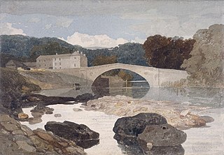
The River Greta is a river in County Durham, England. It is a tributary of the River Tees and flows through the northern part of the old North Riding of Yorkshire. The name "Greta" derives from the Old Norse "Griótá", meaning "stony stream".

Newlands Beck is a minor river of Cumbria in England.

Coledale Beck is a minor river running through Cumbria in England.

Scope Beck is a minor river in the county of Cumbria in England.

Arkle Beck is the stream running through the valley of Arkengarthdale in the Yorkshire Dales, England. It is a tributary of the River Swale, which it joins just past Reeth at Grinton Bridge. The beck itself has several tributaries which include:

Grisedale is a south east facing Dale in Cumbria, England, 8 miles (13 km) east of Sedbergh, and 7 miles (11 km) west of Hawes. Grisedale Beck, which drains Baugh Fell, flows down the dale eastwards, and on reaching the valley floor at Garsdale, forms the River Clough before turning westwards towards the Irish Sea. A small part of the north-eastern side of the dale is in North Yorkshire, however, until 1974, all of the area around, and including Grisedale, was part of the West Riding of Yorkshire. The dale was largely depopulated of its working farmers during the 20th century, however, some of the houses have been re-occupied by non-agricultural inhabitants.