Chapi Urqu

Last updated
Chapi Urqu
Peru physical map.svg
Red triangle with thick white border.svg
Chapi Urqu
Peru
Highest point
Elevation 4,800 m (15,700 ft) [1]
Coordinates 13°04′30″S74°57′38″W / 13.07500°S 74.96056°W / -13.07500; -74.96056 Coordinates: 13°04′30″S74°57′38″W / 13.07500°S 74.96056°W / -13.07500; -74.96056
Geography
Location Peru, Huancavelica Region, Huancavelica Province
Parent range Andes

Chapi Urqu (Quechua chapi tin, urqu mountain, [2] "tin mountain", hispanicized spelling Chapeorcco) is a mountain in the Andes of Peru, about 4,800 m (15,700 ft) high. It is located in the Huancavelica Region, Huancavelica Province, Huacocolpa District. Chapi Urqu lies northeast of Inqhana and Yana Urqu. [1]

Tin Chemical element with atomic number 50

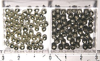
Tin is a chemical element with the symbol Sn (from Latin: stannum) and atomic number 50. It is a post-transition metal in group 14 of the periodic table of elements. It is obtained chiefly from the mineral cassiterite, which contains stannic oxide, SnO2. Tin shows a chemical similarity to both of its neighbors in group 14, germanium and lead, and has two main oxidation states, +2 and the slightly more stable +4. Tin is the 49th most abundant element and has, with 10 stable isotopes, the largest number of stable isotopes in the periodic table, thanks to its magic number of protons. It has two main allotropes: at room temperature, the stable allotrope is β-tin, a silvery-white, malleable metal, but at low temperatures it transforms into the less dense grey α-tin, which has the diamond cubic structure. Metallic tin does not easily oxidize in air.

Peru republic in South America

Peru, officially the Republic of Peru, is a country in western South America. It is bordered in the north by Ecuador and Colombia, in the east by Brazil, in the southeast by Bolivia, in the south by Chile, and in the west by the Pacific Ocean. Peru is a megadiverse country with habitats ranging from the arid plains of the Pacific coastal region in the west to the peaks of the Andes mountains vertically extending from the north to the southeast of the country to the tropical Amazon Basin rainforest in the east with the Amazon river.

Related Research Articles

Churcampa Province Province in Huancavelica, Peru

The Churcampa Province is a province located in the Huancavelica Region of Peru. It is one of the seven that make up that region. The capital of the province is Churcampa.

Huaytará Province Province in Huancavelica, Peru

Huaytará Province is the largest of seven provinces located in the Huancavelica Region of Peru. The capital city is Huaytará. The province has a population of 17,247 inhabitants as of 2017.

Huancavelica Province Province in Huancavelica, Peru

The Huancavelica Province is one of seven provinces located in the Huancavelica Region of Peru. The capital of this province is the city of Huancavelica.

Castrovirreyna Province Province in Huancavelica, Peru

The Castrovirreyna Province is one of seven provinces located in the Huancavelica Region of Peru. The capital of this province is the city of Castrovirreyna.

Acoria District District in Huancavelica, Peru

Acoria District is one of nineteen districts of the Huancavelica Province in Peru.

Huachocolpa District is one of nineteen districts of the province Huancavelica in Peru.

Yana Urqu or Yana Urku may refer to:

Hatun Urqu or Jatun Urqu may refer to:

Hatun Urqu (Huancavelica)

Hatun Urqu is a mountain in the Huancavelica Region in Peru, about 4,900 metres (16,076 ft) high. It is situated in the Huaytará Province, in the west of the Pilpichaca District. Hatun Urqu lies south of the mountain Yana Urqu. Between these mountains there is an intermittent stream. It flows to the river Qullpamach'ay south of Hatun Urqu.

Q'illu Urqu may refer to:

Yana Urqu (Castrovirreyna) mountain in Peru

Yana Urqu is a mountain in the Chunta mountain range in the Andes of Peru, about 5,000 metres (16,404 ft) high. It is located in the Huancavelica Region, Castrovirreyna Province, Santa Ana District. Yana Urqu lies south of Wayra Q'asa.

Awqa Urqu mountain in Peru

Awqa Urqu is a 4,982-metre-high (16,345 ft) mountain in the Chunta mountain range in the Andes of Peru. It is situated in the Huancavelica Region, Castrovirreyna Province, Aurahuá District. Awqa Urqu lies southeast of Wichinka Lake.

Qarwa Urqu (Huancavelica)

Qarwa Urqu is a mountain in the Chunta mountain range in the Andes of Peru, about 4,600 metres (15,092 ft) high. It lies in the Huancavelica Region, Huancavelica Province, Huancavelica District, northwest of Antarasu.

Chawpi Urqu may refer to:

Yana Urqu (Huancavelica)

Yana Urqu is a mountain in the Chunta mountain range in the Andes of Peru, about 5,000 metres (16,404 ft) high. It is located in the Huancavelica Region, Huancavelica Province, Huacocolpa District. Yana Urqu lies northwest of Inqhana and northeast of Wayra Q'asa.

Yana Urqu (Chapi Urqu)

Yana Urqu is a 4,890-metre-high (16,040 ft) mountain in the Andes of Peru. It is located in the Huancavelica Region, Huancavelica Province, Huacocolpa District. Yana Urqu lies southeast of Chapi Urqu and northeast of Inqhana.

Kachi Machay Urqu mountain in Peru

Kachi Mach'ay Urqu is a mountain in the Chunta mountain range in the Andes of Peru, about 5,000 m (16,000 ft) high. It is located in the Huancavelica Region, Huancavelica Province, Huancavelica District. Kachi Mach'ay Urqu lies west of Antarasu and northeast of Wachu Intiyuq.

Chawpi Urqu (Huancavelica)

Chawpi Urqu is a mountain in the Andes of Peru which reaches a height of approximately 4,400 m (14,400 ft). It is located in the Huancavelica Region, Churcampa Province, Chinchihuasi District.

Yanaorco (Coris-Locroja) mountain in Peru

Yanaorco is a mountain in the Andes of Peru which reaches a height of approximately 4,400 m (14,400 ft). It is located in the Huancavelica Region, Churcampa Province, on the border of the districts of Coris and Locroja.

Yana Orjo (Chinchihuasi-Cosme) mountain in Peru

Yana Orjo is a mountain in the Andes of Peru which reaches a height of approximately 4,400 m (14,400 ft). It is located in the Huancavelica Region, Churcampa Province, on the border of the districts of Chinchihuasi and Cosme.

References

  1. 1 2 escale.minedu.gob.pe - UGEL map of the Huancavelica Province 1 (Huancavelica Region)
  2. Teofilo Laime Ajacopa, Diccionario Bilingüe Iskay simipi yuyayk'ancha, La Paz, 2007 (Quechua-Spanish dictionary)