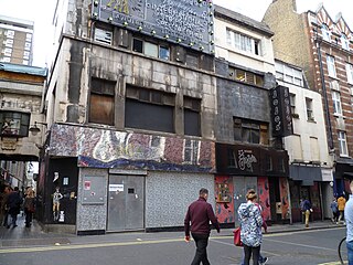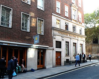
Haymarket is a street in the St James's area of the City of Westminster, London. It runs from Piccadilly Circus in the north to Pall Mall at the southern end. Located on the street are the Theatre Royal, His Majesty's Theatre, New Zealand House, a cinema complex and restaurants.

Pall Mall is a street in the St James's area of the City of Westminster, Central London. It connects St James's Street to Trafalgar Square and is a section of the regional A4 road. The street's name is derived from pall-mall, a ball game played there during the 17th century, which in turn is derived from the Italian pallamaglio, literally "ball-mallet".

St James's is a central district in the City of Westminster, London, forming part of the West End. The area was once part of the northwestern gardens and parks of St. James's Palace. During the Restoration in the 17th century, the area was developed as a residential location for the British aristocracy, and around the 19th century was the focus of the development of their gentlemen's clubs. Once part of the parish of St Martin in the Fields, much of it formed the parish of St James from 1685 to 1922. Since the Second World War the area has transitioned from residential to commercial use.

Great Marlborough Street is a thoroughfare in Soho, Central London. It runs east of Regent Street past Carnaby Street towards Noel Street.

The Highway, part of which was formerly known as the Ratcliffe Highway, is a road in the London Borough of Tower Hamlets, in the East End of London. The route dates back to Roman times. In the 19th century it had a reputation for vice and crime and was the location of the Ratcliff Highway murders. Prior to a renaming programme of 1937, different parts of the route had different names depending on what district they were in.

Coventry Street is a short street in the West End of London, connecting Piccadilly Circus to Leicester Square. Part of the street is a section of the A4, a major road through London. It is named after the politician Henry Coventry, secretary of state to Charles II.

Long Acre is a street in the City of Westminster in central London. It runs from St Martin's Lane, at its western end, to Drury Lane in the east. The street was completed in the early 17th century and was once known for its coach-makers, and later for its car dealers.

Queen's Gate is a street in South Kensington, London, England. It runs south from Kensington Gardens' Queen's Gate to Old Brompton Road, intersecting Cromwell Road.

The A2216 is an A road in south London, England suburbia. It runs from the A215 in Denmark Hill to the A212 in Sydenham. Part of the road is an ancient thoroughfare, Lordship Lane. In Dulwich, the road runs via the A205 South Circular Road.

St Paul's Cathedral School is an independent school associated with St Paul's Cathedral in London and is located in New Change in the City of London.

Brewer Street is a street in the Soho area of central London, running for about 350 metres west to east from Glasshouse Street to Wardour Street.

Fore Street is a street in the City of London, England, near the Barbican Centre. It runs from Wood Street to Fore Street Avenue and is joined by Moor Lane on its north side. The street was extensively damaged by Nazi bombing during World War II and, following later development, nothing now remains of its original buildings other than St Giles-without-Cripplegate, which is a short distance away from the modern street.

West Street is a street in London, that runs from Shaftesbury Avenue in the north to Upper St Martin's Lane in the south. It is joined by Litchfield Street on its south side and the pedestrian Tower Court on the north side. The east side of the street is in the London Borough of Camden and the western side in the City of Westminster.

Essex Street is a street in the City of Westminster that runs from Milford Lane in the south to Strand in the north. It is joined by Little Essex Street on its western side and Devereux Court on the eastern side. It was laid out by Nicholas Barbon in around 1675 or 1680 and contains a number of listed buildings.

Milford Lane is a narrow street in the City of Westminster that runs from Strand in the north to a brief walkway section leading to Temple Place in the south. It is joined by Little Essex Street and Essex Street on its eastern side. Maltravers Street once joined the lane to Arundel Street, but ceased to exist when building work at 190 Strand was completed.

South Audley Street is a major shopping street in Mayfair, London. It runs north to south from the southwest corner of Grosvenor Square to Curzon Street.

King Street is a street in the St James's district of the City of Westminster. It runs south-west to north-east from St James's Street to St James's Square.

Russia Row is a street in the City of London that runs between Milk Street and Trump Street on the northern side of the former Honey Lane Market. Russia Court, formerly Robin Hood Court, the home of the Russia Company, was once located on the northern side of the street and the City of London School on the south side. The street is thought to have received its name around 1804, shortly before Russia decided to enter the Napoleonic Wars on the same side as Britain. It was damaged by German bombing during the Second World War and has since been completely rebuilt.

Trump Street is a street in the City of London that was originally known as Trumpadere Street, probably after the trumpet or horn makers who once worked there or in the adjacent Trump Alley. It was built after the Great Fire of London (1666) but completely destroyed by bombing during the Second World War and has since been entirely rebuilt.

Milk Street in the City of London, England, was the site of London's medieval milk market. It was the location of the parish church of St Mary Magdalen which was destroyed in the Great Fire of London in 1666 and then of Honey Lane Market and the City of London School. The street was seriously damaged by German bombing during the Second World War and has since been completely rebuilt. Nothing remains of its former buildings.


