

Charlotteville is a village lying on the northeastern tip of Tobago on Man-o-War Bay.
Charlotteville is a village lying on the northeastern tip of Tobago on Man-o-War Bay.
The first European settlement on Man-o-War Bay was part of the colony of Nieuw Walcheren established by Jan de Moor, the burgomaster of Vlissingen in the Netherlands. [1] :115–119 [2] :55–59 The first settlement, established in 1633, was abandoned, but the settlement was reestablished by fresh settlers from the Netherlands in 1639. [2] :55–59 New Walcheren was destroyed by the Spanish from Trinidad in 1636, and most of the colonists were executed. [1] :109–111
After various failed attempts at European colonisation, Tobago was designated a neutral island in the 1748 Treaty of Aix-la-Chappelle. [1] :125–128 The Treaty of Paris in 1763 ended Tobago's status as a neutral territory and brought it under British control, and a plantation economy was established on the island. [3] By the middle of the 19th century, the area now occupied by Charlotteville was dominated by two sugar estates, the Pirates' Bay Estate and the Charlotteville Estate which together consisted of approximately 11,000 acres (4,500 ha). These estates, which were purchased by the Turpin family in 1853, constitute Charlotteville. [2] :55–59
This section does not cite any sources .(October 2019) (Learn how and when to remove this template message) |
The history of the village is closely linked to sugar farming, and Charlotteville's harbour was also of importance for the town's development. In more recent times fishing has been important for Charlotteville's economy.
Charlotteville has one of the few remaining tamboo bamboo bands in which rhythms are produced by banging bamboo on the ground. This originated in slavery times when slaves were not allowed to play musical instruments. Today a saxophone player is in the band.
There are a few small restaurants. There are no large hotels; there are only a few small guesthouses and apartments to rent. There is a beach in the village and Pirate's Bay is twenty minutes' walk along a track.
Hidden at the other side of the village is Pirates Bay, also known as "Little Italy" for its popularity in playing football.
The history of Trinidad and Tobago begins with the settlements of the islands by Amerindians, specifically Arawakan and Cariban peoples in Trinidad and Island Caribs in Tobago. Both islands were visited by Christopher Columbus on his third voyage in 1498 and claimed in the name of Spain. Trinidad remained in Spanish hands until 1797, but it was largely settled by French colonists. Tobago changed hands between the British, French, Dutch, and Courlanders, but eventually ended up in British hands following the second Treaty of Paris (1814). In 1889 the two islands were incorporated into a single crown colony. Trinidad and Tobago obtained its independence from the British Empire in 1962 and became a republic in 1976.

The history of the Caribbean reveals the significant role the region played in the colonial struggles of the European powers since the 15th century. In 1492, Christopher Columbus landed in the Caribbean and claimed the region for Spain. The following year, the first Spanish settlements were established in the Caribbean. Although the Spanish conquests of the Aztec empire and the Inca empire in the early sixteenth century made Mexico and Peru more desirable places for Spanish exploration and settlement, the Caribbean remained strategically important.

The Dutch colonization of the Americas began with the establishment of Dutch trading posts and plantations in the Americas, which preceded the much wider known colonization activities of the Dutch in Asia. While the first Dutch fort in Asia was built in 1600, the first forts and settlements along the Essequibo River in Guyana date from the 1590s. Actual colonization, with the Dutch settling in the new lands, was not as common as with other European nations. Many of the Dutch settlements were lost or abandoned by the end of the 17th century, but the Netherlands managed to retain possession of Suriname until it gained independence in 1975. Among its several colonies in the region, only the Dutch Caribbean still remains to be part of the Kingdom of the Netherlands today.
The era of piracy in the Caribbean began in the 1500s and phased out in the 1830s after the navies of the nations of Western Europe and North America with colonies in the Caribbean began combating pirates. The period during which pirates were most successful was from the 1660s to 1730s. Piracy flourished in the Caribbean because of the existence of pirate seaports such as Port Royal in Jamaica, Tortuga in Haiti, and Nassau in the Bahamas. Piracy in the Caribbean was part of a larger historical phenomenon of piracy, as it existed close to major trade and exploration routes in nearly all the five oceans.

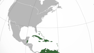
Tobago is an island within the Republic of Trinidad and Tobago. It is located 35 kilometres (22 mi) northeast of the larger island of Trinidad and about 160 kilometres (99 mi) off the northeastern coast of Venezuela. It also lies to the southeast of Grenada. The official bird of Tobago is the cocrico. The indigenous name for the island is Aloubaéra.

The Trinidad and Tobago Carnival is an annual event held on the Monday and Tuesday before Ash Wednesday in Trinidad and Tobago. The event is well known for participants' colorful costumes and exuberant celebrations. There are numerous cultural events such as "band launch fetes" running in the lead up to the street parade on Carnival Monday and Tuesday. It is said that if the islanders are not celebrating it, then they are preparing for it, while reminiscing about the past year's festival. Traditionally, the festival is associated with calypso music, with its origins formulated in the midst of hardship for enslaved West and Central Africans; however, recently Soca music has replaced calypso as the most celebrated type of music. Costumes, stick-fighting and limbo competitions are also important components of the festival.
The Curonian colonization of the Americas was performed by the Duchy of Courland, which was the second-smallest state to colonise the Americas, after the Knights of Malta. It had a colony on the island of Tobago from 1654 to 1659 and intermittently from 1660 to 1689.

The Panyols are a Pardo (tri-racial) ethnic group in Trinidad and Tobago of mixed Spanish, South American Amerindian, Trinidadian and Tobagonian Amerindian, Afro-Latin American, and Afro-Trinidadian and Tobagonian descent. They comprise the Cocoa Estate Plantations owners community along with peasant workers from Venezuela and Colombia, also referred to as Pagnols, local Spanish, Cocoa panyols. They were born of the shared Island nation, on both sides of the Gulf of Paria, Peninsulas that settling within the Northern Range Rain Forest Mountains Valleys of Trinidad and Tobago Caura River, down the mountains into the Tacarigua River into the Caroni River, and the Orinoco, and Caura River, Venezuela. They played an important role in the development of the cocoa industry in Trinidad and Tobago, running the Cocoa Estate and not to be confused with the freed community of former slaves.

Couva is an urban town in west-central Trinidad, south of Port of Spain and Chaguanas and north of San Fernando and Point Fortin. It is the capital and main urban centre of Couva–Tabaquite–Talparo, and the Greater Couva area includes the Point Lisas Industrial Estate and the Port of Point Lisas. It is one of the fastest growing towns in the country. Couva's southern boundary is at the village of California & Point Lisas, and to the north Couva stretches to McBean. To the east of Couva is Preysal. To the west of Couva is the road to Waterloo and Carli Bay, which are located on the Gulf of Paria. Couva was part of the Caroni County. Couva is considered a major power base for the United National Congress (UNC), whose headquarters were previously located here.

Grande Riviere is a village on the north coast of Trinidad located between Toco and Matelot. The area was originally settled by immigrants from Venezuela and Tobago who cultivated cacao and subsistence crops. After falling cocoa prices in the 1920s and expanding pest problems caused the collapse of the cocoa industry, Grande Riviere went into a decline which continued until the development of ecotourism. Between 1931 and 2000 the population of Grande Riviere fell from 718 to 334.

Trinidad and Tobago, officially the Republic of Trinidad and Tobago, is the southernmost island country in the Caribbean and is known for its fossil-fuel wealth. Consisting of the main islands Trinidad and Tobago, and numerous much smaller islands, it is situated 130 kilometres south of Grenada and 11 kilometres off the coast of northeastern Venezuela. It shares maritime boundaries with Barbados to the northeast, Grenada to the northwest and Venezuela to the south and west.
St. Martin's history shares many commonalities with other Caribbean islands. Its earliest inhabitants were Amerindians, followed by Europeans who brought slavery to exploit commercial interests.
Lopinot is a village in Trinidad and Tobago.
Toco is the most northeasterly village on the island of Trinidad in the County of Saint David where the Caribbean Sea and the Atlantic Ocean meet. Tobago is 35 kilometres (22 mi) to the northeast, making Toco the closest point in Trinidad to the sister island. The name Toco was ascribed to the area by its early Amerindian inhabitants. The meaning of the name is uncertain.
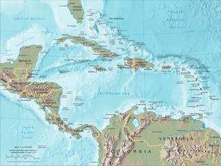
The Caribbean is a region of the Americas that comprises the Caribbean Sea, its surrounding coasts, and its islands. The region lies southeast of the Gulf of Mexico and of the North American mainland, east of Central America, and north of South America.

Bilateral relations between the countries of France and Trinidad and Tobago have existed for about two hundred years. Currently, France has an embassy in Port of Spain. Trinidad and Tobago is represented in France through its embassy in Brussels (Belgium). Trinidad and Tobago also has bilateral investment agreements with France.

The Merikins or Merikens were African-American Marines of the War of 1812 – former African slaves who fought for the British against the US in the Corps of Colonial Marines and then, after post-war service in Bermuda, were established as a community in the south of Trinidad in 1815–16. They were settled in an area populated by French-speaking Catholics and retained cohesion as an English-speaking, Baptist community. It is sometimes said that the term "Merikins" derived from the local patois, but as many Americans have long been in the habit of dropping the initial "A" it seems more likely that the new settlers brought that pronunciation with them from the United States. Some of the Company villages and land grants established back then still exist in Trinidad today.

The history of Tobago covers a period from the earliest human settlements on the island of Tobago in the Archaic period, through its current status as a part of the Republic of Trinidad and Tobago. Originally settled by indigenous people, the island was subject to Spanish slave raids in the sixteenth and early seventeenth century and colonisation attempts by the Dutch, British, French, and Courlanders beginning in 1628, though most colonies failed due to indigenous resistance. After 1763 Tobago was converted to a plantation economy by British settlers and enslaved Africans.
Trinidadian and Tobagonian nationality law is regulated by the Trinidad and Tobago Constitution Order of 1962, as amended; the 1976 Citizenship Act, and its revisions; and various British Nationality laws. These laws determine who is, or is eligible to be, a national of Trinidad and Tobago. Trinidadian and Tobagonian nationality is typically obtained either on the principle of jus soli, i.e. by birth in Trinidad and Tobago or under the rules of jus sanguinis, i.e. by birth abroad to parents with Trinidadian and Tobagonian nationality. It can be granted to persons with an affiliation to the country, or to a permanent resident who has lived in the country for a given period of time through naturalisation. There is not currently a program in Trinidad and Tobago for persons to acquire nationality through investment in the country. Nationality establishes one's international identity as a member of a sovereign nation. Though it is not synonymous with citizenship, for rights granted under domestic law for domestic purposes, the United Kingdom, and thus the commonwealth, have traditionally used the words interchangeably.