Charpokhari

Last updated

Charpokhari
Chārpokhri
Village
Charpokhari block map.png
Map of Charpokhari block
India Bihar location map.svg
Red pog.svg
Charpokhari
Location in Bihar, India
India location map.svg
Red pog.svg
Charpokhari
Charpokhari (India)
Coordinates: 25°21′45″N84°28′52″E / 25.36262°N 84.48101°E / 25.36262; 84.48101 [1]
CountryIndia
State Bihar
District Bhojpur
Area
[2]
  Total0.103 km2 (0.040 sq mi)
Elevation
[1]
77 m (253 ft)
Population
 (2011)
  Total1,874 [2]
Languages
  Official Bhojpuri, Hindi
Time zone UTC+5:30 (IST)

Charpokhari (also spelled Charpokhri) is a village and corresponding community development block in Bhojpur district of Bihar, India. [3] As of 2011, its population was 1,874, in 314 households. The total block population was 101,363, in 15,961 households. [2]

Contents

Demographics

Charpokhari is a rural subdistrict with no large urban centres. As of 2011, the block's sex ratio was 927, which was higher than both the overall Bhojpur district ratio of 907 and the rural-specific Bhojpur district ratio of 910. The sex ratio was lower in the 0-6 age group, with 916 females for every 1000 males, which was slightly below the district's overall (918) and rural (920) sex ratios in this age group. Members of scheduled castes made up 21.44% of the block's population (the highest proportion in Bhojpur) and members of scheduled tribes made up 0.02% (the lowest in Bhojpur). The literacy rate of Charpokhari block was 68.86%, which was lower than the district rate of 70.47%. Literacy was higher in men (81.91%) than in women (54.83%), with the corresponding 27.08% gender gap somewhat exceeding that of the district as a whole (23.71%). [2]

Most of Charpokhari block's workforce in 2011 was employed in agriculture, with 30.70% of workers being cultivators who owned or leased their own land and another 49.89% being agricultural labourers who worked someone else's land for wages. 4.49% were household industry workers, and the remaining 14.92% were other workers. Most workers in the block were men: 24,011, compared to 6,646 women. [2]

Villages

Charpokhari block contains the following 90 villages: [2]

Village nameTotal land area (hectares)Population (in 2011)
Udhwa Dih 400
Pachma 170
Saropur 551,056
Piro Chak 560
Bharhatha 5396
Sonbarsa 3332,711
Kusamhi 1751,491
Koel 3323,556
Dhanauti 2202,294
Dube Dehra 90588
Repura 131600
Koel Arazi 250
Gauri Dih 480
Dherha 102701
Kumhaila 1592,111
Repura 33143
Itaura 2102,080
Madhuri 125633
Mansagar 1601,656
Kashi Dih 76349
Majhiawan 3142,042
Panre Dih 731,240
Patkhauli 180
Sundarpur 6838
Keshopur 47984
Betari 610
Rasulpur 29163
Malipur 92390
Janea Dih 51254
Jairampur 2950
Kori 1571,917
Narotimpur 140
Balihari 119927
Barni 2361,894
Kathrain 1692,031
Kathrain Milik 240
Sukru 1490
Siya Dih 2092,452
Amurza 1531,353
Sahaspura 94652
Madariha 1512,002
Madain 1111,264
Chand Dihri 76.8798
Rampur 350
Kharanti 87529
Charpokhari (block headquarters)1031,874
Dekura 1191,017
Ekauni 1131,091
Barar English 75291
Barar 1241,141
Bhairo Dih 1081,072
Madanpur 350
Malaur 2743,299
Sarbahan Dehri 280
Makundpur 2943,537
Dubea 4199
Paliya 70.9907
Nagri 219.34,616
Kinu Dheri 201396
Nagraon 1431,692
Harpur 1021,366
Dhusra 340
Thakuri 1892,096
Jaitpura 1361,365
Kanai 2022,025
Kasmariya 2271,496
Dhob Diha 961,168
Madarha 821,031
Madarhi 4499
Panraria 771,405
Dumariya 1751,220
Lilari 1091,866
Pasaur 5575,237
Chakiya 530
Kauwa Khot 63138
Bagu Sara 911,038
Barahra 1261,759
Semraon 4236,039
Bhaluana 1011,370
Pirtampur 991,087
Gangajal Dehri 610
Thegua 27338
Babu Bandh 2182,289
Pem Akurha 330
Dego Dehri 104878
Kalianpur 125550
Bajen 1841,456
Manaini 122837
Bagahi 25642
Tetaria 92491

Related Research Articles

<span class="mw-page-title-main">Chausa</span> Town in Bihar, India

Chausa is a village and corresponding community development block in Buxar district, Bihar, India. It is located 11 km west of the district headquarters, Buxar, on the bank of the river Ganga. As of 2011, the population of the village of Chausa was 9,011, in 1,362 households, while the total block population was 103,670, in 15,817 households.

<span class="mw-page-title-main">Behea, Bihar</span> Town in Bihar, India

Behea or Bihiya is a nagar panchayat town and Block in Bhojpur district in the Indian state of Bihar. The Behea block comprises 76 rural villages, along with the town of Bihiya itself and 22 uninhabited villages. As of 2011, the population of the Behea block was 1,51,722 of whom 26,707 lived in the town of Behea itself.

<span class="mw-page-title-main">Nokha, Rohtas</span> Town in Bihar, India

Nokha is a nagar panchayat town and corresponding community development block in Rohtas district in the Indian state of Bihar. As of 2011, the population of the town of Nokha was 27,302 in 4,381 households. The rural population of Nokha block was 146,025, thus bringing the total block population 173,327. The economic situation of this region is mainly dependent on parboiled rice processed by number of rice mills in this area.

<span class="mw-page-title-main">Dinara, Bihar</span> Village in Bihar, India

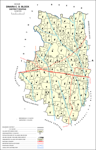
Dinara is a regional market in Rohtas district, Bihar, India, near the National Highway 30. The birthplace of the famous poet Dariya Saheb is just 5 km from Dinara.

<span class="mw-page-title-main">Barhara</span> Village in Bihar, India

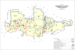
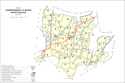
Barhara, also spelled Badahar, Barahara, or Barahra, is a village and corresponding community development block in Bhojpur District of Bihar, India. It is situated on the bank of the river Ganges. By the time of July–August most of the villages under this block are affected by deluge. As of 2011, its population was 6,889, in 927 households, while the total block population was 240,636, in 35,185 households.

<span class="mw-page-title-main">Sahar, Bihar</span> Village in Bihar, India

Sahār is a village and community development block in Bhojpur district of Bihar, India. The sub-district contains 51 inhabited villages, including that of Sahar itself, with a total district population of 110,276 as of 2011. The village of Sahar has a population of 5,674, in 931 households. Sahar was a major center of conflict during the wider Naxalite insurgency in Bhojpur in the late 1960s and throughout the 1970s.

<span class="mw-page-title-main">Chenari, India</span> Census town in Bihar, India

Chenāri or Chanāri is a census town and corresponding community development block in Rohtas district of Bihar, India. As of 2011, the town of Chenari had a population of 6,569, while Chenari block had a population of 131,528. Major commodities produced in the town of Chenari are chironji, rice, and pulses. The census town of Bhardua is administratively counted as part of Chenari block.

<span class="mw-page-title-main">Rajpur, Rohtas</span> Village in Bihar, India

Rajpur is a village and corresponding community development block in Rohtas district of Bihar, India. As of 2011, the village of Rajpur had a population of 11,780, in 1,778 households, while Rajpur block had a population of 75,213.

<span class="mw-page-title-main">Kargahar</span> Village in Bihar, India

Kargahar is a village and corresponding community development block in Rohtas district of Bihar, India. As of 2011, the population of Kargahar was 10,170, in 1,464 households, while the population of Kargahar block was 225,082, in 31,528 households. The nearest city is Sasaram, the district headquarters.

<span class="mw-page-title-main">Kesath, Buxar</span> Village in Bihar, India

Kesath is a village and corresponding community development block in Buxar district of Bihar, India. It is the least populous of Buxar's 11 blocks, with a population of 33,820, in 5,304 households. The population of Kesath itself is 14,843, in 2,351 households.

<span class="mw-page-title-main">Rajpur, Buxar</span> Village in Bihar, India

Rajpur is a village and corresponding community development block in Buxar district of Bihar, India.

<span class="mw-page-title-main">Itarhi, Buxar</span> Village in Bihar, India

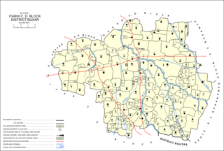
Itarhi is a Nagar Panchayat and corresponding community development block in Buxar district of Bihar, India. According to the 2011 Census of India, its population is 10,275, in 1,711 households, while the total block population is 170,629, in 25,557 households.

<span class="mw-page-title-main">Chakki, Buxar</span> Village in Bihar, India

Chakki, also Charkhi, is a village and corresponding community development block in Buxar district of Bihar, India.

<span class="mw-page-title-main">Garhani</span> Village in Bihar, India

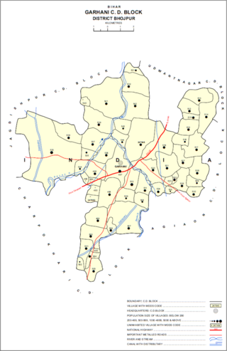
Garhani is a village and corresponding community development block in Bhojpur district of Bihar, India. As of 2011, its population was 5,597, in 959 households. The total block population was 103,262, in 16,427 households.

<span class="mw-page-title-main">Udwantnagar</span> Village in Bihar, India

Udwantnagar is a village and corresponding community development block in Bhojpur district of Bihar, India. As of 2011, its population was 9,000, in 1,496 households. The total block population was 157,809, in 24,336 households.

<span class="mw-page-title-main">Tarari, Bihar</span> Village in Bihar, India

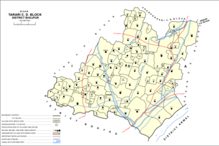
Tarari is a village and corresponding community development block in Bhojpur district of Bihar, India. As of 2011, its population was 3,586, in 393 households. The total block population was 182,631, in 28,316 households.

<span class="mw-page-title-main">Agiaon</span> Village in Bihar, India

Agiaon is a village and corresponding community development block in Bhojpur district of Bihar, India. As of 2011, its population was 4,801, in 835 households. The total block population was 148,373, in 23,117 households.

<span class="mw-page-title-main">Sandesh, Bihar</span> Indian village in Bhojpur district, Bihar

Sandesh is a village and corresponding community development block in Bhojpur district of Bihar, India. As of 2011, its population was 6,874, in 1,037 households. The total block population was 109,712, in 17,011 households.

Ramgarh is a census town and corresponding community development block in Kaimur district of Bihar, India. As of 2011, its population was 8,690, in 1,345 households. It was first upgraded to census town status for the 2011 census. The total population of the rural areas of Ramgarh block was 123,973, in 18,375 households. The overall population of the subdistrict was 132,663.

<span class="mw-page-title-main">Deenshah Gaura</span> Development in Raebareli district, Uttar Pradesh

Deenshah Gaura is a community development block in Dalmau tehsil of Raebareli district, Uttar Pradesh, India. It consists of 71 rural villages, with a total population of 104,149 people. The headquarters are located in the village of Gaura Hardo.

References

  1. 1 2 "Geonames.org. Chārpokhri" . Retrieved 22 August 2020.
  2. 1 2 3 4 5 6 "Census of India 2011: Bihar District Census Handbook - Bhojpur, Part A (Village and Town Directory)". Census 2011 India. pp. 27–94, 564–603. Retrieved 22 August 2020.
  3. "Pin Code: CHARPOKHARI, BHOJPUR, BIHAR, India, Pincode.net.in". pincode.net.in. Retrieved 23 August 2020.