Charre | |
|---|---|
Town | |
 Charre | |
| Coordinates: 17°19′11″S35°09′17″E / 17.31972°S 35.15472°E | |
| Country | Mozambique |
| Province | Tete |
| Time zone | UTC+2:00 (CAT) |
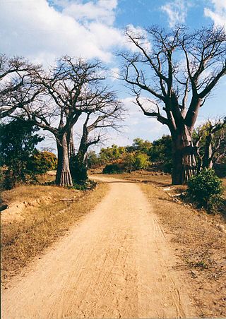
Charre is a town in northern Mozambique, near the border with Malawi.
Charre | |
|---|---|
Town | |
| Charre | |
| Coordinates: 17°19′11″S35°09′17″E / 17.31972°S 35.15472°E | |
| Country | Mozambique |
| Province | Tete |
| Time zone | UTC+2:00 (CAT) |
Charre is a town in northern Mozambique, near the border with Malawi.
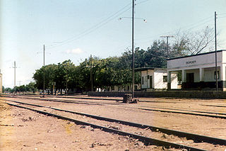
It is served by a station on the branchline of the national railway network that leads into Malawi.
Transportation in Malawi is poorly developed. The country of almost 14 million has 39 airports, 6 with paved runways and 33 with unpaved runways. It has 797 kilometres of railways, all narrow-gauge and about 45 percent of its roads are paved. Though it is landlocked, Malawi also has 700 km (435 mi) of waterways on Lake Malawi and along the Shire River.

Modes of transport in Mozambique include rail, road, water, and air. There are rail links serving principal cities and connecting the country with Malawi, Zimbabwe and South Africa. There are over 30,000km of roads, but much of the network is unpaved.

Nsanje is the main city in Nsanje District within the Southern Region of Malawi.
The Beira Railroad Corporation, or CCFB, was a joint venture railway company that was responsible for operating the railway lines in central Mozambique. It was formed to reform the railway lines that run from the Port of Beira, Mozambique, originally linking to Zimbabwe, although it later also linked to Malawi.
Nacala, also known as Cidade de Nacala or Nacala-Porto is a city on the northern coast of Mozambique. Located in the southwestern indentation of inner Fernao Veloso Bay, it is the deepest natural port on the east coast of Africa. Nacala serves as the terminal for the Nacala railway, a rail line to the landlocked Malawi. South of Nacala is Mozambique Island, at one time the capital of Mozambique and now a World Heritage Site.

Cuamba is a city and district of Niassa Province in Mozambique, lying north west of Mount Namuli. Before independence the town was known as Nova Freixo.
Dondo is a city and district Dondo District of Sofala Province in Mozambique.
Malawi Railways was a government corporation that ran the national rail network of Malawi, Africa, until privatisation in 1999. With effect from 1 December 1999, the Central East African Railways consortium led by Railroad Development Corporation won the right to operate the network. This was the first rail privatisation in Africa which did not involve a parastatal operator.

Portos e Caminhos de Ferro de Moçambique is a state-owned company that oversees the railway system of Mozambique and its connected ports.
Central East African Railways is a consortium formed in 1999, led by the Railroad Development Corporation, which won the right to operate the Malawi Railways network. The company was sold in September 2008 to INSITEC, an investment group based in Mozambique.
Railway stations in Mozambique include:

Railway stations in Zambia include:

Mutarara, or Nhamayabué, is a town in Mozambique. It lies on the north bank of the Zambezi River.
Malawi Railways is the national rail network in Malawi, run by a government corporation until privatisation in 1999. As of 1 December 1999 the Central East African Railways, a consortium led by Railroad Development Corporation, won the right to operate the network.
Sankulani is a town in southern Malawi.
The Port of Nacala, also called the Nacala port complex, is a Mozambican port located in the cities of Nacala and Nacala-a-Velha. Is the deepest port in Southern Africa. The natural deep harbour serves landlocked Malawi with a 931-kilometre (578 mi) railway.
Mwanza is a town in Malawi on the border with Mozambique. It is the administrative headquarters for Mwanza District.

Nacala railway, also known as Northern Corridor railway and Nacala Corridor railway, is a railway line that operates in northern Mozambique on a 912 kilometres (567 mi) line that runs west from the port city of Nacala, crossing the central region of Malawi, connecting with the coal belt of Moatize, in northwest Mozambique. It is connected to the Dona Ana-Moatize railway branch and the Sena railway (Chipata-Lilongwe-Blantyre-Nhamayabue-Dondo). It also has a 262 kilometres (163 mi) branch line from Cuamba to Lichinga.

Sena railway, also called Shire Highlands railway, Dondo-Malawi railway and North-South Malawi railway, is a railway that connects Dondo, Mozambique, to Chipata, in Zambia. It is c. 1000 km long, in a 1067 mm gauge.
Marka is a town located in Nsanje District in Malawi. It is the southernmost location in the country, serving as a border post for road and rail control between Malawi and Mozambique.
| | This Mozambique location article is a stub. You can help Wikipedia by expanding it. |