Related Research Articles

Marlborough District or the Marlborough Region, commonly known simply as Marlborough, is one of the 16 regions of New Zealand, located on the northeast of the South Island. Marlborough is a unitary authority, both a district and a region. Marlborough District Council is based at Blenheim, the largest town. The unitary region has a population of 51,900.

Molesworth Station is a high country cattle station. It is located behind the Inland Kaikoura Mountain range in the South Island's Marlborough District. It is New Zealand's largest farm, at over 1,800 square kilometres and supports the country's biggest herd of cattle. It also hosts government science programs, such as research into bovine tuberculosis and related research into possums. The station helps rabbit population reduction.

The Kaikōura Ranges are two parallel ranges of mountains located in the northeast of the South Island of New Zealand. The two ranges are visible from a great distance, including from the southern coast of the North Island.

The Conway River is part of the traditional boundary between the Canterbury and Marlborough regions in the South Island of New Zealand.
The Hundalee Hills are located close to the borders of Hurunui District and Kaikoura District in Canterbury in the South Island of New Zealand.

The Main North Line between Picton and Christchurch and the Main South Line between Lyttelton and Invercargill, running down the east coast of the South Island of New Zealand, are sometimes together referred to collectively as the South Island Main Trunk Railway (SIMT). Construction of a line running the length of the east coast began in the 1860s and was completed all the way from Picton to Invercargill in 1945; the last sections being on the Main North Line south of Picton. The designation "South Island Main Trunk" originally referred to only that line between Christchurch and Invercargill.
The Waiau Branch was a branch line railway in the northern Canterbury region of New Zealand's South Island. Known as the Great Northern Railway for its first few decades of life, the Waiau Branch was seen as part of a main line north but was ultimately superseded by a coastal route. Opened in stages from 1882 to 1919, the line closed in 1978 but a portion has been retained as the Weka Pass Railway.
Medbury is a rural locality in the Canterbury region of New Zealand's South Island. It is located just off State Highway 7 near the Hurunui River. There is no longer a significant population base forming a township, just rural properties.
Tophouse, also known as Tophouse Settlement, is a rural locality in the Tasman District of New Zealand's South Island, some 8 km northeast of Saint Arnaud. It is named after a hotel established in the 19th century to service drovers transporting their sheep between Canterbury and Marlborough. The hotel is still in operation today and has an eventful history, including a double murder suicide in October 1894. For many years, "Tophouse" referred specifically to the hotel, but it has also been used to refer to the general vicinity, and on 20 February 2001, the New Zealand Geographic Board assigned the name "Tophouse Settlement" to the area.
Parnassus is a locality in the Canterbury region's Hurunui District on the east coast of New Zealand's South Island. It is located on the north bank of the Waiau River.

The Main North Line, sometimes referred to as part of the South Island Main Trunk railway, is a railway line that runs north from Christchurch in New Zealand up the east coast of the South Island through Kaikōura and Blenheim to Picton. It is a major link in New Zealand's national rail network and offers a connection with roll-on roll-off ferries from Picton to Wellington. It was also the longest railway construction project in New Zealand's history, with the first stages built in the 1870s and not completed until 1945.

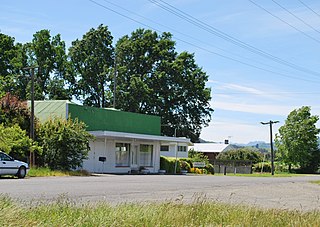
Wharanui is a small village located in Marlborough on the east coast of New Zealand's South Island between Ward and Kaikoura. State Highway 1 and the Main North Line railway both pass through the village.

The Leader River is a river in the Hurunui District of the Canterbury region in New Zealand's South Island. It is a tributary of the Waiau River, which it meets near Parnassus. Numerous smaller watercourses join the Leader River, including the Hookhamsnyvy Creek.
Hundalee is a rural locality in the Hurunui District of the Canterbury region of New Zealand's South Island. It straddles the Conway River, the traditional boundary between Canterbury and Marlborough and is in the Hundalee Hills.
The Picton Express was a passenger express train operated by the New Zealand Railways Department (NZR) between Christchurch and Picton. It ran from December 1945 until February 1956, and was thus the shortest-lived provincial express in New Zealand. Following the end of railcar services in 1976, a new carriage train between Christchurch and Picton began, under the same name as the earlier service, until it was replaced in 1988 by the Coastal Pacific Express.
Mt Lyford (1590m) is the home of an alpine village and ski resort in the South Island of New Zealand. It is 146 kilometres by road north of Christchurch on the Inland Kaikōura Road (SH70) between Culverden and Kaikoura. The resort is a 40-minute drive to Hanmer Springs and a 45-minute drive to Kaikoura. The nearby township of Waiau, Canterbury has a small supermarket, DIY store and petrol station. The Inland Kaikōura Road is very scenic and windy from Waiau through to Kaikōura and forms part of the Alpine Pacific Touring Route.
The Hookhamsnyvy Creek is a natural watercourse in the northern Canterbury region of New Zealand's South Island.

The Kowhai River is a river of the northeast of New Zealand's South Island. It flows south from the slopes of Manakau in the Seaward Kaikōura Range, turning southeast as it reaches its narrow coastal plain. The Kowhai River flows to the ocean to the west of the Kaikōura Peninsula, three kilometres west of the town of Kaikōura.
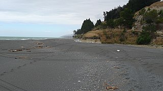
The Oaro River is a river of the north Canterbury region of New Zealand's South Island. It flows south from its sources in the Hundalee Hills, turning east shortly before reaching the coast at Oaro, 15 kilometres (9 mi) southwest of Kaikoura.

The Kowhai Valley and Shearwater Stream Important Bird Area comprises a disjunct site in the Seaward Kaikōura Range in the north-east of New Zealand’s South Island, some 15 km inland from the coastal town of Kaikōura. The site, at an altitude of 1200–1800 m above sea level, has been identified as an Important Bird Area by BirdLife International because it contains the entire breeding population of Hutton's shearwaters; about 100,000 pairs in two colonies.
References
- ↑ Patrick Dunford, "Parnassus & Leader Section SIMT MNL" Archived 2007-10-08 at the Wayback Machine , accessed 12 November 2007.
Coordinates: 42°30′S173°19′E / 42.500°S 173.317°E