Related Research Articles
Dean Channel is the upper end of one of the longest inlets of the British Columbia Coast, 105 km (65.2 mi) from its head at the mouth of the Kimsquit River. The Dean River, one of the main rivers of the Coast Mountains, enters Dean Channel about 9.5 km (5.9 mi) below the head of the inlet, at the community of Kimsquit.

The Gwa'Sala-Nakwaxda'xw Nations are a union of two Kwakwaka'wakw peoples in a band government based on northern Vancouver Island in British Columbia, Canada, whose main reserve community is near the town of Port Hardy in the Queen Charlotte Strait region of the Central Coast region of British Columbia, Canada. The band government is a member of the Kwakiutl District Council and, for treaty negotiation purposes, the Winalagalis Treaty Group which includes three other members of the Kwakiutl District Council.

The Bonaparte Indian Band a.k.a. Bonaparte First Nation, is a member band of the Shuswap Nation Tribal Council of the Secwepemc (Shuswap) people.
The Whispering Pines/Clinton Indian Band, also called the Pellt'iq't First Nation is a member of the Secwepemc (Shuswap) Nation, located in the Central Interior region of the Canadian province of British Columbia. Its main Indian reserve is located at Clinton, British Columbia. It was created when the government of the then-Colony of British Columbia established an Indian reserve system in the 1860s. It is a member government of the Shuswap Nation Tribal Council.
The Esk'etemc First Nation, also known as the Alkali Lake Indian Band, is a First Nations government of the Secwepemc (Shuswap) people, located at Alkali Lake in the Cariboo region of the Central Interior of the Canadian province of British Columbia. It was created when the government of the then-Colony of British Columbia established an Indian reserve system in the 1860s. It is one of three Secwepemc bands that is not a member of either the Shuswap Nation Tribal Council or the Northern Shuswap Tribal Council.
The Kluskus First Nation is the band government of the Lhoosk’uz, a Dakelh people whose main reserve located on the Chilcotin Plateau 130 km west of the city of Quesnel, British Columbia, Canada. The First Nation is a member of the Carrier-Chilcotin Tribal Council, which includes both Tsilhqot'in and Carrier (Dakelh) communities.
The Tlʼesqox First Nation is a Tsilhqotʼin community located west of the Fraser Canyon in the Chilcotin region of the Canadian province of British Columbia. It is a member of the Carrier-Chilcotin Tribal Council, which includes both Tsilhqotʼin and Carrier (Dakelh) communities.
The Wuikinuxv Nation, also known as the Oweekeno Nation, is a First Nations band government whose traditional territory is the shores of Rivers Inlet and Owikeno Lake in the Central Coast region of the Canadian province of British Columbia, in the area south of Bella Bella and north of Queen Charlotte Strait. The Wuikinuxv people a.k.a. the Oweekeno people reside in the area of Rivers Inlet and Owikeno Lake, primarily at a village on the Wannock River. Substantial numbers of Wuikinuxv also reside away from the traditional territory in Port Hardy on Vancouver Island and in larger BC communities such as Campbell River, Vancouver and Victoria. Approximately 80 people reside at the village while overall membership was 283 in 2006, 194 of whom lived off-reserve.
Kimsquit is a former village of the Nuxalk at the mouth of the Dean River on the northeast side of Dean Channel in the Central Coast region of British Columbia, Canada. Kemsquit Indian Reserve No. 1 is nearby at 52°49′00″N126°58′00″W, which is on Kimsquit Bay; Kimsquit Mountain is nearby.
Kitlope 16, properly the Kitlope Indian Reserve No. 16, is an Indian reserve on the North Coast of British Columbia, to the south of Kitimat, British Columbia and at the mouth of the Kitlope River, which flows north into the head of the Gardner Canal to the south of that town. It is the home reserve of the Henaksiala or Kitlope or Gitlope group of the Haisla, who are now part of the Haisla Nation government and settled with the Haisla at Kitamaat Village, the reserve community near Kitimat.
The Leq'á:mel First Nation, formerly known as Lakahahmen First Nation, is a First Nations band government whose community and offices are located in the area near Deroche, British Columbia in the Fraser Valley region in Canada, about 12 kilometres east of the District of Mission. They are a member government of the Sto:lo Nation Chiefs Council, which is one of two tribal councils of the Sto:lo.

The Nuxalk people, also referred to as the Bella Coola, Bellacoola or Bilchula, are an Indigenous First Nation of the Pacific Northwest Coast, centred in the area in and around Bella Coola, British Columbia. Their language is also called Nuxalk. Their on-reserve tribal government is the Nuxalk Nation.
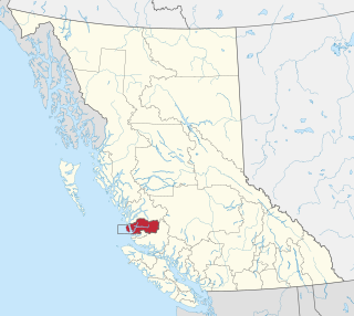
The Bella Coola Valley is a relatively small but distinct region located in the Central Coast region of British Columbia, Canada, comprising the valley of the Bella Coola River and its tributaries. The region is served by BC Hwy 20, which runs from Williams Lake to the town of Bella Coola at the head of North Bentinck Arm, from where there is seasonal ferry service to Vancouver Island and Prince Rupert.
The Kimsquit River is a river in the Kitimat Ranges of the Coast Mountains in British Columbia, Canada, flowing into the head of Dean Channel, one of the major inlets of the Central Coast region.
Comet Mountain, 1742 m, is a mountain in the Kitimat Ranges of British Columbia, Canada, located immediately west of the head of Dean Channel in the Central Coast region of that province, to the northwest of the town of Bella Coola. The former Nuxalk village and still-Indian reserve Kimsquit is located immediately east across Dean Channel, Chatscah Indian Reserve No. 2 is immediately north at the mouth of the Kimsquit River.
Kimsquit Peak, 2268 m, is a mountain in the Kitimat Ranges of the Coast Mountains of British Columbia, Canada, located immediately north of the former Nuxalk village of Kimsquit, which is at the mouth of the Dean River. Immediately to its west across the head of Dean Channel is Comet Mountain.
The Taleomey River is a river in the northernmost Pacific Ranges of the Coast Mountains in the Central Coast region of British Columbia, Canada, flowing west to South Bentinck Arm where its waters enter the sea a few miles north of the head of that inlet. The Asseek River also enters the head of South Bentinck Arm, flowing into its head from the south.
Taleomy Indian Reserve No. 3, officially Taleomy 3, is an Indian reserve under the governance of the Nuxalk Nation, located at the mouth of the Taleomey River on the east shore of South Bentinck Arm in the Central Coast region of British Columbia, Canada.
The Sakumtha River is a river in British Columbia, Canada, flowing south out of the Kitimat Ranges from an origin west of the Tsaydaychuz Peak massif into the Dean River north of Bella Coola.