Related Research Articles

Bridal Veil Falls Provincial Park is a BC Park situated on the Trans-Canada Highway just east of Rosedale, British Columbia, Canada, within of the City of Chilliwack. The community of Bridal Falls is located adjacent to the falls and park, as well as the interchange between the Trans-Canada and BC Highway 9, offering a variety of highway-based tourism services. Access to the falls requires a short hike from the parking lot and well-groomed trails, taking most groups 15-25 minutes.

Worcester Park is a suburban town in South West London, England. It lies in the London boroughs of Sutton and Kingston, and partly in the Surrey borough of Epsom and Ewell. The area is 10 miles (16 km) southwest of Charing Cross. The suburb's population was 16,031 at the time of the 2001 census. The suburb comprises the Worcester Park ward, an electoral area of the London Borough of Sutton with a population in 2011 of 11,655, as well as the Cuddington ward, an electoral area of Epsom and Ewell, which had a population of 5,791 at the time of the 2001 census.
Cariboo River Provincial Park is a provincial park in British Columbia, Canada, located between Barkerville and Likely in the upper Cariboo River basin.

Diana Lake Provincial Park is a 233 hectares provincial park located 16 kilometres east of the city of Prince Rupert in the North Coast Regional District of British Columbia, Canada. The park was established by BC Parks in 1980.
Kikomun Creek Provincial Park is a provincial park in British Columbia, Canada.
Lakelse Lake Wetlands Provincial Park is a provincial park in British Columbia, Canada, located near the city of Terrace in that province's Skeena Country. It is 1214 ha. in size.
Porcupine Meadows Provincial Park is a 2,704 hectare provincial park in British Columbia, Canada, located north of Tranquille Lake to the northwest of Kamloops. Its name is a direct translation of the Shuswap word for this area, "pisitsoolsia", named so for the numerous porcupine in the area.
Schoen Lake Provincial Park is a provincial park in northeastern Vancouver Island, British Columbia, Canada, located east of the community of Woss Lake and southwest of Sayward. The park lies inside the Nimpkish Valley watershed. On October 28, 1977, the "Class A" park was officially created to protect, exhibit and interpret an example of the natural features and processes of the Insular Mountains Natural Region. The park covers a total area of 8,775 hectares. Within those hectares of park land is a number of lakes, creeks and mountain ranges.
Seeley Lake Provincial Park is a provincial park in British Columbia, Canada, located within the asserted traditional territory of the Gitxsan First Nation, south of the confluence of the Skeena and Bulkley Rivers.

Trepanier Provincial Park is a provincial park in British Columbia, Canada. This 2,884-hectare (11.14 sq mi) park is roughly 24 km west of Kelowna.
The Cheam Indian Band is a First Nations band government of the Stó:lō people in the Upper Fraser Valley region of British Columbia, Canada, located near the community of Rosedale. They traditionally speak the Upriver dialect of Halkomelem, one of the Salishan family of languages. The name Cheam means "wild strawberry place" and is the namesake of Mount Cheam, which overlooks the community and most of the Upper Fraser Valley. They are a member government of the Sto:lo Tribal Council, one of two Sto:lo tribal councils.

Cheam Peak or Mount Cheam.
Popkum, also known as Popkum Village, is an unincorporated community in the Fraser Valley Regional District, in the census metropolitan area of Chilliwack, British Columbia, Canada. Its namesake is the indigenous Popkum First Nation and adjacent Indian reserve. The name is derived from the Halq'eméylem word Pópkw'em meaning "puffballs."

The Columbia Wetlands is a 15,070 hectare wetland in the Columbia Valley region of southeastern British Columbia, Canada. It was designated a wetland of international importance on World Environment Day, June 5, 2005, and is the thirty-seventh such site in Canada. The wetland satisfies all the inclusion criteria of the Ramsar Convention. It is maintained by the Columbia Wetlands Wildlife Management Area and administered by the Canadian Wildlife Service. It is also part of the Living Lakes Network.

Smith and Bybee Wetlands Natural Area is a public park and nature reserve between the Columbia Slough and the Columbia River in Portland, Oregon. At about 2,000 acres (810 ha), it is one of the largest urban freshwater wetlands in the United States. Metro, the regional government for the Oregon part of the Portland metropolitan area, manages the park. A covered shelter, restrooms, a paved walkway, and a canoe launch lie on the north side of the natural area.

The geography of the North Cascades describes a range of rugged mountains in British Columbia, Canada and Washington, United States. In Canada, the range is officially named the Cascade Mountains but is commonly referred to as the Canadian Cascades.
Columbia Lake Ecological Reserve is a nature reserve on Columbia Lake in the East Kootenay region of British Columbia, Canada, located on the east side of Columbia Lake just north of the village of Canal Flats.
Widgeon Valley National Wildlife Area is a National Wildlife Area located near the south end of Pitt Lake in British Columbia, Canada. The property was purchased by the Nature Trust of British Columbia in 1973 and declared a National Wildlife Area by the Canadian Wildlife Service in October of that year. The Widgeon Valley National Wildlife Area is a biologically diverse marsh wetland. It is the traditional territory of various First Nations groups. The Widgeon Valley Wildlife Area is a protected wildlife area that is home to a number of sensitive waterfowl and fish species. The public uses the channels through the Widgeon Valley National Wildlife Area for recreational canoeing, anywhere else within the protected area is strictly off-limits to the public. There are future plans to develop interpretive trails through the park and open it to the public.
Omineca Provincial Park and Protected Area is a provincial park and protected area located in the north-central interior of British Columbia, Canada. It was established on 11 April 2001 by BC Parks to protect provincially significant riparian and wetland habitats along the Omineca River.
References
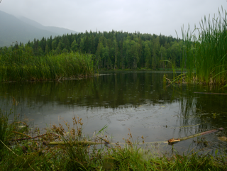
- ↑ "Cheam Lake Wetlands". Tourism Chilliwack. Retrieved 17 February 2019.
- ↑ Cannings, Richard; Cannings, Russell (2013). Birdfinding in British Columbia. Greystone Books Ltd. pp. 167–168. ISBN 9781771000031.
| | This article about a location on the Coast of British Columbia, Canada is a stub. You can help Wikipedia by expanding it. |