
Ballari in the eponymous Ballari district, is a city in the state of Karnataka, India. Bellari houses many steel plants such as JSW Vijayanagar, one of the largest in Asia.
Araria is a city and a municipality that is the headquarters of Araria district in the Indian state of Bihar. Araria is situated in the northern part of Bihar.

Hospet is the largest and fastest-growing industrial city and district headquarters of the Vijayanagara district in the Indian state of Karnataka. Hospet is known as "the steel city of Karnataka". It is located on the bank of the Tungabhadra River and is 13 km (8.1 mi) from Hampi (Vijayanagar). Hampi was once the capital of the Vijayanagara Empire. It has been designated a UNESCO World Heritage Site. Hospet is the connecting link between North and South Karnataka. It is 333 km (207 mi) from the state capital Bengaluru.
Dausa is a city and administrative headquarters of Dausa district in the state of Rajasthan, India. It is 55 km from Jaipur, 240 km from Delhi and located on Jaipur-Agra National Highway (NH-21).

Anantapur district, officially Ananthapuramu district, is one of the eight districts in the Rayalaseema region of the Indian state of Andhra Pradesh. The district headquarters is located in Anantapur city. It is one of the driest places in South India. In the year 2022, as part of re-organisation of districts, Sri Sathya Sai district was carved out.
Gadhinglaj ([ɡəɖᵊɦiŋɡləd͡z]) is a city in India in the Kolhapur district in the southwest corner of the state of Maharashtra, India. It is located on the banks of the river Hiranyakeshi. It is the Taluka (Tehsil) headquarters of Gadhinglaj Taluka and a subdivision headquarters of the Gadhinglaj Subdivision of the Kolhapur District. It is governed by a municipal council. The rapidly growing city is the third largest in the Kolhapur District, with population of more than 50,000. Places to visit include Samagad fort, temples and beautiful weather.
Harapanahalli is a small city, taluk and sub-divisional headquarter in Vijayanagara District in the Indian state of Karnataka.
Kampli is a town in the Bellary district, Kampli taluk, in the Indian state of Karnataka. It is a headquarters of Kampli Taluk. The town is situated about 15 km away from Hampi.
Manawar is a town with tehsil in Dhar district in the Indian state of Madhya Pradesh. The name Manawar came from name of river Mān that flows at southern edge of the town. Pin code of Manawar is 454446.
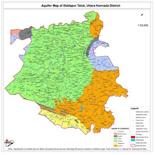
Siddapur Taluk is the destination of world famous Jog Falls. It is a part of Uttara Kannada district, Karnataka, India and is located in the midst of forest areas of Western Ghats and it is also a part of Malenadu. The taluk is full of greenery, hills and arecanut gardens developed in the valleys’. The taluk headquarters is Siddapur. Sirsi is the nearest city,
Tasgaon is a city in Maharashtra and Taluka in Sangli district in the Indian state of Maharashtra. Tasgaon city is developing city in Maharashtra. Tasgaon was given as Jahagir to Parshuram Bhau Tasgaonkar by Narayanrao Ballal Peshwa in 1774. Tasgaon Sansthan was lapsed by British during ruling of Shrimant Ganpatrao Tasgaonkar.
Uravakonda is a census town in Anantapur district of the Indian state of Andhra Pradesh. It is the headquarters of Uravakonda mandal in Anantapur revenue division. The town is a constituent of urban agglomeration.

Bali is a town and a municipality in Pali district in the state of Rajasthan, India. The town is situated on the left bank of the Mithari River. This walled town was the headquarters of a district having the same name in the Jodhpur State. Bali is a tehsil and panchayat samiti with the same name. Bali is also a sub-divisions among the 10 sub-divisions of the Pali district. It is known for its fort. Nearest towns are Falna & Sadri and nearest villages are Kot Baliyan, Shri Sela and Boya.
Aspari is a village under the adoni revenue division in Kurnool district of Andhra Pradesh, India.

Dhone or Dronachalam is a town in Nandyal district of the Indian state of Andhra Pradesh. It is a municipality located in Dhone mandal, and it is the head quarters of Dhone revenue division.
Usraon (Mariyahu) is a town and nagar panchayat in Jaunpur district in the Indian state of Uttar Pradesh. It is one of the six tahsils of Jaunpur District; the others are Jaunpur City, Shahganj, Machalishahar, Badlapur and Kerakat.
Apra, also known as The Golden City Apra, is a census town in Phillaur Tehsil in Jalandhar district of Punjab State, India. The town is known for gold jewelry and paddy crops which are produced in large amounts. It is located 46 kilometres (29 mi) towards East from Jalandhar, 12 kilometres (7.5 mi) from Phillaur and 110 kilometres (68 mi) from Chandigarh. Apra is the largest town as compared to other surrounding villages and has the main marketplace. The town is administrated by Sarpanch an elected representative of the village.
Ramgarh is a medium size village in Phillaur tehsil of Jalandhar District of Punjab State, India. It is located 1 km away from postal head office Phillaur, 16 km from Ludhiana, 45 km from district headquarter Jalandhar and 118 km from state capital Chandigarh. The village is administrated by a sarpanch who is an elected representative of village as per Panchayati raj (India).
Bainapur is a small size village in Phillaur tehsil of Jalandhar district of Punjab State, India. It is located 25 km away from Phillaur, 5.8 km from Nurmahal, 27.7 km from district headquarter Jalandhar and 147 km from state capital Chandigarh. The village is administrated by a sarpanch who is an elected representative of the village, as per Panchayati raj (India).
Kurumgram is an old village located in Nalhati I CD Block in Rampurhat subdivision of Birbhum district in West Bengal State of India.

