Related Research Articles
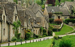
Gloucestershire is a ceremonial county in South West England. It is bordered by Herefordshire to the north-west, Worcestershire to the north, Warwickshire to the north-east, Oxfordshire to the east, Wiltshire to the south, Bristol and Somerset to the south-west, and the Welsh county of Monmouthshire to the west. The city of Gloucester is the largest settlement and the county town.
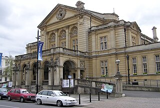
Cheltenham is a spa town and borough on the edge of the Cotswolds in Gloucestershire, England. Cheltenham became known as a health and holiday spa town resort following the discovery of mineral springs in 1716, and claims to be the most complete Regency town in Britain. It is directly northeast of Gloucester.

Cheltenham is a suburb in Melbourne, Victoria, Australia, 18 km south-east of Melbourne's Central Business District, located within the Cities of Bayside and Kingston local government areas. Cheltenham recorded a population of 23,992 at the 2021 census.

Cheltenham is an unincorporated community in Cheltenham Township, Pennsylvania, United States, with a ZIP code of 19012. It is located directly over the city line of Philadelphia. It also borders Northeast Philadelphia over the Fox Chase Line on the east and over Cottman Avenue on the north side. The community is listed for statistical purposes as the Cheltenham Village census-designated place. As of the 2020 census it had a population of 1,993.
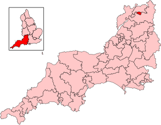
Cheltenham is a constituency in Gloucestershire represented in the House of Commons of the UK Parliament since 1832. As with all constituencies, it elects one Member of Parliament (MP) by the first past the post system of election at least every five years. Since 2024, its MP has been Max Wilkinson of the Liberal Democrats.

West Oak Lane is a neighborhood in Northwest Philadelphia, Pennsylvania, United States. The neighborhood was developed primarily between the early 1920s and late 1930s, with the areas near to Cedarbrook constructed after World War II. At the northeast corner of Limekiln Pike and Washington Lane was the site of the Cedar Park Inn, a historic tavern built in the early 19th century, which was torn down sometime after 1931 as the neighborhood was being fully developed.

Cheltenham High School is a public high school in the Wyncote neighborhood of Cheltenham Township, in the U.S. state of Pennsylvania, located 0.5 miles (800 m) from the border of the city of Philadelphia and 12 miles (19 km) from Center City. Serving grades 9 through 12, Cheltenham is the only high school in the School District of Cheltenham Township. It is fed by Cedarbrook Middle School, the only school in the school district for grades 7 and 8.
Half of Cheltenham Borough Council is the local authority for Cheltenham in Gloucestershire, England. Half the council is elected every two years, while before 2002 the council was elected by thirds. Since the last boundary changes in 2002, 40 councillors have been elected from 20 wards.

Cheltenham is a single-member electoral district for the South Australian House of Assembly. Named after the suburb of the same name, it is a 17.5 km² suburban electorate in Adelaide's north-west, taking in the suburbs of Albert Park, Alberton, Beverley, Cheltenham, Findon, Hendon, Pennington, Queenstown, St Clair, Woodville, Woodville North, Woodville Park, Woodville South, Woodville West, and part of Rosewater. The Cheltenham electorate is inside the federal-level electorate of Hindmarsh.
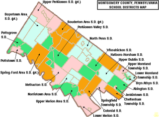
The Cheltenham Township School District is a public school district serving Cheltenham Township in Montgomery County, Pennsylvania. The district is one of the 500 public school districts of Pennsylvania. The District encompasses approximately 9 square miles (23 km2). According to 2020 federal census data, it serves a resident population of 37,452.
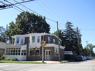
La Mott is an unincorporated residential community located within Cheltenham Township, Montgomery County, Pennsylvania, United States. Its name honors the leading 19th Century abolitionist and suffragist, Lucretia Mott, who resided in the neighborhood.

The county of Gloucestershire is divided into seven districts. The districts of Gloucestershire are Gloucester, Tewkesbury, Cheltenham, Cotswold, Stroud, Forest of Dean, South Gloucestershire.

The Gloucestershire Rugby Football Union is the union responsible for rugby union in the county of Gloucestershire, England and is one of the constituent bodies of the national Rugby Football Union. Formed in 1878, it has won the county championship on numerous occasions.

The Cheltenham and District Light Railway operated an electric tramway service in Cheltenham between 1901 and 1930.
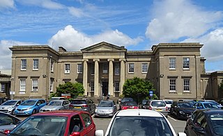
Cheltenham General Hospital is an NHS district general hospital in Cheltenham, Gloucestershire, run by Gloucestershire Hospitals NHS Foundation Trust. It provides general hospital services including Accident and Emergency.

The county of Gloucestershire is divided into seven districts. The districts of Gloucestershire are Gloucester, Tewkesbury, Cheltenham, Cotswold, Stroud, Forest of Dean, South Gloucestershire.
There are over 20,000 Grade II* listed buildings in England. This page is a list of these buildings in the district of Cheltenham in Gloucestershire.

Cheltenham Borough Council is the local authority for Cheltenham, a non-metropolitan district with borough status in Gloucestershire, England. The council is based at the Municipal Offices on the Promenade.

Cheltenham Township is a home rule municipality and Township of the First Class located in the southeast corner of Montgomery County, Pennsylvania, United States. It borders Philadelphia to the south and east, Abington Township and Jenkintown to the north, and Springfield Township to the west.
McKinley is an census-designated place, in Montgomery County, Pennsylvania, United States. Almost all of it is in Abington Township, while some blocks are in Cheltenham Township. McKinley is located along Forrest Avenue between Pennsylvania Route 73 and Jenkintown Road southeast of Jenkintown. As of the 2020 United States census the community had a population of 3,128.
References
- ↑ "Cheltenham RD through time | Census tables with data for the Local Government District". www.visionofbritain.org.uk.