Borough of Tewkesbury

Last updated

Tewkesbury Borough
Tewkesbury Abbey 2011.jpg
Tewkesbury Abbey in the town of Tewkesbury which the district is named after and governed from
Tewkesbury UK locator map.svg
Tewkesbury shown within Gloucestershire
Sovereign state United Kingdom
Constituent country England
Region South West England
Non-metropolitan county Gloucestershire
Status Non-metropolitan district
Admin HQ Tewkesbury
Incorporated1 April 1974
Government
  TypeNon-metropolitan district council
  BodyTewkesbury Borough Council
   MPs Mark Harper
Laurence Robertson
Area
  Total160.0 sq mi (414.4 km2)
  Rank83rd (of 296)
Population
 (2021)
  Total95,429
  Rank252nd (of 296)
  Density600/sq mi (230/km2)
  Ethnicity
98.6% White
Time zone UTC0 (GMT)
  Summer (DST) UTC+1 (BST)
ONS code 23UG (ONS)
E07000083 (GSS)
OS grid reference SO8855933566

The Borough of Tewkesbury is a local government district with borough status in Gloucestershire, England. The borough is named after its largest town, Tewkesbury, which is where the council is based. The district also includes the town of Winchcombe and numerous villages including Bishops Cleeve, Ashchurch, Churchdown, Innsworth and Brockworth as well as other hamlets and surrounding rural areas. Parts of the district lie within the Cotswolds Area of Outstanding Natural Beauty.

Contents

The neighbouring districts are Cotswold, Cheltenham, Stroud, Gloucester, Forest of Dean, Malvern Hills and Wychavon.

History

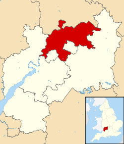
Prior to 1974 the borough of Tewkesbury only covered the town itself. The town was an ancient borough, having been granted a charter of incorporation by Elizabeth I in 1575. [1] The town was reformed in 1836 to become a municipal borough under the Municipal Corporations Act 1835, governed by a body formally called the "mayor, aldermen and burgesses of the borough of Tewkesbury", but generally known as the corporation or town council. [2]

The modern district was formed on 1 April 1974 under the Local Government Act 1972, covering the whole area of two former districts and part of a third, which were all abolished at the same time: [3]

The new district was named Tewkesbury after its main town. [4] The new district was awarded borough status from its creation, allowing the council to take the name Tewkesbury Borough Council and letting the chair of the council take the title of mayor. [5] A successor parish was created at the same time covering the area of the former municipal borough of Tewkesbury, with the parish council taking the name Tewkesbury Town Council. [6]

In 1991 the borough ceded the parishes of Leckhampton, Prestbury, Swindon and Up Hatherley to neighbouring Cheltenham. [7]

Governance

Tewkesbury Borough Council
Tewkesbury Borough Council.svg
Type
Type
Leadership
Ian Yates,
Liberal Democrat
since 16 May 2023 [8]
Richard Stanley,
Liberal Democrat
since 17 May 2023
Alistair Cunningham
since 13 June 2022 [9]
Structure
Seats38 councillors
Tewkesbury Borough Council 2023.svg
Political groups
  Liberal Democrat (16)
  Conservative (9)
  Independent (7)
  Green Party (4)
  TTI (2)
Elections
First past the post
Last election
4 May 2023
Next election
6 May 2027
Meeting place
Tewkesbury Borough Council - geograph.org.uk - 988327.jpg
Council Offices, Gloucester Road, Tewkesbury, GL20 5TT
Website
www.tewkesbury.gov.uk

Tewkesbury Borough Council provides district-level services. County-level services are provided by Gloucestershire County Council. [10] The whole district is also covered by civil parishes, which form a third tier of local government. [11]

Political control

The council has been under no overall control since the 2023 election, with leadership roles shared between the Liberal Democrats, Greens and independent councillors.

The first election to the modern council was held in 1973, initially operating as a shadow authority alongside the outgoing authorities until the new arrangements took effect on 1 April 1974. Political control of the council since 1974 has been as follows: [12] [13]

Party in controlYears
No overall control 1974–1976
Independent 1976–1987
No overall control 1987–1991
Independent 1991–1995
No overall control 1995–2011
Conservative 2011–2023
No overall control 2023–present

Leadership

The role of mayor is largely ceremonial. Political leadership is provided instead by the leader of the council. The leaders since 2007 have been: [14]

CouncillorPartyFromTo
Robert Vines Conservative 200716 May 2017
Dave Waters Conservative 16 May 201715 May 2018
Rob Bird Conservative 15 May 20187 May 2023
Richard Stanley Liberal Democrats 17 May 2023

Composition

Following the 2023 election, the composition of the council was: [15]

PartyCouncillors
Liberal Democrats 16
Conservative 9
Independent 7
Green 4
Tewkesbury and Twyning Independents2
Total38

Of the independent councillors, two sit together as the "Isbourne and Winchcombe Independents", and the other five sit with local party the Tewkesbury and Twyning Independents as a group called "The Independents". [16] The next election is due in 2027.

Premises

The council is based at the Council Offices on Gloucester Road in Tewkesbury. The building was purpose-built for the council, being completed in 1976. [17]

Towns and parishes

The whole district is covered by civil parishes. The parish councils for Tewkesbury and Winchcombe take the style "town council". Some of the smaller parishes have a parish meeting rather than a parish council. [18]

Transport

Gloucestershire Airport is in the borough, near to Gloucester and Cheltenham. The borough is also served by Ashchurch for Tewkesbury railway station on the mainline. Heritage railway the Gloucestershire Warwickshire Railway also has a number of stations in the borough.

Elections

Since the last full review of boundaries in 2019 the council has comprised 38 councillors representing 20 wards, with each ward electing one, two or three councillors. Elections are held every four years. [19]

As of May 2023, the councillors were: [20]

WardCouncillorParty
BadgeworthRobert Vines Conservative
Brockworth EastCharlotte Mills Independent
Jason Mills Independent
Brockworth WestCraig Carter Independent
Deborah Harwood Independent
Churchdown Brookfield with HucclecotePaul Smith Liberal Democrats
Richard Smith Liberal Democrats
Ian Yates Liberal Democrats
Churchdown St John'sStewart Dove Liberal Democrats
Mary Jordan Liberal Democrats
Liz Skelt Liberal Democrats
Cleeve GrangeThomas Budge Liberal Democrats
Cleeve HillNigel Adcock Liberal Democrats
Cheryl Agg Liberal Democrats
Cleeve St Michael'sAlex Hegenbarth Liberal Democrats
Kashan Pervaiz Liberal Democrats
Cleeve WestRichard Stanley Liberal Democrats
Murray Stewart Liberal Democrats
Highnam with Haw BridgePaul McLain Conservative
Jill Smith Conservative
InnsworthSarah Hands Liberal Democrats
Paul Ockelton Liberal Democrats
IsbourneChristopher Coleman Independent
Mel Gore Conservative
NorthwayPauline Godwin Conservative
Elaine MacTiernam Independent
Severn Vale NorthHeather McLain Conservative
Severn Vale SouthMark Williams Conservative
ShurdingtonGeorge Porter Liberal Democrats
Tewkesbury EastHilarie Bowman Green
Helena Sundarajoo Green
Tewkesbury North and TwyningMike SztymiakTewkesbury and Twyning Independents
Philip WorkmanTewkesbury and Twyning Independents
Tewkesbury SouthMatt Dimond-Brown Green
Cate Cody Green
WinchcombeDavid Gray Conservative
Gemma Madle Independent
Jim Mason Conservative

Related Research Articles

<span class="mw-page-title-main">Gloucestershire</span> County of England

Gloucestershire is a ceremonial county in South West England. It is bordered by Herefordshire to the north-west, Worcestershire to the north, Warwickshire to the north-east, Oxfordshire to the east, Wiltshire to the south, Bristol and Somerset to the south-west, and the Welsh county of Monmouthshire to the west. The city of Gloucester is the largest settlement and the county town.

<span class="mw-page-title-main">Tewkesbury</span> Town and civil parish in England

Tewkesbury is a market town and civil parish in the north of Gloucestershire, England. The town grew following the construction of Tewkesbury Abbey in the twelfth century and played a significant role in the Wars of the Roses. It stands at the confluence of the River Severn and the River Avon, and thus became an important trading point, which continued as railways and, later, the M5 and M50 motorway connections were established. The town gives its name to the Borough of Tewkesbury, a local government district of Gloucestershire. The town lies on the border with Worcestershire, marked largely by the Carrant Brook.

<span class="mw-page-title-main">Basingstoke and Deane</span> Borough and non-metropolitan district in England

Basingstoke and Deane is a local government district with borough status in Hampshire, England. The main town is Basingstoke, where the council is based. The district also includes the towns of Tadley and Whitchurch, along with numerous villages and surrounding rural areas. The modern district was created in 1974, initially being called Basingstoke. It changed its name to "Basingstoke and Deane" in 1978 at the same time that it was made a borough; Deane was added to the name to represent the rural parts of the borough, being the area's smallest village.

<span class="mw-page-title-main">Borough of Swindon</span> Unitary authority area in Wiltshire, England

The Borough of Swindon is a local government authority in South West England, centred on the urban area and town of Swindon and forming part of the ceremonial county of Wiltshire.

<span class="mw-page-title-main">Cotswold District</span> Non-metropolitan district in England

Cotswold is a local government district in Gloucestershire, England. It is named after the wider Cotswolds region and range of hills. The council is based in the district's largest town of Cirencester. The district also includes the towns of Chipping Campden, Fairford, Lechlade, Moreton-in-Marsh, Northleach, Stow-on-the-Wold and Tetbury, along with numerous villages and surrounding rural areas.

<span class="mw-page-title-main">West Devon</span> Non-metropolitan district and borough in England

West Devon is a local government district with borough status in Devon, England. Its council is based in Tavistock, the borough's largest town. The borough also includes the towns of Hatherleigh, North Tawton and Okehampton, along with numerous villages and surrounding rural areas.

<span class="mw-page-title-main">Stroud District</span> Non-metropolitan district in England

Stroud District is a local government district in Gloucestershire, England. The district is named after its largest town of Stroud. The council is based at Ebley Mill in Cainscross. The district also includes the towns of Berkeley, Dursley, Nailsworth, Stonehouse and Wotton-under-Edge, along with numerous villages and surrounding rural areas. Over half of the district lies within the Cotswolds Area of Outstanding Natural Beauty.

<span class="mw-page-title-main">Forest of Dean District</span> Non-metropolitan district in England

Forest of Dean is a local government district in west Gloucestershire, England, named after the Forest of Dean. Its council is based in Coleford. Other towns and villages in the district include Blakeney, Cinderford, Drybrook, English Bicknor, Huntley, Littledean, Longhope, Lydbrook, Lydney, Mitcheldean, Newnham and Newent.

<span class="mw-page-title-main">Mansfield District</span> Non-metropolitan district in England

Mansfield District is a local government district in Nottinghamshire, England. It is named after the town of Mansfield, where the council is based. The district also contains Mansfield Woodhouse and Warsop.

<span class="mw-page-title-main">Ashchurch for Tewkesbury railway station</span> Railway station in Gloucestershire, England

Ashchurch for Tewkesbury is a railway station serving the medieval market town of Tewkesbury and the village of Ashchurch in Gloucestershire, England. The station is located less than 14 mile (400 m) from junction 9 of the M5 motorway and located on the main Bristol–Birmingham main line 7+14 miles (11.7 km) north of Cheltenham Spa and was opened on 1 June 1997 by Railtrack. There are regular bus connections from the station to Tewkesbury town centre, Gloucester Transport Hub and Cheltenham.

<span class="mw-page-title-main">Tewkesbury (UK Parliament constituency)</span> Parliamentary constituency in the United Kingdom, 1997 onwards

Tewkesbury is a constituency in Gloucestershire represented in the House of Commons of the UK Parliament since its 1997 recreation by Laurence Robertson, a Conservative.

<span class="mw-page-title-main">Ashchurch</span> Village in Gloucestershire, England

Ashchurch is a village and former civil parish, now in the parish of Ashchurch Rural, in the Tewkesbury district, in the county of Gloucestershire, England, 2 miles (3.2 km) east of the town of Tewkesbury, 11 mi (18 km) southwest of Evesham, 10 mi (16 km) north of Cheltenham, 13 mi (21 km) north-north-east of Gloucester and 10 mi (16 km) south of Pershore.

Cirencester and Tewkesbury was a parliamentary constituency in Gloucestershire which returned one Member of Parliament (MP) to the House of Commons of the Parliament of the United Kingdom. It was created for the 1918 general election and abolished for the 1997 general election when it was partly replaced by the new constituencies of Cotswold and Tewkesbury.

<span class="mw-page-title-main">Gloucestershire County Council</span> Local authority in England

Gloucestershire County Council is the upper-tier local authority for the non-metropolitan county of Gloucestershire, in England. The council was created in 1889. The council's principal functions are county roads and rights of way, social services, education and libraries, but it also provides many other local government services in the area it covers. The council's administrative area does not include South Gloucestershire, which is a unitary authority with all the functions of a county and a non-metropolitan district. The council is based at Shire Hall in Gloucester.

<span class="mw-page-title-main">Cheltenham Borough Council</span>

Cheltenham Borough Council is the local authority for Cheltenham, a non-metropolitan district with borough status in Gloucestershire, England. The council is based at the Municipal Offices on the Promenade.

<span class="mw-page-title-main">Gloucester City Council</span>

Gloucester City Council is the local authority for Gloucester, a non-metropolitan district with city status in Gloucestershire, England.

Tewkesbury Borough Council is the local authority for the Borough of Tewkesbury in Gloucestershire, England. The whole council is elected together every four years. Since the last boundary changes in 2019, a total of 38 councillors have been elected from 20 wards.

Tewkesbury Town Council is a local council covering the parish of Tewkesbury, Gloucestershire. It is a successor parish to the Tewkesbury Municipal Borough Council that existed prior to the reorganisation of English Local Government in April 1974. The Town Council in its original form was constituted by the Local Government Order 1973, where Tewkesbury Town is listed in Schedule Part 1.

<span class="mw-page-title-main">Borough of Chesterfield</span> Borough and non-metropolitan local government district in north eastern Derbyshire, England

The Borough of Chesterfield is a non-metropolitan district with borough status in Derbyshire, England. It is named after the town of Chesterfield, its largest settlement, and also contains the town of Staveley and the large village of Brimington.

References

  1. "The borough of Tewkesbury: Introduction Pages 110-118 A History of the County of Gloucester: Volume 8". Victoria County History. Archived from the original on 5 June 2020. Retrieved 24 August 2020 via British History Online.
  2. "Tewkesbury Municipal Borough". A Vision of Britain through Time. GB Historical GIS / University of Portsmouth. Retrieved 28 August 2023.
  3. "The English Non-metropolitan Districts (Definition) Order 1972", legislation.gov.uk , The National Archives, SI 1972/2039, retrieved 31 May 2023
  4. "The English Non-metropolitan Districts (Names) Order 1973", legislation.gov.uk , The National Archives, SI 1973/551, retrieved 31 May 2023
  5. "District Councils and Boroughs, 28 March 1974". Hansard. Retrieved 20 August 2023.
  6. "Tewkesbury Town Council". Tewkesbury Town Council. Archived from the original on 30 January 2019. Retrieved 24 August 2020.
  7. "The Gloucestershire (District Boundaries) Order 1991", legislation.gov.uk , The National Archives, SI 1991/281, retrieved 27 August 2023
  8. "Mayor of Tewkesbury Borough".
  9. "Tewkesbury Borough Council welcomes new chief executive". Tewkesbury Borough Council. Retrieved 28 August 2023.
  10. "Local Government Act 1972", legislation.gov.uk , The National Archives, 1972 c. 70, retrieved 31 May 2023
  11. "Election maps". Ordnance Survey. Retrieved 26 August 2023.
  12. "Compositions calculator". The Elections Centre. Retrieved 31 July 2023.
  13. Rallings, Colin; Thrasher, Michael (2015). Tewkesbury Borough Council Election Results 1973–2011 (PDF). The Elections Centre, Plymouth University. Retrieved 28 June 2022.
  14. "Council minutes". Tewkesbury Borough Council. Retrieved 28 June 2022.
  15. "Local elections 2023: live council results for England". The Guardian.
  16. "Your councillors by party". Tewkesbury Borough Council. Retrieved 28 August 2023.
  17. "Council unveils its new HQ". Western Daily Press. Bristol. 16 September 1976. p. 14. Retrieved 26 August 2023.
  18. "Parish councils contact information". Tewkesbury Borough Council. Retrieved 29 August 2023.
  19. "The Tewkesbury (Electoral Changes) Order 2018", legislation.gov.uk , The National Archives, SI 2018/37, retrieved 29 August 2023
  20. "Your Councillors by Ward" . Retrieved 9 May 2023.

52°0′0″N2°10′0″W / 52.00000°N 2.16667°W / 52.00000; -2.16667