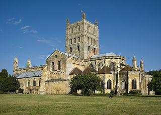
Gloucestershire is a ceremonial county in South West England. It is bordered by Herefordshire to the north-west, Worcestershire to the north, Warwickshire to the north-east, Oxfordshire to the east, Wiltshire to the south, Bristol and Somerset to the south-west, and the Welsh county of Monmouthshire to the west. The city of Gloucester is the largest settlement and the county town.

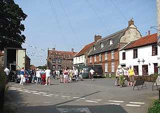
Worstead is a village and civil parish in the North Norfolk district of Norfolk, England.

Stroud is a market town and civil parish in Gloucestershire, England. It is the main town in Stroud District. The town's population was 13,500 in 2021.

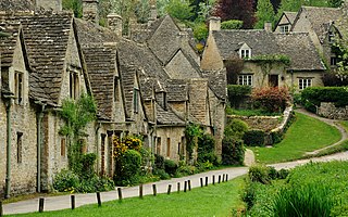
Painswick is a town and civil parish in the Stroud District in Gloucestershire, England. Originally the town grew from the wool trade, but it is now best known for its parish church's yew trees and the local Rococo Garden. The village is mainly constructed of locally quarried Cotswold stone. Many of the buildings feature south-facing attic rooms once used as weavers' workshops.

Stroud District is a local government district in Gloucestershire, England. The district is named after its largest town of Stroud. The council is based at Ebley Mill in Cainscross. The district also includes the towns of Berkeley, Dursley, Nailsworth, Stonehouse and Wotton-under-Edge, along with numerous villages and surrounding rural areas. Over half of the district lies within the Cotswolds Area of Outstanding Natural Beauty.

Nailsworth is a town and civil parish in the Stroud District in Gloucestershire, England, lying in one of the Stroud Valleys in the Cotswolds, on the A46 road, 4 miles (6.4 km) south of Stroud and about 25 miles (40 km) north-east of Bristol and Bath. The parish had a population of 5,794 at the 2011 census.

Hucclecote is a suburb in Gloucestershire, United Kingdom, comprising a ward in the City of Gloucester. It is located on the periphery of the city, between Barnwood and Brockworth, along Ermin Way, an old Roman road connecting Gloucester with Cirencester and the Cotswolds.

Stroud is a constituency represented in the House of Commons of the UK Parliament. It is held by Simon Opher of the Labour Party, who won the seat from Siobhan Baillie of the Conservatives in 2024.

St Martin's is the northernmost populated island of the Isles of Scilly, England, United Kingdom. It has an area of 237 hectares (0.92 sq mi).

Hill is a village and civil parish in South Gloucestershire, England, midway between the towns of Thornbury in South Gloucestershire and Berkeley in Gloucestershire. The parish stretches from the banks of the River Severn to an outcrop of the Cotswolds escarpment. At the 2001 census, it had a population of 114. Hill is approximately 5 miles from the M5 motorway which links to Gloucester, Cheltenham and Bristol.

Broadwell is a village and civil parish in the English county of Gloucestershire. It is about 1.5 miles (2.4 km) north of Stow-on-the-Wold, In the 2001 United Kingdom census, the parish had a population of 384. decreasing to 355 at the 2011 census.

Brookthorpe-with-Whaddon, formerly just Brookthorpe, is a civil parish in the Stroud district of Gloucestershire, England. According to the 2001 census it had a population of 308, increasing to 322 at the 2011 census. In 2019 the population was estimated at 395. It consists of the small villages of Brookthorpe and Whaddon, both to the south of Gloucester.

Sheepscombe is a small village in the civil parish of Painswick, in the Stroud district, in the county of Gloucestershire, England. Sheepscombe is located some 6.5 miles (10 km) south-east of the city of Gloucester, 6 miles (10 km) north-east of the town of Stroud, and 1.5 miles (2 km) east of the village of Painswick. It lies in a narrow valley, hidden behind the Cotswold scarp, and just off the A46 and B4070 roads.
Rodborough is a large village and civil parish in the district of Stroud, Gloucestershire, in South West England. It is directly south of the town of Stroud, north of the town of Nailsworth and north-west of the town of Minchinhampton. The parish includes the settlements of Bagpath, Butterrow, Kingscourt, Lightpill and Rooksmoor, and is adjacent to the Stroud suburb of Dudbridge. The population taken at the 2011 census was 5,334.
Stroud District Council in Gloucestershire, England is elected every four years. The all-out elections every four years began in 2016; up to and including the 2015 election one third of the council was elected each year, followed by one year without election.

Leonard Stanley, or Stanley St.Leonard, is a village and parish in Gloucestershire, England, 95 miles (150 km) west of London and 3.5 miles (5.5 km) southwest of the town of Stroud. Situated beneath the Cotswold escarpment overlooking the Severn Vale, the surrounding land is mainly given over to agricultural use. The village is made up of some 600 houses and has an estimated population of 1,545 as of 2019. The hamlet of Stanley Downton lies less than a mile to the north and lies within the parish. In 1970, the village was twinned with the commune of Dozulé in the Calvados region of Normandy, northern France.

Gloucester City Council is the local authority for the city of Gloucester, in Gloucestershire, England. Gloucester has had a council since medieval times, which has been reformed on numerous occasions. Since 1974 Gloucester has been a non-metropolitan district with city status.

The Borough of Tewkesbury is a local government district with borough status in Gloucestershire, England. The borough is named after its largest town, Tewkesbury where the council is based. The district also includes the town of Winchcombe and numerous villages including Bishops Cleeve, Ashchurch, Churchdown, Innsworth and Brockworth as well as other hamlets and surrounding rural areas. Parts of the district lie within the Cotswolds Area of Outstanding Natural Beauty. In September 2024 the council voted to formally change the borough's name to North Gloucestershire.

Ebley is a community in Gloucestershire, England. It was once a village, and is now part of the Stroud urban area. It lies in the valley of the River Frome, 2 miles west of the town centre of Stroud. It is part of the civil parish of Cainscross.

Evenlode is a village and civil parish in the Cotswold District of eastern Gloucestershire in England.


