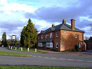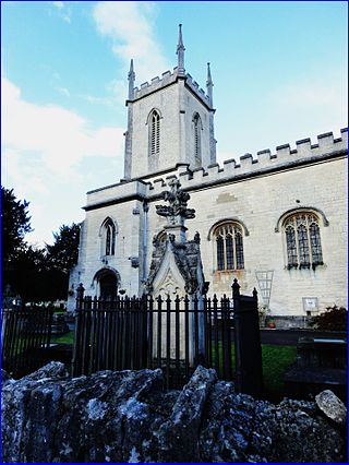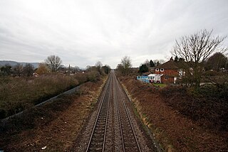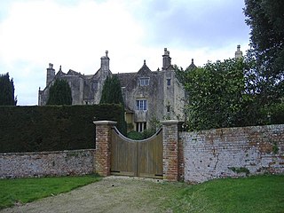
Verney Junction is a hamlet in the parish of Middle Claydon in north Buckinghamshire, England. It is on the route of the former Varsity Line. As of December 2017, the line is disused but is scheduled to be reopened by about 2025 as part of the East West Rail project.

Stroud District is a local government district in Gloucestershire, England. The district is named after its largest town of Stroud. The council is based at Ebley Mill in Cainscross. The district also includes the towns of Berkeley, Dursley, Nailsworth, Stonehouse and Wotton-under-Edge, along with numerous villages and surrounding rural areas. Over half of the district lies within the Cotswolds Area of Outstanding Natural Beauty.

The A419 road is a primary route between Chiseldon near Swindon at junction 15 of the M4 with the A346 road, and Whitminster in Gloucestershire, England near the M5 motorway. The A419 is managed and maintained by a private company, Road Management Group, on behalf of the UK Department for Transport.

Ayot Green is a hamlet in Hertfordshire, England and is near the A1(M) Motorway, close to Welwyn Garden City. It is a typical traditional English village, centred on a village green. There are several other Ayots in the area, including Ayot St Lawrence and Ayot St Peter, and it also gives name to the rail trail called Ayot Greenway which stretches from Ayot Green to Wheathampstead.

The Five Valleys are a group of valleys in Gloucestershire, England, which converge on the town of Stroud at the western edge of the Cotswolds. The Five Valleys are notable both for the landscape, which attracts visitors, and their role in industrial development of Britain starting with the wool trade in the 11th century, and developing through cloth manufacturing in the 18th century. Despite very poor roads, the use of the rivers and streams in developing links to other centres, via, for example the Thames and Severn Canal, helped the Five Valleys to prosper.

Gaunt's Earthcott, sometimes spelt Gaunts Earthcott, is a hamlet in the civil parish of Almondsbury in South Gloucestershire, England. It consists of a ruined chapel, a few houses and two farms, Green Farm and Court Farm. The village is located approximately 2.5 miles (4 km) from Rudgeway and the A38 road and about the same distance from Frampton Cotterell and Winterbourne. The village is located close to the interchange between the M4 and M5 motorways. There is no real industry as such and the main economic activity in the area is farming.

Engine Common is a village in the civil parish of Iron Acton in South Gloucestershire, England. It lies about 1 mile north west of Yate.

Hinton is a village in South Gloucestershire, England. It is one mile north of Dyrham and forms part of the civil parish of Dyrham and Hinton. The Bull is the local pub.

The A105 road is an A road in London, England. It runs from Canonbury, in between Highbury and Dalston, to Enfield Town. The road is 8 miles (13 km) long. Part of the road forms Green Lanes, one of the longest streets in London, while the A105 also serves as the primary access route to the Shopping City shopping centre in Wood Green.

Lye Green is a hamlet in the civil parish of Chesham in Buckinghamshire, England. It is located north east of Chesham. Lycrome Road runs through the centre of the hamlet, from the A416 in the east to the B4505 in the west.

Whelpley Hill is a hamlet in the parish of Ashley Green in Buckinghamshire, England. It is located to the east of Chesham, near the border with Hertfordshire and is the site of an Iron Age hillfort.

Cainscross is a suburban town and civil parish in Gloucestershire, England, bordering the town of Stroud and forming part of the Stroud urban area. The parish includes the communities of Ebley, Cashes Green and Cainscross, and part of Dudbridge.
Darby Green is a village in the parish of Yateley, North East Hampshire, England. The electoral ward of Frogmore and Darby Green is separated from the rest of the parish by a small gap around Clarks Farm, until recently a composting farm in the mushroom producing industry. The ward has a boundary shared with Blackwater, which is one part of the Civil Parish of Hawley.

Swan Island is a private mooring island in the Thames at Twickenham, in the London Borough of Richmond upon Thames, London, England. It is on the Tideway about 3⁄4 mile (1.2 km) north of and thus below Teddington Lock.

Cashes Green Halt was opened on 22 January 1930 on what is now the Golden Valley Line between Stroud and Stonehouse. This line was opened in 1845 as the Cheltenham and Great Western Union Railway from Swindon to Gloucester and this was one of many small stations and halts built on this line for the local passenger service. This particular halt was built later than the rest and was built to serve the then new Cashes Green housing development west of Stroud in response to a public request.

Standish is a small village and civil parish in the Stroud local government district in Gloucestershire, England.

Bradley is a small village in the Stroud District, in the county of Gloucestershire, England.

The 2007 Stroud Council election took place on 3 May 2007 to elect members of Stroud District Council in Gloucestershire, England. One third of the council was up for election and the Conservative Party stayed in overall control of the council.

The 2008 Stroud Council election took place on 1 May 2008 to elect members of Stroud District Council in Gloucestershire, England. One third of the council was up for election and the Conservative Party stayed in overall control of the council.


