
South Gloucestershire is a unitary authority area in the ceremonial county of Gloucestershire, South West England. Towns in the area include Yate, Chipping Sodbury, Thornbury, Filton, Patchway and Bradley Stoke. The southern part of its area falls within the Greater Bristol urban area surrounding the city of Bristol.

Kingswood is a town and civil parish in the South Gloucestershire district of the ceremonial county of Gloucestershire, England. The town is situated 3 miles (4.8 km) east-northeast of Bristol.

The M32 is a 4.42 miles (7.11 km) long motorway in South Gloucestershire and Bristol, England. It provides a link from the M4, a major motorway linking London and South Wales, to Bristol city centre and is maintained by National Highways, the national roads body.

Patchway is a town in South Gloucestershire, England, situated 6 mi (9.7 km) north-north west of central Bristol. The town has become an overflow settlement for Bristol and is contiguous with Bristol's urban area, along with the nearby towns of Filton and Bradley Stoke.
Avonmouth is a port and outer suburb of Bristol, England, facing two rivers: the reinforced north bank of the final stage of the Avon which rises at sources in Wiltshire, Gloucestershire and Somerset; and the eastern shore of the Severn Estuary. Strategically the area has been and remains an important part of the region's maritime economy particularly for larger vessels for the unloading and exporting of heavier goods as well as in industry including warehousing, light industry, electrical power and sanitation. The area contains a junction of and is connected to the south by the M5 motorway and other roads, railway tracks and paths to the north, south-east and east.

Mangotsfield is a village and former civil parish in the unitary authority area of South Gloucestershire, in the ceremonial county of Gloucestershire, England, to the north-east of Bristol.

The Avon Valley Railway (AVR) is a standard gauge heritage railway in South Gloucestershire, England, operated by a local group, the Avon Valley Railway Company Ltd. The 3-mile (5 km) heritage line runs from Oldland Common to Avon Riverside. It follows the Avon Valley southeast from Oldland Common to Bitton and then it runs alongside the River Avon from Bitton towards Saltford.

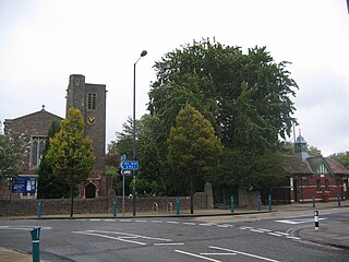
Staple Hill is a suburb of Bristol, England, lying outside the city boundary in South Gloucestershire, in the ceremonial county of Gloucestershire. It is directly east of Fishponds, south of Downend, west of Mangotsfield and north of Soundwell.

Downend is an affluent residential suburb of Greater Bristol, England, the housing stock is typically terraced Victorian, 1930s and 1950s semi-detached and detached. It is in the South Gloucestershire local district, located to the northeast of Bristol and bordered by the Bristol City suburb of Fishponds, and the South Gloucestershire suburbs of Staple Hill, Frenchay, Mangotsfield, and Emersons Green.

Pucklechurch is a large village and civil parish in South Gloucestershire, England. It has a current population of about 3000. The village dates back over a thousand years and was once the site of a royal hunting lodge, as it adjoined a large forest.
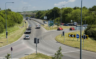
The A4174 is a major ring road in England which runs around the northern and eastern edge of Bristol, mainly in South Gloucestershire, and through the southern suburbs of the city. When it was first conceived it was planned to circle the whole of Bristol, and is commonly referred to as the "Avon Ring Road", or less accurately the "Bristol Ring Road", on road signs. The road does not circle the whole city, instead covering roughly half of the route. It is broken in part where it is concurrent with the A4.
Bristol is a city in south west England, near the Bristol Channel coast, approximately 106 miles (170 km) west of London. Several factors have influenced the development of its transport network. It is a major centre of employment, retail, culture and higher education, has many historic areas, and has a history of maritime industry. The city has a population of 450,000, with a metropolitan area of 650,000, and lies at the centre of the former County of Avon, which includes many dormitory towns, and has a population of one million.

The Bristol and Bath Railway Path is a 15-mile (24 km) off-road cycleway, part of National Cycle Network National Cycle Route 4. It has a 3-metre (9.8 ft) wide tarmacked surface, and was used for 2.4 million trips in 2007, increasing by 10% per year.

The North Fringe of Bristol, England is a mostly developed area between the northern edge of the administrative city of Bristol and the M4 and M5 motorways. Its eastern edge is usually defined as the M32 motorway. The area falls within South Gloucestershire Council, and is the northern part of Greater Bristol.
Mangotsfield School is a secondary school located in Mangotsfield in South Gloucestershire, north of the Kingswood suburb of Bristol.

Bristol Supertram was a proposed light rail system for the Bristol and South Gloucestershire regions of England. In 2001, the project was given backing from the government to build a line that would link the city centre with the North Bristol region, but the project was cancelled in 2004.
Cheswick is a new village bridging the South Gloucestershire and Bristol borders. It straddles the boundaries of Stoke Gifford, Filton and Lockleaze and lies close to the major employment sites of the University of the West of England (UWE), MoD Abbey Wood and Hewlett Packard. The development has three points of motor vehicular access: From Coldharbour Lane, just south of the UWE East Entrance, and two bus and cycle only routes from the Abbey Wood Roundabout on the A4174 Avon Ring Road and from Lockleaze.

Ram Hill is a hamlet in the civil parish of Westerleigh and Coalpit Heath, in the South Gloucestershire district, in the ceremonial county of Gloucestershire, England. It is located between Coalpit Heath and Westerleigh and adjoins the hamlet of Henfield immediately to the south. In the Mudge Map 1815, Ram Hill was known as Nutridge Hill, and was linked to Westerleigh by Broad Lane and to Mays Hill by Frog Lane.
This article lists proposed developments to transport in Bristol, England.

MetroBus is a bus rapid transit system in Bristol, England, created as a joint project between Bristol, North Somerset and South Gloucestershire councils. The first route, service m3, began operations on 29 May 2018, followed by m2 on 3 September 2018, m1 on 6 January 2019 and m4 on 22 January 2023.

