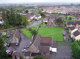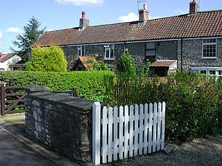
South Gloucestershire is a unitary authority area in the ceremonial county of Gloucestershire, South West England. Towns in the area include Yate, Chipping Sodbury, Kingswood, Thornbury, Filton, Patchway and Bradley Stoke. The southern part of its area falls within the Greater Bristol urban area surrounding the city of Bristol.

Longwell Green is a suburb just outside the east fringe of Bristol. Longwell Green takes its name from the medieval well which used to be situated on the site of the Church. It is located within the traditional county of Gloucestershire and the unitary authority of South Gloucestershire. It lies along the A431 Bath Road, near the River Avon at grid reference ST658710. Population was 6761.

The Avon Valley Railway (AVR) is a standard gauge heritage railway in South Gloucestershire, England, operated by a local group, the Avon Valley Railway Company Ltd. The 3-mile (5 km) heritage line runs from Oldland Common to Avon Riverside. It follows the Avon Valley southeast from Oldland Common to Bitton and then it runs alongside the River Avon from Bitton towards Saltford.

Staple Hill is a suburb of Bristol, England, lying outside the city boundary in South Gloucestershire, in the ceremonial county of Gloucestershire. It is directly east of Fishponds, south of Downend, west of Mangotsfield and north of Soundwell.

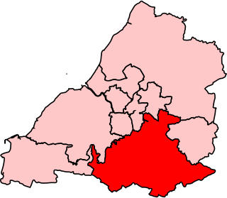
Wansdyke was a county constituency represented in the House of Commons of the Parliament of the United Kingdom. It elected one Member of Parliament (MP) by the first past the post system of election.

Oldland Common is a village in the far south region of South Gloucestershire, England, on the outskirts of Bristol. It is in the civil parish of Bitton, approximately 8 miles between the centres of cities Bristol and Bath.

Warmley is a village in South Gloucestershire, England.

Bitton Association Football Club is a football club based in the South Gloucestershire suburb of Bitton, in England. Affiliated to the Gloucestershire County Football Association, they are currently members of the Western League Division One and play at the Recreation Ground on Bath Road.
North Common is a village just outside Warmley, Bristol, in South Gloucestershire, England. Historically this was a rural hamlet surrounded by farmland. The residents are fortunate enough that to the east of the village is attractive rolling countryside, with views of Lansdown, and the surrounding hills. The village is on the eastern outskirts of Bristol and approximately halfway between Bristol city centre and the neighbouring city of Bath.

The Bristol and Bath Railway Path is a 15-mile (24 km) off-road cycleway, part of National Cycle Network National Cycle Route 4. It has a 3-metre (9.8 ft) wide tarmacked surface, and was used for 2.4 million trips in 2007, increasing by 10% per year.

Newbridge is a largely residential electoral ward on the western edge of Bath, Somerset, England.

The A431 is an A road running from Bristol to Bath in England. It runs parallel to, and about 3 miles (4.8 km) to the north of, the A4, the principal route between Bristol and Bath on the south side of the River Avon.

Bitton railway station is the main station of the Avon Valley Railway. It is located near the village of Bitton, South Gloucestershire.

Warmley was a small railway station just south of Mangotsfield on the Midland Railway Mangotsfield and Bath Branch Line. The station was sited just north of a level crossing on the A420 road through the village. It had wooden buildings: the shelter on the down platform survives and is used on occasion as a refreshment stop on the Bristol & Bath Railway Path, which follows the route of the railway.
Swineford is a hamlet in the South Gloucestershire council area, very close to the boundary with Bath and North East Somerset. It is located around 1 km south-east of Bitton, and lies on the River Avon, on which the Swineford Lock is sited. The A431 road runs through the village.

Siston Brook rises in two separate streams which issue from a ridge just north of the village of Siston, South Gloucestershire, England. The brook is approximately 6 miles (9.7 km) long and is a tributary of the Bristol Avon. Much of its course is through the eastern suburbs of Bristol, although it remains outside the city boundaries. Tributaries include the Warmley Brook and an unnamed tributary from Bridgeyate.

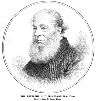
Henry Thomas Ellacombe or Ellicombe (1790-1885), was an English divine and antiquary. He was the inventor of an apparatus to allow a single ringer to ring multiple bells.

Ram Hill is a hamlet in the civil parish of Westerleigh and Coalpit Heath, in the South Gloucestershire district, in the ceremonial county of Gloucestershire, England. It is located between Coalpit Heath and Westerleigh and adjoins the hamlet of Henfield immediately to the south. In the Mudge Map 1815, Ram Hill was known as Nutridge Hill, and was linked to Westerleigh by Broad Lane and to Mays Hill by Frog Lane.

The Avon and Gloucestershire Railway also known as The Dramway was an early mineral railway, built to bring coal from pits in the Coalpit Heath area, north-east of Bristol, to the River Avon opposite Keynsham. It was dependent on another line for access to the majority of the pits, and after early success, bad relations and falling traffic potential dogged most of its existence.
Henry Nicholson Ellacombe (1822–1916) was a British plantsman and author on botany and gardening.


