Ford is a hamlet in the parish of Dinton-with-Ford and Upton, in Buckinghamshire, England. It is located in the south eastern corner of the main parish.

Gibraltar is a hamlet in the parish of Dinton-with-Ford and Upton in Buckinghamshire, England. It is located on the modern main road that links Aylesbury with Thame.
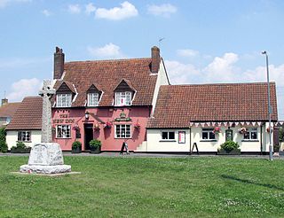
Handy Cross is a hamlet in the parish of Little Marlow, Buckinghamshire, England. It is located on Marlow Hill, on the old road between Marlow and High Wycombe. At the 2011 Census the population of the hamlet was included in the civil parish of Great Marlow. Today the hamlet consists of a farm, several households and a Harvester pub & restaurant.
Hundridge is a hamlet in the parish of Chartridge, in Buckinghamshire, England. It is located in the Chiltern Hills to the west of the town of Chesham. During the 14th century it was known as Hunderugge, and Hundrige in the 15th/16th century. The hamlet name derives from either the Anglo Saxon hunda-hrycg meaning 'hounds' ridge', or from Hundan-hrycg meaning 'Hunda's ridge'.

Llantwit Major is a town and community in Wales. Situated on the Bristol Channel coast, it is one of four towns in the Vale of Glamorgan, with the third largest population after Barry and Penarth, and ahead of Cowbridge. Llantwit Major is 4 1⁄2 miles (7.2 km) from Cowbridge, 9 miles (14 km) from Bridgend, 10 miles (16 km) from Barry, and 15 miles (24 km) from Cardiff.

Coalpit Heath is a small village in the parish of Westerleigh, South Gloucestershire, England, south of Yate and east of Frampton Cotterell in South Gloucestershire.
Westerleigh is a residential neighborhood in the northwestern part of Staten Island in New York City.
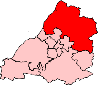
Northavon was, from 1983 until 2010, a constituency represented in the House of Commons of the Parliament of the United Kingdom. It elected one Member of Parliament (MP) by the first past the post system of election.

Frampton Cotterell is a village and parish, in South Gloucestershire, South West England, on the River Frome. The village is contiguous with Winterbourne to the south-west and Coalpit Heath to the east. The parish borders Iron Acton to the north and Westerleigh to the south-east, the large town of Yate is 3 miles (4.8 km) away. The village is 8.7 miles (14 km) north-east of the city of Bristol.
Piddington is a hamlet in the parish of Piddington and Wheeler End in Buckinghamshire, England. It is located on the main A40 between Stokenchurch and West Wycombe.

Hawkesbury is a hamlet consisting of a few cottages around a triangular green. It is also the name of a civil parish in the South Gloucestershire unitary authority in England in which Hawkesbury itself lies, it is located west of Hawkesbury Upton, off the A46 road.

Gaunt's Earthcott, sometimes spelt Gaunts Earthcott, is a hamlet in the civil parish of Almondsbury in South Gloucestershire, England. It consists of a ruined chapel, a few houses and two farms, Green Farm and Court Farm. The village is located approximately 2.5 miles (4 km) from Rudgeway and the A38 road and about the same distance from Frampton Cotterell and Winterbourne. The village is located close to the interchange between the M4 and M5 motorways. There is no real industry as such and the main economic activity in the area is farming.
North Common is a village just outside Warmley, Bristol, in South Gloucestershire, England. Historically this was a rural hamlet surrounded by farmland. The residents are fortunate enough that to the east of the village is attractive rolling countryside, with views of lansdown, and the surrounding hills. The village is on the eastern outskirts of Bristol and approximately halfway between Bristol city centre and the neighbouring city of Bath.
Pinkneys Green is a semi-rural, suburban village at the northwestern boundary of the town of Maidenhead in the English county of Berkshire. Until the boundary changes of 1894, Pinkneys Green had been a hamlet in the civil parish of Cookham.

Frampton Mansell is a small English village 5 miles ESE of Stroud, in the parish of Sapperton. It is lies off the A419 road between Stroud and Cirencester.
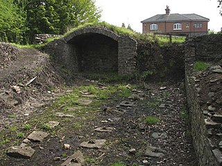
Ram Hill Colliery, was a privately owned colliery in the Coalpit Heath area north-east of Bristol, England. It operated between about 1825 and 1865.

Henfield is a hamlet in South Gloucestershire, England between Coalpit Heath and Westerleigh, adjoining the hamlet of Ram Hill immediately to the north.

Westerleigh Junction is a railway junction in Gloucestershire, England, where the Cross Country Route (XCR) from York to Bristol Temple Meads meets the South Wales Main Line (SWML) from London Paddington to Swansea, near the village of Westerleigh.

Ram Hill is a hamlet in South Gloucestershire, England. It is located between Coalpit Heath and Westerleigh and adjoins the hamlet of Henfield immediately to the south. In the Mudge Map 1815, Ram Hill was known as Nutridge Hill, and was linked to Westerleigh by Broad Lane and to Mays Hill by Frog Lane.