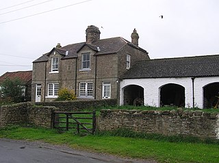
Morton Tinmouth is a hamlet of a few farms in County Durham, England. It is situated a few miles to the north-west of Darlington close to the village of Bolam.
Whitfield is a hamlet in South Gloucestershire, England.

Bamfurlong is a village in Gloucestershire, England, between Cheltenham and Gloucester, near Gloucestershire Airport, and divided in two by the M5 motorway. There is no access from one half of Bamfurlong to the other other than via Bamfurlong Lane and the motorway bridge.

Coombe Hill is a hamlet in the civil parish of Leigh in Gloucestershire, England. It lies on the A38 road between Gloucester and Tewkesbury, at the junction with the A4019 road to Cheltenham.
Bridgeyate is a hamlet in South Gloucestershire, England. Bridgeyate is situated between the cities of Bristol and Bath. The increase in housebuilding in the area has seen Bridgeyate become attached to the nearby villages of Warmley and North Common, but it still retains its own identity with a large common and three public houses, The Griffin, The White Hart and The Hollybush. The Hollybush reopened in March 2014 after an extensive refit.

Gaunt's Earthcott, sometimes spelt Gaunts Earthcott, is a hamlet in the civil parish of Almondsbury in South Gloucestershire, England. It consists of a ruined chapel, a few houses and two farms, Green Farm and Court Farm. The village is located approximately 2.5 miles (4 km) from Rudgeway and the A38 road and about the same distance from Frampton Cotterell and Winterbourne. The village is located close to the interchange between the M4 and M5 motorways. There is no real industry as such and the main economic activity in the area is farming.

Engine Common is a village in the civil parish of Iron Acton in South Gloucestershire, England. It lies about 1 mile north west of Yate.

Hinton is a village in South Gloucestershire, England. It is one mile north of Dyrham and forms part of the civil parish of Dyrham and Hinton. The Bull is the local pub.

Little Badminton is a village in South Gloucestershire, England.
Upton Cheyney is a village near to Bitton and Bristol in South Gloucestershire, England.

Wapley is a rural village in South Gloucestershire, England.

West Littleton is a small hamlet in South Gloucestershire, England. It is located between the M4 and the A420. The closest amenities are in Marshfield and the historic city of Bath is a short distance to the south. The stately home, Dyrham Park, is located a few hundred metres from the village.
Bishop's Hill Wood is a 30.6 hectares biological Site of Special Scientific Interest (SSSI) in England. It lies just to the east of the village of Wickwar, South Gloucestershire and was notified in 1984.

Codrington is a settlement in South Gloucestershire, England. It is located near Junction 18 of the M4 motorway south of Wapley and Yate.

Lower Wick is a small hamlet located in the county of Gloucestershire, England. It is situated about five miles south west of Dursley, eighteen miles southwest of Gloucester and fifteen miles northeast of Bristol. Lower Wick is within the civil parish of Alkington.

Brentford Ait is a long 4.572-acre (1.9 ha) uninhabited ait in the River Thames, with no buildings, on the Tideway near Brentford in London, England.

Bradley is a small village in the Stroud District, in the county of Gloucestershire, England.

The Four Shire Stone is a boundary marker that marks the place where the four historic English counties of Warwickshire, Oxfordshire and Gloucestershire, and Worcestershire once met. Since 1931, with a change to the boundaries of Worcestershire, only three counties have met at the stone.

The Burnley Coalfield is the most northerly portion of the Lancashire Coalfield. Surrounding Burnley, Nelson, Blackburn and Accrington, it is separated from the larger southern part by an area of Millstone Grit that forms the Rossendale anticline. Occupying a syncline, it stretches from Blackburn past Colne to the Yorkshire border where its eastern flank is the Pennine anticline.


