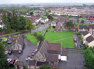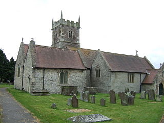
South Gloucestershire is a unitary authority area in the ceremonial county of Gloucestershire, South West England. Towns in the area include Yate, Chipping Sodbury, Kingswood, Thornbury, Filton, Patchway and Bradley Stoke. The southern part of its area falls within the Greater Bristol urban area surrounding the city of Bristol.

Bradley Stoke is a town and civil parish in South Gloucestershire, England, situated 6 miles north-northeast of Bristol city centre. The town is the northernmost part of the Bristol built-up area.

The A38, parts of which are known as Devon Expressway, Bristol Road and Gloucester Road, is a major A-class trunk road in England.

Almondsbury is a large village and civil parish in South Gloucestershire, England. It is situated on the A38 road in the Avon Green Belt 7 miles (11 km) north of Bristol city centre. It is adjacent to junction 16 of the M5 motorway and Almondsbury Interchange, where the M4 and M5 cross. It is part of the Bristol Built-up Area.

Filton is a town and civil parish in South Gloucestershire, England, 6 miles (10 km) north of Bristol. Along with nearby Patchway and Bradley Stoke, Filton forms part of the Bristol urban area and has become an overflow settlement for the city.

Patchway is a town and civil parish in South Gloucestershire, England, situated 6 mi (9.7 km) north-north west of central Bristol. The town has become an overflow settlement for Bristol and is contiguous with Bristol's urban area, along with the nearby towns of Filton and Bradley Stoke.

Stoke Gifford is a neighbourhood and parish and electoral ward in the South Gloucestershire district, in the ceremonial county of Gloucestershire, England. Formerly a separate village, it is now a suburb in the Bristol built-up area, part of the city's North Fringe. The ward had 14,200 residents in 5,788 households at the 2021 census and the parish had 19,794.

Little Stoke is a village in the parish of Stoke Gifford, situated in South Gloucestershire, England. It is surrounded by Patchway, Stoke Gifford and Bradley Stoke. Home to Patchway railway station, a minor stop on the railway network, the railway line separates Little Stoke from the large Rolls-Royce factories in nearby Filton. Gipsy Patch Lane Bridge provides access under the line.
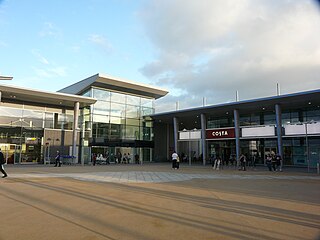
Cribbs Causeway is both a road in South Gloucestershire, England, running north of the city of Bristol, and the adjacent area which is notable for its out-of-town shopping and leisure facilities. The retail and leisure complex takes its name from the road, and includes retail parks, supermarkets, an enclosed shopping centre known as Cribbs, an ice-rink, Vue, a cinema, Hollywood Bowl, a ten-pin bowling venue, and a gym.

Filton Airport or Filton Aerodrome was a private airport in Filton and Patchway, within South Gloucestershire, 4 NM north of Bristol, England.

The A453 road was formerly the main trunk road connecting the English cities of Nottingham and Birmingham. However, the middle section of this mainly single-carriageway road has largely been downgraded to B roads or unclassified roads following the construction of the parallel M42-A42 link around 1990. The M42 was originally meant to pass further north than it does, and to join the M1 at Sandiacre in Derbyshire. The M42/A42 does not enter Derbyshire, but instead joins the M1 closer to the A453 junction at Kegworth. The A42 shadows the former A453 from Appleby Magna to Castle Donington. The road historically connected the East Midlands with the West Midlands.

Patchway railway station is on the South Wales Main Line, serving the town of Patchway and village of Stoke Gifford in South Gloucestershire, England. It is 6 miles (10 km) from Bristol Temple Meads. Its three letter station code is PWY. It is managed by Great Western Railway, who provide all train services at the station; there is generally a train every hour in each direction between Cardiff Central and Taunton.

The Almondsbury Interchange in South Gloucestershire, is one of the United Kingdom's largest motorway stack interchanges. The interchange is one of only three four-level stacks in the UK, spanning a range of 1 km by 1 km. It is the interchange for the M5 at junction 15 and M4 at junction 20, and is situated at the northern fringes of Bristol close to the village of Almondsbury, the Aztec West industrial estate, and Bradley Stoke. When it opened in 1966, it was the most complex junction on the British motorway network, a free-flowing interchange on four levels. Since then traffic volumes have increased. At busy periods, the Interchange becomes more difficult to negotiate safely. In an attempt to ease congestion, the Interchange has become part of a smart motorway.

Aztec West is a business park in South Gloucestershire, England, situated in the north of Bristol, near Bradley Stoke and Patchway. It is close to the M4 and M5 motorways and the Almondsbury Interchange. Adjacent is the A38 trunk road.

Severn Stoke is an English village and civil parish in the Malvern Hills District, in the south of the county of Worcestershire, alongside the A38 trunk road. It had a population of 611 in 2011.

The North Fringe of Bristol, England is a mostly developed area between the northern edge of the administrative city of Bristol and the M4 and M5 motorways. Its eastern edge is usually defined as the M32 motorway. The area falls within South Gloucestershire Council, and is the northern part of Greater Bristol.

Charlton Hayes is a mixed-use development and civil parish in the South Gloucestershire district, in the ceremonial county of Gloucestershire, England. It is located on land north of the old Filton Airfield and is a new extension to Patchway. Planning permission was granted by South Gloucestershire Council in 2008 to build 2,200 homes for 6,000 residents. Charlton Hayes was named after the village of Charlton, which was demolished in the late 1940s to make way for the Filton Airfield runway extension.

MetroBus is a metrobus system in Bristol, England, created as a joint project between Bristol, North Somerset and South Gloucestershire councils. The first route, service m3, began operations on 29 May 2018, followed by m2 on 3 September 2018, m1 on 6 January 2019 and m4 on 22 January 2023.
The Olympus Academy Trust was set up in 2012. Situated within the districts of Bradley Stoke, Filton, Patchway and surrounding areas the trust currently comprises nine South Gloucestershire schools; one all-through, three secondary and five primary academies.


