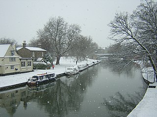
The River Cam is the main river flowing through Cambridge in eastern England. After leaving Cambridge, it flows north and east before joining the River Great Ouse to the south of Ely, at Pope's Corner. The total distance from Cambridge to the sea is about 40 mi (64 km) and is navigable for punts, small boats, and rowing craft. The Great Ouse also connects to England's canal system via the Middle Level Navigations and the River Nene. In total, the Cam runs for around 69 kilometres (43 mi) from its furthest source to its confluence with the Great Ouse.
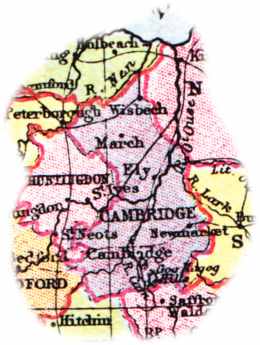
The English county of Cambridgeshire has a long history.
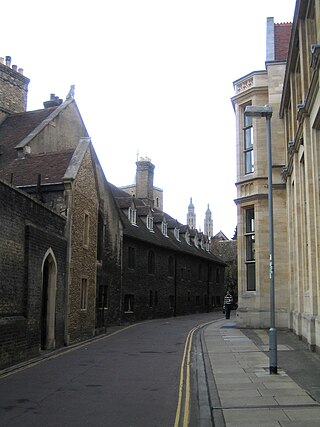
Free School Lane is a historic street in central Cambridge, England which includes important buildings of University of Cambridge. It is the location of the Whipple Museum of the History of Science, the Department of History and Philosophy of Science (HPS,) the University's faculty of Social and Political Sciences, and is the original site of the Engineering Department, and the Physics Department's Cavendish Laboratory. At the northern end is Bene't Street and at the southern end is Pembroke Street. To the east is the New Museums Site of the University. To the west is Corpus Christi College.

Chesterton was a rural district in Cambridgeshire, England from 1894 to 1974.
Lightwood is a suburb of Stoke-on-Trent, Staffordshire, England. It is located to the south of Longton, and Lightwood Road runs from here to Rough Close.

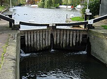
Jesus Lock is a lock on the River Cam in the north of central Cambridge, England. This is Lock No. 1 on the navigable portion of the River Cam. It was built in 1836 and is the only lock in the city. Jesus Green Lock Cottage, the former lock-keeper's cottage, is by the lock on Jesus Green. It is owned by the Conservators of the River Cam and is rented out to students.

Chesterton Hall is a house in Chesterton, Cambridge. It lies in the city of Cambridge in the county of Cambridgeshire approximately 50 miles (80 km) north-northeast of London. Most of the grounds have long since been sold off and the house is now located on one of the major roundabouts of the city. The house dates from the early 17th century.

Jesus Green is a park in the north of central Cambridge, Cambridgeshire, England, north of Jesus College. Jesus Ditch runs along the southern edge Jesus Green. On the northern edge of Jesus Green is the River Cam, with Chesterton Road on the opposite side. To the east is Victoria Avenue and beyond that Midsummer Common, common land that is still used for grazing. Victoria Avenue crosses the Cam at Victoria Bridge, connecting to Chesterton Road, at the northeastern corner of Jesus Green.

Madingley Road is a major arterial road linking central Cambridge, England with Junction 13 of the M11 motorway. It passes by West Cambridge, a major new site where some University of Cambridge departments are being relocated.
Magdalene Street is a street in the north of central Cambridge, England. It runs between Castle Street, by Castle Hill, at the junction with Northampton Street and Chesterton Lane, then Chesterton Road, to the northwest and Bridge Street at the junction with Thompson's Lane to the southeast.

Northampton Street is a street in the north of central Cambridge, England. It runs between Madingley Road and Queen's Road to the west and Castle Street, by Castle Hill, Chesterton Lane, and Magdalene Street to the east.
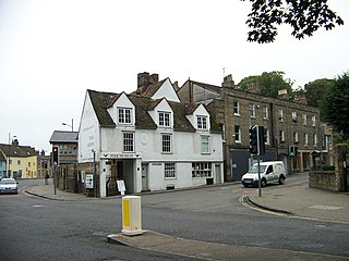
Castle Street is a street in the north of central Cambridge, England. To the southeast is a junction with Northampton Street, Magdalene Street, and Chesterton Lane. To the northwest is a junction with Mount Pleasant, Huntingdon Road, Histon Road, and Victoria Road.

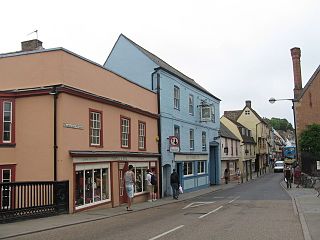
Market Street is a shopping street in central Cambridge, England. It runs between Market Hill, location of the city's central Market Square to the west and Sidney Street to the east. On the other side of the market square, the street continues west as St Mary's Street north of Great St Mary's, the University church. On the other side of Sidney Street is Hobson's Passage leading east to Hobson Street. To the north is Market Passage and to the south is Petty Cury, a pedestrianised shopping street.

Elizabeth Way is a road in northeast Cambridge, England. It is designated the A1134 and forms part of Cambridge's inner ring road. At the northern end is a roundabout forming a junction with Milton Road. Near the north end is another roundabout linking with Chesterton Road to the west. At the southern end there is a roundabout that links with East Road and Newmarket Road.

Victoria Road is a residential road in the north of Cambridge, England. The road is designated the A1134. At the western end, the road links with Histon Road, Huntingdon Road, Mount Pleasant, and Castle Street.In 1950, there were plans to improve this junction, but they never came to fruition. At the eastern end it links with Chesterton Road (A1303) and also links to Milton Road, the A1134, then A1309, northeast out of the city, also linking with the A14.
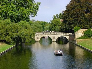
Victoria Bridge is a single-arch road bridge across the River Cam in Cambridge, England. It carries Victoria Avenue. Immediately to the north is Chesterton Road and a major junction with Victoria Road and Milton Road.

The Milton Keynes Hoard is a hoard of Bronze Age gold found in September 2000 in a field at Monkston Park in Milton Keynes, England. The hoard consisted of two torcs, three bracelets, and a fragment of bronze rod contained in a pottery vessel. The inclusion of pottery in the find enabled it to be dated to around 1150–800 BC.

There are two notable Ipswich Hoards. The first was a hoard of Anglo-Saxon coins discovered in 1863. The second was a hoard of six Iron Age gold torcs that was discovered in 1968 and 1969. The latter hoard has been described as second only to the Snettisham Hoard in importance as a hoard from the Iron Age, and is held at the British Museum.
Swavesey Priory was a medieval monastic house in the village of Swavesey, Cambridgeshire, England. A church existed in Swavesey at the time of the Norman Conquest, when Alan, Count of Richmond, granted it to the Benedictine Abbey of St Sergius and St Bacchus in Angers, France. The Abbey founded an alien priory in Swavesey by 1086. It ceased to function in 1539, during the dissolution of the monasteries. The site is now a scheduled monument.