Related Research Articles

Shawnee County is located in northeast Kansas, in the central United States. Its county seat and most populous city is Topeka, the state capital. As of the 2020 census, the population was 178,909, making it the third-most populous county in Kansas. The county was one of the original 33 counties created by the first territorial legislature in 1855, and it was named for the Shawnee tribe.

Labette County is a county located in Southeast Kansas. Its county seat is Oswego, and its most populous city is Parsons. As of the 2020 census, the county population was 20,184. The county was named after LaBette creek, the second-largest creek in the county, which runs roughly NNW-SSE from near Parsons to Chetopa. The creek in turn was named after French-Canadian fur trapper Pierre LaBette who had moved to the area, living along the Neosho River, and marrying into the Osage tribe in the 1830s and 1840s.

Chetopa is a city in Labette County, Kansas, United States. As of the 2020 census, the population of the city was 929. Chetopa was named for Chief Chetopah, an Osage Indian chief. Later, the community name was shortened.
Berryman is an unincorporated community on the border between Crawford and Washington counties in the U.S. state of Missouri. Located along Route 8, it lies in the Mark Twain National Forest, approximately sixteen miles west of Potosi. Courtois Creek flows under Route 8, just west of the village. Berryman Recreation Area and trail lie to the northeast of the village.
East-Central Kansas is a region of Kansas. It is located between the Kansas City metropolitan area and Southeast Kansas, and on the border with Missouri. The region extends westward towards the Flint Hills to Lyon County. East-Central Kansas geographically features rolling hills and deep forested river valleys. The main crop of this predominantly agricultural region is corn. The area is more forested and more moist compared to the rest of the state. East-Central Kansas is rich with state history, as many locations of this region saw battles in Bleeding Kansas, and the infamous abolitionist John Brown and his men battled in Osawatomie. Much of the area is powered by Wolf Creek Nuclear Generating Station which is located near Burlington. The most populous cities of the region include Emporia, Ottawa, Paola, Osawatomie, Garnett, Osage City, Burlington, and Louisburg.
Cofachique is a ghost town situated along the Neosho River near the present-day city of Iola in Allen County, Kansas, United States. Being the first town established in Allen County in 1855, it was the original county seat. However, within five years the greater part of the town was moved to the new town of Iola, while the old site of Cofachique became farm land. The town was named in honor of an Osage chief known as Cofachique, who is said to have been particularly helpful to early settlers, bringing aid to the distressed and homeless. The name "Cofachique" appears to have origins with the Cofachiqui tribe in South Carolina, who were Siouan speakers, and the Osage who settled this area were closely affiliated with the Siouan.
Clinton Township is a township in Douglas County, Kansas, USA. As of the 2000 census, its population was 531. It took its name from Clinton, Illinois.

Marion Township is a township in Douglas County, Kansas, USA. As of the 2000 census, its population was 836. It was named after the former town of Marion which in turn was named after Francis Marion.
Barclay is an unincorporated community in Osage County, Kansas, United States.
Chetopa Township is a township in Wilson County, Kansas, in the United States.
Neodesha Township is a township in Wilson County, Kansas, United States.
Deer Creek is a stream in Allen County, Kansas and Anderson County, Kansas, in the United States. It is a tributary of the Neosho River.
Vegetarian Creek is a stream in Allen and Neosho counties, Kansas in the United States.
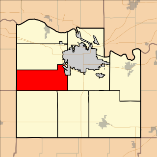
Canville Township is a township in Neosho County, Kansas, in the United States.
Canville Creek is a stream in Neosho County, Kansas and Allen County, Kansas, in the United States.
Opossum Creek is a stream in Bourbon and Linn counties, in the U.S. state of Kansas. It is a tributary of the Little Osage River.
Limestone Creek is a stream in Bourbon and Allen counties, in the U.S. state of Kansas.
Pawnee Creek is a stream in Bourbon and Crawford counties, in the U.S. state of Kansas. It is a tributary via Paint Creek of the Marmaton River, which in turn flows east to the Little Osage River, the Osage River, the Missouri River, and ultimately the Mississippi River.
Pease is an unincorporated community in Laclede County, in the Ozarks of southern Missouri. Pease is located along the Osage Fork Gasconade River, just upstream of the Missouri Route J crossing and the confluence of Parks Creek with the Osage Fork.
Duncan Creek is a stream in Bates and Vernon counties in the U.S. state of Missouri. It is a tributary of the Little Osage River. The stream headwaters arise at 38°4′55″N94°34′58″W south of the community of Hume in Bates County and one mile from the Missouri-Kansas border. It flows to the south into Vernon County and passes just west of the community of Amos and on to its confluence with the Little Osage two miles northwest of Stotesbury at 37°59′48″N94°35′3″W.
References
- ↑ U.S. Geological Survey Geographic Names Information System: Chetopa Creek
- ↑ History of the State of Kansas: Containing a Full Account of Its Growth from an Uninhabited Territory to a Wealthy and Important State. A. T. Andreas. 1883. p. 826.
- ↑ Burns, Louis F. (28 January 2004). A History of the Osage People. University of Alabama Press. p. 52. ISBN 978-0-8173-5018-5.
37°26′14″N95°40′09″W / 37.437281°N 95.669147°W
| | This article about a location in Neosho County, Kansas is a stub. You can help Wikipedia by expanding it. |
| | This article about a location in Wilson County, Kansas is a stub. You can help Wikipedia by expanding it. |