Cheviot Beach

Last updated

Cheviot Beach
Beach
Cheviot Beach.png
Australia Victoria metropolitan Melbourne location map.svg
Red pog.svg
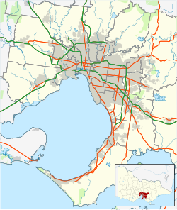
Cheviot Beach
Location within South Central Victoria
Coordinates: 38°18′42″S144°39′50″E / 38.3117°S 144.6640°E / -38.3117; 144.6640
Location Portsea, Victoria, Australia

Cheviot Beach is a beach near Point Nepean in Victoria, Australia. It was named after the SS Cheviot, which broke up and sank nearby with the loss of 35 lives on 20 October 1887. [1] [2]

It was the site of the disappearance of Prime Minister Harold Holt; on 17 December 1967, Holt went swimming at the beach, disappeared, and was presumed drowned. He was last seen in the ocean and was then dragged under a wave, never to be seen again. His body was never recovered. [3] Point Nepean had long been a restricted area, initially for quarantine and then later for defence purposes; at the time, it was used by the officer training school of the Australian Army, and Holt had reportedly been issued a special pass to use the beach. [2]

A lookout and memorial to Holt overlook the beach on Cheviot Hill, accessible via a self-guided walk from Point Nepean; however, there remains no beach access, with swimming prohibited for safety reasons. Surf Life Saving Australia rates it as "extremely hazardous" for swimming, noting "at high tide the rocks and reefs lie immediately off the beaches and, as the tide drops, strong permanent rips intensify off the rocks and amongst the reefs." [4] [5] [2]

Related Research Articles

<span class="mw-page-title-main">Coffin Bay National Park</span> Protected area in South Australia

Coffin Bay National Park is a protected area in on the Eyre Peninsula of South Australia, Australia, which is located about 301 km west of Adelaide and about 46 km west of Port Lincoln. The town of Coffin Bay is near the entrance to the national park. The national park occupies the Coffin Bay Peninsula - a long peninsula with a sheltered bay to its north, coastal dunes, swamps and a coastline which overlooks islands, reefs, limestone cliffs and white surf beaches.

<span class="mw-page-title-main">Port Phillip</span> Bay in Victoria, Australia

Port Phillip or Port Phillip Bay is a horsehead-shaped enclosed bay on the central coast of southern Victoria, Australia. The bay opens into the Bass Strait via a short, narrow channel known as The Rip, and is completely surrounded by localities of Victoria's two largest cities — metropolitan Greater Melbourne in the bay's main eastern portion north of the Mornington Peninsula, and the city of Greater Geelong in the much smaller western portion north of the Bellarine Peninsula. Geographically, the bay covers 1,930 km2 (750 sq mi) and the shore stretches roughly 264 km (164 mi), with the volume of water around 25 km3 (6.0 cu mi). Most of the bay is navigable, although it is extremely shallow for its size — the deepest portion is only 24 m (79 ft) and half the bay is shallower than 8 m (26 ft). Its waters and coast are home to seals, whales, dolphins, corals and many kinds of seabirds and migratory waders.

<span class="mw-page-title-main">Mornington Peninsula</span> Peninsula and region of Victoria, Australia

The Mornington Peninsula is a peninsula located south of Melbourne, Victoria, Australia. It is surrounded by Port Phillip to the west, Western Port to the east and Bass Strait to the south, and is connected to the mainland in the north. Geographically, the peninsula begins its protrusion from the mainland in the area between Pearcedale and an area north of Frankston. The area was originally home to the Mayone-bulluk and Boonwurrung-Balluk clans and formed part of the Boonwurrung nation's territory prior to European settlement.

<span class="mw-page-title-main">Aireys Inlet</span> Town in Victoria, Australia

Aireys Inlet is a small coastal inlet and town located on the Great Ocean Road, southwest of Melbourne, Victoria, Australia. Aireys Inlet is located between Anglesea and Lorne, and joined with Fairhaven, Moggs Creek, and Eastern View to the west.

<span class="mw-page-title-main">Portsea, Victoria</span> Suburb of Melbourne, Victoria, Australia

Portsea is a seaside town on the Mornington Peninsula in Melbourne, Victoria, Australia, approximately 60 kilometres (37 mi) south-west of Melbourne's Central Business District, located within the Shire of Mornington Peninsula local government area. Portsea recorded a population of 787 at the 2021 census.

<span class="mw-page-title-main">Torquay, Victoria</span> Town in Victoria, Australia

Torquay is a seaside resort in Victoria, Australia, which faces Bass Strait, 21 km south of Geelong and is the gateway to the Great Ocean Road. It is bordered on the west by Spring Creek and its coastal features include Point Danger and Zeally Bay. At the 2021 census, Torquay had a population of 18,534.

<span class="mw-page-title-main">The Rip</span> Waterway entrance in Victoria, Australia

"The Rip", also known as "The Heads", is the narrow waterway entrance connecting the Bass Strait to the bay of Port Phillip in southern Victoria, Australia, and is the only route of maritime transport into Port Phillip and thus seaport access into Melbourne and Geelong, Victoria's two largest cities. Because of large tidal flows through the relatively narrow channel from the bay to the ocean, and a high rocky seabed, The Rip is a dangerous stretch of water and has claimed numerous ships and many lives. Geographically, it is the roughly triangular area of water between the land points of Point Nepean on the Mornington Peninsula, Shortlands Bluff and Point Lonsdale on the Bellarine Peninsula, with these three forming The Heads.

<span class="mw-page-title-main">Inverloch, Victoria</span> Town in Victoria, Australia

Inverloch is a seaside town in Victoria, Australia. It is 143 kilometres (89 mi) south east of Melbourne via the South Gippsland Highway on the Bass Highway in the Bass Coast Shire of Gippsland. Known originally for the calm waters of Anderson Inlet, it is now also known for the discovery of Australia's first dinosaur bone.

<span class="mw-page-title-main">Point Nepean</span> Geographic location

Point Nepean marks the southern point of The Rip and the most westerly point of the Mornington Peninsula, in Victoria, Australia. It was named in 1802 after the British politician and colonial administrator Sir Evan Nepean by John Murray in HMS Lady Nelson. Its coast and adjacent waters are included in the Port Phillip Heads Marine National Park, while its land area is part of the Point Nepean National Park. The point includes Cheviot Beach on its southern side, notable as the site of the disappearance in 1967 of Australia's then-Prime Minister Harold Holt.

<span class="mw-page-title-main">Leo Carrillo State Park</span> State park in Los Angeles and Ventura counties, California, United States

Leo Carrillo State Park is a state park in Los Angeles County, California, United States. Situated along the Malibu coast, the park is a component of Santa Monica Mountains National Recreation Area. With 1.5 miles (2.4 km) of beach, the parkland stretches into the Santa Monica Mountains. The park has expanded into Ventura County and also includes management of County Line Beach. California State Route 1 runs through the park, where it intersects with the western terminus of the Mulholland Highway. The 2,513-acre (1,017 ha) park was established in 1953. It is named for actor and conservationist Leo Carrillo (1880–1961), who served on the State Parks commission.

<span class="mw-page-title-main">Cape Paterson</span> Town in Victoria, Australia

Cape Paterson is a cape and seaside village located near the town of Wonthaggi, 132 kilometres (82 mi) south-east of Melbourne via the South Gippsland and Bass Highways, in the Bass Coast Shire of Gippsland, Victoria, Australia. Known originally for the discovery of coal by William Hovell in 1826, it is now extremely popular for its beaches and rockpool and at the 2011 census, it had a population of 718.

<span class="mw-page-title-main">Port Phillip Heads Marine National Park</span> Protected area in Victoria, Australia

The Port Phillip Heads Marine National Park is a marine protected area located in the vicinity of the bay of Port Phillip, between the Bellarine and Mornington Peninsulas, in Victoria, Australia. The 3,580-hectare (8,800-acre) marine national park comprises six separate sites located approximately 60 kilometres (37 mi) south-west of Melbourne and stretches along 40 kilometres (25 mi) of coastline of Victoria.

SS Cheviot was an iron screw steamer built by Charles Mitchell and Co., of Low Walker, Newcastle upon Tyne, England in 1870. She was owned by Wm. Howard Smith & Sons, Melbourne, Australia, for the transportation of coal and passengers. In 1887, she was wrecked in rough seas near Point Nepean in Victoria, Australia, with the loss of 35 lives, after the propeller was disabled. The beach nearby was subsequently named Cheviot Beach.

<span class="mw-page-title-main">Etty Bay</span>

Etty Bay is a relatively sheltered bay in Far North Queensland with a 700 metres (2,300 ft) long beach in the far north of the Australian state of Queensland. The beach is 15 kilometres (9.3 mi) by road from the township of Innisfail, 20 minutes drive from Paronella Park and 7 kilometres (4.3 mi) from the Bruce Highway. The final kilometre of the route is a scenic drive climbing 100 metres (330 ft) over the Moresby Range before descending into a picturesque bay. The Bay has a Surf Lifesaving Club and a small caravan park.

<span class="mw-page-title-main">Seaspray, Victoria</span> Town in Victoria, Australia

Seaspray is a small coastal town in Victoria, Australia, in the Gippsland region of the state. The town is located alongside the Ninety Mile Beach about 10 kilometres (6.2 mi) off the South Gippsland Highway in the Shire of Wellington, 242 kilometres (150 mi) east of the state capital, Melbourne.

Forrest Beach is a small coastal locality in the Shire of Hinchinbrook, Queensland, Australia. In the 2016 census, Forrest Beach had a population of 1,254 people.

Grey River is a rural locality in the Shire of Colac Otway, Victoria, Australia. It lies on the Great Ocean Road at the mouth of the Grey River, from which it derives its name.

<span class="mw-page-title-main">Disappearance of Harold Holt</span> 1967 presumed death of the Prime Minister of Australia

On 17 December 1967, Harold Holt, the 17th prime minister of Australia, disappeared while swimming in the sea near Portsea, Victoria. An enormous search operation was mounted in and around Cheviot Beach, but his body was never recovered. Holt was presumed to have died, and his memorial service five days later was attended by many world leaders.

<span class="mw-page-title-main">1968 Liberal Party of Australia leadership election</span>

A leadership election in the Liberal Party of Australia, the party of government in the Parliament of Australia, was held on 9 January 1968. It followed the disappearance and presumed drowning of previous leader Harold Holt, who had been declared dead on 19 December 1967. The contest was won by Senator John Gorton in a party room ballot; he was sworn in as prime minister the following day, replacing caretaker John McEwen.

<span class="mw-page-title-main">Long Reef (New South Wales)</span>

Long Reef is a prominent headland on the Northern Beaches of Sydney, Australia. Connected to the mainland by a tombolo, the reef has an extensive wave-cut platform. Long Reef is a popular recreational destination and is one of the more interesting geological areas in Sydney.

References

  1. Brad Duncan & Martin Gibbs (2015). Please God Send Me a Wreck: Responses to Shipwreck in a 19th Century Australian Community. Springer. p. 100. ISBN   9781493926428.
  2. 1 2 3 "Point Nepean - The Silent Sands of Cheviot Beach" (PDF). Victoria's Heritage. Parks Victoria. Archived from the original (PDF) on 27 June 2012. Retrieved 8 February 2016.
  3. "Harold Holt's disappearance - Fact sheet 144". National Archives of Australia. Archived from the original on 25 February 2015. Retrieved 8 February 2016.
  4. "Cheviot". Beachsafe. Surf Live Saving Australia. Retrieved 8 February 2016.
  5. "Park Note: Point Nepean National Park" (PDF). Parks Victoria. Archived from the original (PDF) on 23 October 2015. Retrieved 8 February 2016.