This article is about the demographic features of the population of Peru, including population density, ethnicity, education level, the health of the populace, economic status, religious affiliations and other aspects of the population.

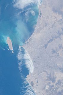
Lima is the capital and the largest city of Peru. It is located in the valleys of the Chillón, Rímac and Lurín rivers, in the central coastal part of the country, overlooking the Pacific Ocean. Together with the seaport of Callao, it forms a contiguous urban area known as the Lima Metropolitan Area. With a population of more than 9 million, Lima is the most populous metropolitan area of Peru and the seventh-largest metropolitan area in the Americas.

Trujillo is a city in coastal northwestern Peru and the capital of the Department of La Libertad. It is the third most populous city and center of the third most populous metropolitan area of Peru. It is located on the banks of the Moche River, near its mouth at the Pacific Ocean, in the Moche Valley. This was a site of the great prehistoric Moche and Chimu cultures before the Inca conquest and subsequent expansion.

Chiclayo is the principal city of the Lambayeque region in northern Peru. It is located 13 kilometers inland from the Pacific coast and 770 kilometers from the nation's capital, Lima.

Cusco, also spelled Cuzco, is a department in Peru. It is bordered by the departments of Ucayali on the north; Madre de Dios and Puno on the east; Arequipa on the south; and Apurímac, Ayacucho and Junín on the west. Its capital is Cusco, the historical capital of the Inca Empire.

Arequipa is a province in the Arequipa Region, Peru. Its capital, Arequipa, is Peru's third most populous province of Peru. It borders the provinces of Islay, Camaná, Caylloma, and the Cusco and Puno regions. According to INEI in the year 2014 it has a population of 958.351 people.

Lima Province is located in the central coast of Peru and is the only province in the country not belonging to any of the twenty-five regions. Its capital is Lima, which is also the nation's capital.

The Lima metropolitan area, is an area formed by the conurbation of the Peruvian provinces of Lima and Callao. It is the largest of the metropolitan areas of Peru, the seventh largest in the Americas, the fourth largest in Latin America, and among the thirty largest in the world. The conurbation process started to be evident in the 1980s. The metropolitan area is composed of five subregions. These are Lima Norte, Lima Sur, Lima Este, Central Lima, and Callao. Its estimated 2020 population is over 11 million according to the INEI.

Trujillo Province is one of twelve provinces in La Libertad Region in Peru.
Patapo District is one of twenty districts of the province Chiclayo in Peru. It is west of the Chongoyape District, east of the Tuman District, north of the Pucala District, and south of the Mesones Muro District. Patapo District is the sixth largest district in the province of Chiclayo, only below Nueva Arica District, Saña District, Lagunas District, Oyotun District, and Chongoyape District. The district was founded on January 29, 1998. The district is home to the Cerro Patapo Ruins, a complex city on a mountainside with artifacts and numerous remnants of walls, staircases, and entrances, and was inhabited by the Wari peoples.

The Trujillo Metropolitan Area is the name used to refer to the metropolitan area whose core is the city of Trujillo, capital La Libertad Region, this metropolitan area located on the north coast of Peru, extends over an area of approximately 110,000 has and comprises nine of the eleven districts that make up the province of Trujillo. According to population statistics of INEI, It is the third most populous metropolitan area of Peru.
The Arequipa Metropolitan Area is the name used to refer to the metropolitan area whose principal city is Arequipa, according to Metropolitan Development Plan of Arequipa According to population statistics of INEI It is the second most populous metropolitan area of Peru in year 2017.
The Piura Metropolitan Area is the name used to refer to the metropolitan area whose principal city is Piura, located in northern Peru. According to "Concerted development plan Piura 2009–2014" the districts of Piura, Veintiséis de Octubre, Castilla and Catacaos of Piura Province currently are consolidated into a metropolitan area to act with the same urban, industrial and commercial plan. It is one of the most populous metropolitan area of Peru in year 2015.

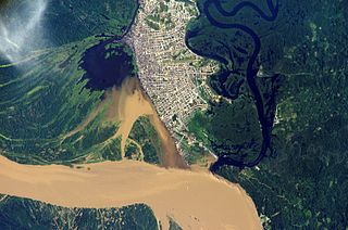
The Iquitos Metropolitan Area is the name used to refer to the Peruvian metropolitan area whose principal city is Iquitos, according to Municipality of Iquitos. According to population statistics of INEI It is the sixth most populous metropolitan area of Peru in year 2015.

Poverty in Peru has rapidly declined since the start of the 21st century, as a result of prosperity from the international market, tourism, low inflation, greater economic opportunities, and neoliberal economic policy, at one of the fastest rates in South America. Poverty decreased from 58.7% in 2004 to 20.5% in 2018, or from 14.9 million people in poverty to fewer than 6.8 million people in 2018, with millions of Peruvians rising out of poverty according to the Instituto Nacional de Estadística e Informática (INEI).


