Chilpi

Last updated

Chilpi
town
India Chhattisgarh location map.svg
Red pog.svg
Chilpi
Location in Chhattisgarh, India
India location map.svg
Red pog.svg
Chilpi
Chilpi (India)
Coordinates: 22°10′0″N81°03′0″E / 22.16667°N 81.05000°E / 22.16667; 81.05000 Coordinates: 22°10′0″N81°03′0″E / 22.16667°N 81.05000°E / 22.16667; 81.05000
CountryFlag of India.svg  India
State Chhattisgarh
District Kabirdham
Elevation 807 m (2,648 ft)
Languages
  Official Hindi, Chhattisgarhi
Time zone IST (UTC+5:30)
Vehicle registration CG
Coastline 0 kilometres (0 mi)

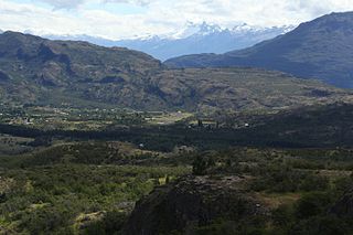
Chilpi is a town in Kabirdham district of Chhattisgarh, India
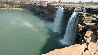
Chhattisgarh Central-east state in India

Chhattisgarh is one of the 29 states of India, located in the centre-east of the country. It is the tenth-largest state in India, with an area of 135,191 km2 (52,198 sq mi). With a 2011 population of 25.5 million, Chhattisgarh is the 16th-most populated state in the country. A resource-rich state, it is a source of electricity and steel for the country, accounting for 15% of the total steel produced. Chhattisgarh is one of the fastest-developing states in India.

India Country in South Asia

India, also known as the Republic of India, is a country in South Asia. It is the seventh largest country by area and with more than 1.3 billion people, it is the second most populous country as well as the most populous democracy in the world. Bounded by the Indian Ocean on the south, the Arabian Sea on the southwest, and the Bay of Bengal on the southeast, it shares land borders with Pakistan to the west; China, Nepal, and Bhutan to the northeast; and Bangladesh and Myanmar to the east. In the Indian Ocean, India is in the vicinity of Sri Lanka and the Maldives, while its Andaman and Nicobar Islands share a maritime border with Thailand and Indonesia.

Contents

Geography

It is located at an elevation of 807 m above MSL. [1]

Location

National Highway 12A passes through Chilpi. Nearest airport is Raipur Airport.

Related Research Articles

Amsterdam Airport Schiphol airport in Haarlemmermeer, Netherlands

Amsterdam Airport Schiphol, known informally as Schiphol Airport, is the main international airport of the Netherlands. It is located 9 kilometres southwest of Amsterdam, in the municipality of Haarlemmermeer, North Holland. It is the third busiest airport in Europe in terms of passenger volume. The airport is built as a single-terminal concept: one large terminal split into three large departure halls.

Victoria Airport is an airport serving Victoria, a town in the Araucanía Region of Chile. The airport is on the southwest side of the town.

Mocopulli Airport is an airport serving Dalcahue, a port city on Chiloé Island in the Los Lagos Region of Chile. The airport is 6 kilometres (3.7 mi) northwest of Dalcahue.

Pupelde Airport is an airport serving Ancud, a Pacific port city in the Los Lagos Region of Chile. Ancud is on the northern shore of Chiloé Island.

Franco Bianco Airport is an airport 5 kilometres (3.1 mi) northwest of Cerro Sombrero, a petroleum production town in the Magallanes Region of Chile. Cerro Sombrero is near the eastern entrance to the Strait of Magellan.

Chañaral Airport Spanish: Aeropuerto de Chañaral, is an airport serving Chañaral, a Pacific coastal city in the Atacama Region of Chile.

Cochrane Airfield

Cochrane Airport Spanish: Aeródromo Cochrane, is an airport serving Cochrane, a town in the Aysén Region of Chile. The airport is just northwest of the town, at the foot of Cerro Tamanguito (sv).

General Freire Airport Spanish: Aeródromo General Freire, is an airport serving Curicó, a city in the Maule Region of Chile. The airport is within the northeast part of the city.

San Rafael Airport Spanish: Aeródromo de San Rafael de Los Andes, is an airport serving Los Andes, a city in the Valparaíso Region of Chile. The airport is 5 kilometres (3.1 mi) west-northwest of the city.

María Dolores Airport is an airport serving Los Ángeles, capital of Bío Bío Province in the Bío Bío Region of Chile.

El Mirador Airport, is an airport just southeast of Puerto Varas, a city in the Los Lagos Region of Chile. Puerto Varas is on the southwest shore of Llanquihue Lake.

Panguilemo Airport is an airport 5 kilometres (3.1 mi) northeast of Talca, capital of the Maule Region of Chile.

Las Breas Airport is an airport 20 kilometres (12 mi) south-southeast of Taltal, a Pacific coastal town in the Antofagasta Region of Chile.

Barriles Airport Spanish: Aeropuerto Barriles is an airport 15 kilometres (9.3 mi) east-southeast of Tocopilla, a Pacific coastal town in the Antofagasta Region of Chile.

Vallenar Airport (Spanish: Aeródromo de Vallenar, is an airport serving Vallenar, a city in the Atacama Region of Chile.

Rodelillo Airfield is a public airport near the Pacific coastal city of Valparaíso in the Valparaíso Region of Chile.

References