Mount Richardson Provincial Park is a provincial park in British Columbia, Canada, located on the lower Sunshine Coast to the north of Sechelt.

Pirates Cove Marine Provincial Park is a provincial park on De Courcy Island in British Columbia, Canada.
Apsey Cove was formerly named Apsey Cove Point. It was a settlement in the "Trinity District". It was a fishing and farming settlement in 1911 with a population of 30.

Pouch Cove is a town in the Canadian province of Newfoundland and Labrador. The population is 2,063 according to the Canada 2021 Census. It is located on the northeast Avalon Peninsula, 27 kilometres north of St. John's, the province's capital city.
Fairbanks–Hillgrade is a local service district and designated place in the Canadian province of Newfoundland and Labrador. It is on New World Island.
Indian Cove is a local service district and designated place in the Canadian province of Newfoundland and Labrador. It is just off Route 340 on New World Island. It is the last community before crossing the causeway to Twillingate. Before the construction of the causeway, there was a ferry that ran from Indian Cove to Twillingate. Education is provided by New World Island Academy in Summerford and grocery shopping can be done in nearby Twillingate.

Comfort Cove-Newstead is a small fishing community located outside Campbellton, on the east coast of Newfoundland and Labrador, Canada,.

Humber Arm South is a town in the Canadian province of Newfoundland and Labrador. The town consists of the communities of Halfway Point, Benoit's Cove, John's Beach, and Frenchman's Cove. The town had a population of 1,537 in the Canada 2021 Census. The Town's Post Office is located in Benoit's Cove. Humber Arm South is located in the Bay of Islands and is in the Humber-Bay of Islands electoral district. The town's residents are of Mi'kmaw, Innu, and European descent.
Miles Cove is a town on Sunday Cove Island in the Canadian province of Newfoundland and Labrador. The town had a population of 104 in 2016, down from 140 in the Canada 2006 Census.
Port Anson is a town on Sunday Cove Island in the Canadian province of Newfoundland and Labrador. The town had a population of 42 in 2021, down from 155 in the Canada 2006 Census.
Seal Cove is a town in the Canadian province of Newfoundland and Labrador, located on Fortune Bay. The town had a population of 100 in the 2021 Census. The population of Seal Cove, Fortune Bay has fallen to approximately 100 largely due to outmigration for education and other work-related pursuits. The town was incorporated in 1972.
The Headland of Cape St. Gregory is north of the abandoned community of Chimney Cove of the west coast of the island of Newfoundland in the Canadian province of Newfoundland and Labrador.
Lance Cove, Newfoundland and Labrador is a local service district and designated place in the Canadian province of Newfoundland and Labrador.

Lobster Cove is a fishing village near Rocky Harbour, Newfoundland.
Musket Island Marine Provincial Park is a provincial park in British Columbia, Canada, located on the west side of Nelson Island, at the mouth of Jervis Inlet and near Earl's Cove in the Sunshine Coast region.
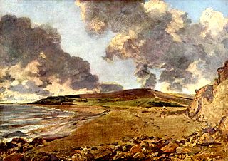
Jordan Hill is located near the coast close to the village of Preston, just to the east of Weymouth, Dorset, England. The hill leads down to Furzy Cliff on the coast to the south. Close by to the east is Bowleaze Cove. The hill figure of the Osmington White Horse can be seen from the hill to the north. There are also views across Bowleaze Cove from the hill and nearby public footpaths. The hill is a short detour from the South West Coastal Path National Trail.
Eddies Cove West is a local service district and designated place in the Canadian province of Newfoundland and Labrador.
Cottrell's Cove is a local service district and designated place in the Canadian province of Newfoundland and Labrador.
Brake's Cove is an abandoned community in Newfoundland and Labrador.

Watermill Cove is on the north–east coast of St Mary's, Isles of Scilly.
This page is based on this
Wikipedia article Text is available under the
CC BY-SA 4.0 license; additional terms may apply.
Images, videos and audio are available under their respective licenses.
