Chingizgala

Last updated
Chingizgala
Cingizqala XIX @srin sonu-XX @srin @vv@ll@rind@.jpg
Chingizgala
General information
Typetower
Location Car
Town or city Zagatala
Country Azerbaijan
Coordinates 41°40′22″N46°41′03″E / 41.67264°N 46.68411°E / 41.67264; 46.68411
Completed16th century

Chingizgala or Jingozgala is a tower located in the Jar village of the Zagatala District of Azerbaijan. [1] The towers, which gave the impression of strength and stability through their appearance, are the reflection of the harsh life of the society that created them. Chingizgala is located near the road. The adjacent area was surrounded by walls preserved only in a small part. The outline of the survived sections of the wall indicates that there was a small fortification here, and not a separate tower.

Contents

The tower is the best-preserved part of the fortification. Unfortunately, during the 20th century, the tower and the adjacent house were inhabited, which led to the distortion of the architectural features and the destruction of some parts.

Historical and political context

Chingizgala Cingoz qala.jpg
Chingizgala

The socio-political conditions inherent in the Jar-Balakan jamaats with frequent military clashes should have influenced the creation of a peculiar architecture, particularly, the development of various types of defensive structures. [2] Here, as well as in other adjacent territories of the Caucasus, one can find combinations of residential buildings with combat towers, edifices of a castle and fortress type, and so on. [2] Such structures were usually intended for the defence of one family or clan. The most ancient tribal fortifications could serve as a refuge not only for one, but also for several clans, a fact that should have been reflected in the size of the building. [2]

The decomposition of the jamaat system and with the beginning of the top of the community feudalization, emphasizing the privileged families, caused the construction of a new type fortified structures; at first, these were probably separate towers around which powerful fortress walls were then raised. [2] The further path of the development leads to the creation of a small fortified ownership. [3]

Unfortunately, many of these structures were destroyed, most likely during the wars, especially in the last period of the communities' existence. In the anonymous "Chronicle of the Jar Wars in the 18th century" there are numerous references to the destruction of the settlements and fortresses. [4]

Mission

The towers, which gave the impression of strength and stability through their appearance, are the reflection of the harsh life of the society that created them. Nowadays these towers (even in a dilapidated form), unexpectedly growing in the dense greenery of the forests, remind of the times when the wars and the armed clashes were a daily occurrence in the life of the Jar-Balakans. [5] People working in the field, in the garden, being in the pastures were on the alert to always have time to lock themselves in the tower and be ready to repel the enemy. [5]

Towers were usually built on a high ground with a good visibility and natural defence conditions, as well as over the roads to control the latter. [5] Chingizgala [5] also belongs to this type of towers.

Description

Chingizgala is located near the road. The adjacent area was surrounded by walls, preserved only in a small part. The outline of the survived sections of the wall indicates that there was a small fortification here, and not a separate tower. [5] On the site, in addition to the tower and the remains of the walls, there is also a residential building, apparently of a later origin. [5] It is possible that in its place there was a building of an earlier construction, which was later destroyed. [5] No other structures were found in the immediate vicinity of the tower. [5]

Architectural features

The fortification is located at a fork of the road. The western corner of the outer walls is located directly on the fork itself. The best-preserved north-western wall of the fortification ran along the edge of the road. It is likely that there were loopholes in the wall, from which it was possible to fire on the road in the both directions, which, therefore, was completely controlled by the owner of the fortification. [6]

The tower is the best-preserved part of the fortification. Unfortunately, during the 20th century, the tower and the adjacent house were inhabited, and this led to the distortion of the architectural features and the destruction of some parts. [6]

The crown of the tower was completely dismantled, only strong stone brackets remained. A new door was installed in the tower, and openings for two windows were installed in the third tier. [6]

Judging by the survived old photograph, the tower was originally five-story and was square on its plan with the external dimensions equal to an average of 5.70 x 5.60. The first floor of the tower is located at a height of 2 m from the ground. In the north-western wall of the first floor there is an entrance to the tower, in the form of a low door (1.0 x 1.6). The entrance is located at a height of 2 meters from the ground and is inaccessible to the uninvited guests. [6] To the right and above the door, a loophole with a strong downward slope was broken through, protecting the access to the door. In the same wall there is another loophole, also turned towards the door and intended to protect it. In the north-eastern and in the south-eastern walls, two loopholes were arranged being turned towards the corners of the building. [6] The western corner is protected by two loopholes one of which is located almost in the very corner. Both last loopholes are directed along a suitable road. All loopholes of this floor are located at a height of about 1.0 m and 1.8 m above the floor mark, respectively. [6]

On the second floor, the loopholes are directed almost perpendicular to the facades' planes and are designed to protect the approaches to the tower's walls. There are three loopholes on the south-eastern and on the north-western sides, and two on the other two walls. [6] The loopholes are punched at a height of 1.3-1.4 m from the floor and are designed for firing. There was a small window in the south-western wall. [6]

The largest number of loopholes is on the third floor of the tower. In the north-eastern and south-eastern walls there are three loopholes, and in the north-western wall there are two. [6] In addition to those indicated, loopholes are also arranged directly in all four corners of this floor, almost on the continuation of the diagonals. [7]

The loopholes on the all three floors were obviously designed for rifle fire. Strongly expanding inside the tower, they come out on the facade in the form of very narrow low cracks, barely noticeable against the background of the unevenness of the rough masonry, and even then only from a short distance. [7]

The fourth and fifth floors of the tower have not survived to nowadays. However, the available photograph and the survived stone brackets make it possible to almost completely restore the view of the both upper floors. [7]

On the powerful stone brackets, three on each side of the tower, the protective walls were pushed outward, somewhat spaced from the main walls of the tower itself. The resulting gap between the main and the extended walls made it possible for the defenders of the tower to protect the base of the walls, while remaining invulnerable. [7]

The fourth floor, judging by the photograph, was illuminated by a small window with a pointed arch located in the south-western wall. Two loopholes are visible on the both sides of the window. [7]

The uppermost, the fifth floor of the tower was illuminated through a window blocked by a flat lintel in the same south-western wall. Two loopholes were arranged on the both sides of the window. Just like the rest of the buildings of this type, the roof of the tower was gable. [7]

Related Research Articles

<span class="mw-page-title-main">Holstentor</span> City gate in Lübeck, Germany

The Holsten Gate is a city gate marking off the western boundary of the old center of the Hanseatic city of Lübeck. Built in 1464, the Brick Gothic construction is one of the relics of Lübeck's medieval city fortifications and one of two remaining city gates, the other being the Citadel Gate (Burgtor). Known for its two-round towers and arched entrance, it is regarded today as a symbol of the city. Together with the old city centre (Altstadt) of Lübeck it has been a UNESCO World Heritage Site since 1987.

<span class="mw-page-title-main">Blockhouse</span> Type of fortification

A blockhouse is a small fortification, usually consisting of one or more rooms with loopholes, allowing its defenders to fire in various directions. It is usually an isolated fort in the form of a single building, serving as a defensive strong point against any enemy that does not possess siege equipment or, in modern times, artillery, air force or cruise missiles. A fortification intended to resist these weapons is more likely to qualify as a fortress or a redoubt, or in modern times, be an underground bunker. However, a blockhouse may also refer to a room within a larger fortification, usually a battery or redoubt.

<span class="mw-page-title-main">Beijing city fortifications</span>

The Beijing city fortifications were a series of walls with towers and gates constructed in the city of Beijing, China in the early 1400s until they were partially demolished in 1965 for the construction of the 2nd Ring Road and Line 2 of the Beijing Subway. The original walls were preserved in the southeastern part of the city, just south of the Beijing railway station. The entire perimeter of the Inner and Outer city walls stretched for approximately 60 kilometres (37 mi).

<span class="mw-page-title-main">Manasija</span> Monastery in Serbia

The Manasija Monastery also known as Resava, is a Serbian Orthodox monastery near Despotovac, Serbia founded by Despot Stefan Lazarević between 1406 and 1418. The church is dedicated to the Holy Trinity. It is one of the most significant monuments of medieval Serbian culture and it belongs to the "Morava school". The monastery is surrounded by massive walls and towers. Immediately following its foundation, the monastery became the cultural centre of the Serbian Despotate. Its School of Resava was well known for its manuscripts and translations throughout the 15th and 16th centuries, even after the fall of the Despotate to the Ottoman Turks. Manasija complex was declared Monument of Culture of Exceptional Importance in 1979, and it is protected by Republic of Serbia, and monastery have entered a UNESCO Tentative List Process in 2010.

<span class="mw-page-title-main">Lithgow railway station</span> Railway station in New South Wales, Australia

Lithgow railway station is a heritage-listed former station master's residence and railway station located on the Main Western line at Railway Parade, Lithgow, City of Lithgow, New South Wales, Australia. It was designed and built by New South Wales Government Railways and built from 1924 to 1925. It is also known as Lithgow Railway Station Group and Residence and Eskbank East. The property was added to the New South Wales State Heritage Register on 30 August 2013. The station has frequent NSW TrainLink services running to and from Sydney Central.

<span class="mw-page-title-main">Strečno Castle</span>

The Strečno Castle (also called Strechun, Strechyn, Streczen, Streczan alebo Strežín) is a reconstructed ruin of a medieval castle of an irregular plan located in northern Slovakia, 12 km east of Žilina. The castle stands on a 103-metre-high (338 ft) calcite cliff above the international road E50 and village Strečno. Along with the Old castle constitutes a significant landscape landmark of the Upper Váh region. Nowadays, after reconstruction, there are expositions of the Vah region regional museum. The first recorded mention of the stone castle is from 1316. Today the castle belongs to the national cultural heritage of the Slovak republic.

<span class="mw-page-title-main">Barry Castle</span>

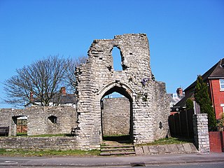
Barry Castle is a small Grade II* listed ruined two-storey gatehouse with the adjacent walls of a hall in the Romilly district of Barry, Vale of Glamorgan in south Wales.

<span class="mw-page-title-main">Bedia Cathedral</span> Medieval Georgian Orthodox cathedral

Bedia Cathedral is a medieval Georgian Orthodox cathedral located in Bedia, in the Tkvarcheli district of Abkhazia, a disputed region on the Black Sea coast.

<span class="mw-page-title-main">Medieval Royal Palace (Buda Castle)</span>

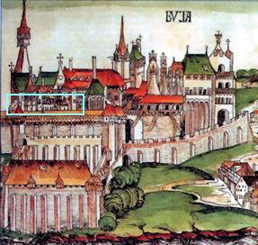
The Medieval Royal Palace of Buda Castle is a series of rooms from the old palace of the Hungarian kings, destroyed after 1686. Some rooms were unearthed and reconstructed during the postwar rebuilding of Buda Castle in 1958–62. The palace is now part of the permanent exhibition of the Budapest History Museum in "Building E" of Buda Castle.

<span class="mw-page-title-main">Vainakh tower architecture</span>

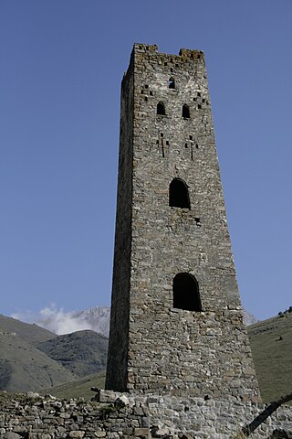
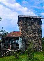
The Vainakh tower architecture, also called Nakh architecture, is a characteristic feature of ancient and medieval architecture of Chechnya and Ingushetia.

<span class="mw-page-title-main">Nativity of the Blessed Virgin Mary Catholic Church</span> United States historic place

The Nativity of the Blessed Virgin Mary Catholic Church is a Catholic church in Cassella, an unincorporated community in Mercer County, Ohio, United States. One of several Catholic churches in Marion Township, it was designated a historic site because of its well-preserved 19th-century architecture.

<span class="mw-page-title-main">Round Mardakan Fortress</span> Historical and architectural monument in the Khazar district in Baku

The Round Mardakan Fortress or the Small Mardakan Castle is a historical and architectural monument located in the Mardakan settlement of the Khazar district in Baku. By the Decree of the Cabinet of Ministers of the Republic of Azerbaijan, it was included in the list of historical and cultural monuments of world importance. In 2001, together with other coastal defence facilities of the Caspian Sea, it was included in the UNESCO World Heritage Reserve List.

<span class="mw-page-title-main">Sinap Castle</span>

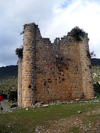
Sinap Castle is a medieval Armenian fortification in Çamlıyayla ilçe (district) of Mersin Province in southern Turkey.

<span class="mw-page-title-main">Thurant Castle</span>

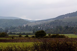
The ruins of the Thurant Castle stand on a wide slate hill spur above the villages of Alken on the Moselle in Germany. The castle is in the district of Mayen-Koblenz in Rhineland-Palatinate and belongs to the spur castle type. Vine gardens on the sunniest slope.

<span class="mw-page-title-main">Paddington Post Office</span> Post office in Sydney, Australia

The Paddington Post Office is a heritage-listed post office located at 246 Oxford Street in Paddington, a suburb of Sydney, Australia. The post office is owned and operated by Australia Post. The building was also a former telephone exchange. It was designed by the New South Wales Colonial Architect's Office under James Barnet and later Walter Liberty Vernon, and was built by William Farley. The building was added to the Commonwealth Heritage List, the New South Wales State Heritage Register on 22 December 2000, and the Register of the National Estate.

<span class="mw-page-title-main">Bjelaj Fortress</span> Medieval town-fortress complex in Bosnia and Herzegovina

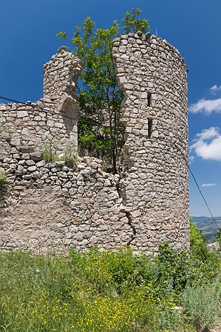
Bjelaj Fortress, locally known as Stari Grad Bjelaj, is a medieval town-fortress complex near the village of Bjelaj, Bosanski Petrovac, Bosnia and Herzegovina.

<span class="mw-page-title-main">Kempsey Post Office</span> Historic site in New South Wales, Australia

Kempsey Post Office is a heritage-listed post office at Belgrave Street, Kempsey, Kempsey Shire, New South Wales, Australia. It was designed by the Colonial Architect's Office under James Barnet, and was built by Gabriel and McMorrine, with additions in 1903-04 built by Hocking Brothers. The property is owned by Australia Post. It was added to the New South Wales State Heritage Register on 22 December 2000.

<span class="mw-page-title-main">Gara Boyuk Khanim Castle</span> Historic palace in Shusha, Azerbaijan

Gara Boyuk Khanim Castle is an 18th century palace-castle located on a hill in the southeastern part of the town of Shusha (Shushi) in the Karabakh region of Azerbaijan. It is composed of four towers in a square plan. It is one of the two castles of Shusha that have survived to present day.

<span class="mw-page-title-main">St Mary's Anglican Church, Busselton</span> Church in Western Australia

St Mary's Anglican Church is a heritage-listed Anglican church in Peel Terrace, Busselton, Western Australia. It is possibly the oldest stone church in the state. Opened in 1845, and consecrated in 1848, it has been the subject of a number of additions, and has also been repaired or conserved on several occasions.

<span class="mw-page-title-main">Ostheim Fortress Church</span> Ostheim Fortress Church is located in the Lower Franconian, town of Ostheim

Ostheim Fortress Church is a fortress church located in the Lower Franconian town of Ostheim vor der Rhön in the Rhön-Grabfeld district. The church building of St. Michael there is located within a double ring wall built between 1400 and 1450 with a zwinger in between. The double ring wall has five defense towers and is reinforced with six bastions halfway along the wall. The Protestant church, built in the Renaissance style on the foundations of a predecessor church, dates from 1615 to 1619. Within the fortifications there are 66 vaulted cellars with 72 lofts, which served as protective dwellings in times of war and in which the local inhabitants kept their belongings safe in times of crisis. With a floor area of 75 by 75 meters, it is considered the largest and best-preserved fortress church in Germany. Some of the vaulted cellars are used by the local population as storage cellars.

References

  1. Azərbaycan Respublikası ərazisində dövlət mühafizəsinə götürülmüş daşınmaz tarix və mədəniyyət abidələrinin əhəmiyyət dərəcələrinə görə bölgüsünün təsdiq edilməsi haqqında Azərbaycan Respublikası Nazirlər Kabinetinin Qərarı Archived 2017-04-12 at the Wayback Machine (Распоряжение Кабинета Министров Азербайджанской Республики об исторических и культурных памятниках)
  2. 1 2 3 4 Бретаницкий & Мамиконов 1950, p. 111.
  3. Лавров, Л. И. (1940). Башня Андиюх в Черкесии (Краткие сообшения ИИМК им. Н. Я. Марра Академии наук СССР ed.). М.-Л.: вып. VII. p. 100.
  4. Хроника войн Джара 1931, pp. 21–23.
  5. 1 2 3 4 5 6 7 8 Бретаницкий & Мамиконов 1950, pp. 112.
  6. 1 2 3 4 5 6 7 8 9 Бретаницкий & Мамиконов 1950, pp. 113.
  7. 1 2 3 4 5 6 Бретаницкий & Мамиконов 1950, pp. 114.

Bibliography