Chinook River

Last updated
Chinook River
USA Washington relief location map.jpg
Red pog.svg
Location of the mouth of the Chinook River in Washington
Location
Country United States
State Washington
County Pacific
Physical characteristics
Source Willapa Hills
  coordinates 46°16′0″N123°53′10″W / 46.26667°N 123.88611°W / 46.26667; -123.88611 [1] [2]
  elevation900 ft (270 m) [3]
Mouth Columbia River
  location
Baker Bay
  coordinates
46°18′7″N123°58′19″W / 46.30194°N 123.97194°W / 46.30194; -123.97194 Coordinates: 46°18′7″N123°58′19″W / 46.30194°N 123.97194°W / 46.30194; -123.97194 [1]
  elevation
0 ft (0 m)
Length6.5 mi (10.5 km) [4]
Basin size13.6 sq mi (35 km2) [5]

The Chinook River is a short stream located near the mouth of the Columbia River in the U.S. state of Washington.

Columbia River River in the Pacific Northwest of the United States

The Columbia River is the largest river in the Pacific Northwest region of North America. The river rises in the Rocky Mountains of British Columbia, Canada. It flows northwest and then south into the US state of Washington, then turns west to form most of the border between Washington and the state of Oregon before emptying into the Pacific Ocean. The river is 1,243 miles (2,000 km) long, and its largest tributary is the Snake River. Its drainage basin is roughly the size of France and extends into seven US states and a Canadian province. The fourth-largest river in the United States by volume, the Columbia has the greatest flow of any North American river entering the Pacific.

U.S. state constituent political entity of the United States

In the United States, a state is a constituent political entity, of which there are currently 50. Bound together in a political union, each state holds governmental jurisdiction over a separate and defined geographic territory and shares its sovereignty with the federal government. Due to this shared sovereignty, Americans are citizens both of the federal republic and of the state in which they reside. State citizenship and residency are flexible, and no government approval is required to move between states, except for persons restricted by certain types of court orders.

Contents

Course

The Chinook River originates just north of the Astoria–Megler Bridge, near Scarboro Hill in the Willapa Hills. The river flows west and northwest, just north of Fort Columbia State Park, Chinook Point, and the small town of Chinook on the Columbia River.

Astoria–Megler Bridge bridge in Washington state, USA

The Astoria–Megler Bridge is a steel cantilever through truss bridge in the northwest United States that spans the lower Columbia River, between Astoria, Oregon, and Point Ellice near Megler, Washington. Opened 53 years ago in 1966, it is the longest continuous truss bridge in North America.

Willapa Hills mountain range

The Willapa Hills is a geologic, physiographic, and geographic region in southwest Washington. When described as a physiographical province, the Willapa Hills are bounded by the Pacific Ocean to the west, the Columbia River to the south, the Olympic Mountains to the north, and the Cascade Range to the east. Some definitions place the Puget Lowland physiographic province east of the Willapa Hills. Included within the province are the Black Hills, the Doty Hills, and a number of broad river valleys, some of which open up into broad estuaries on the Pacific such as Grays Harbor and Willapa Bay. Other definitions do not include the Black Hills. The USGS GNIS defines the Willapa Hills as bounded by the Columbia River to the south and the Chehalis River to the north, without giving specific east and west bounds. The Willapa Hills are one of the Pacific Coast Ranges, which continue north as the Olympic Mountains and south, across the Columbia River, as the Oregon Coast Range.

Fort Columbia State Park

Fort Columbia State Park is a public recreation area and historic preserve at the site of former Fort Columbia, located on Chinook Point at the mouth of the Columbia River in Chinook, Washington. The 618-acre (250 ha) state park features twelve historic wood-frame fort buildings as well as an interpretive center and hiking trails. The park's grounds are located over a tunneled section of U.S. Route 101.

Its lower course runs through the Chinook Wildlife Area [6] . The river empties into Baker Bay, part of the Columbia River, at Stringtown, about 2 mi (3.2 km) east of Ilwaco. Baker Bay is part of the Columbia River Estuary and located just east of Cape Disappointment and the Pacific Ocean. [2]

Ilwaco, Washington City in Washington, United States

Ilwaco is a city in Pacific County, Washington, United States. The population was 936 at the 2010 census. Founded in 1890, the city was home to the Ilwaco Railway and Navigation Company along the Long Beach Peninsula, with its core economy based on logging and timber rafting. The city is located on the southern edge of the Long Beach Peninsula, on the north bank of the Columbia River where it meets the Pacific Ocean. It is near the city of Astoria, Oregon, which lies to the southeast on the southern bank of the Columbia.

Columbia River Estuary

The Columbia River Estuary is an estuary and a bay on the Oregon–Washington border and the Pacific Coast of the United States.

Cape Disappointment (Washington) cape in Washington, United States

Cape Disappointment is a headland located at the extreme southwestern corner of Washington, United States on the north side of the Columbia River bar. The point of the cape is located on the Pacific Ocean in Washington's Pacific County, approximately two miles (3.2 km) southwest of the town of Ilwaco. Cape Disappointment receives about 2,552 hours of fog a year—the equivalent of 106 days—making it one of the foggiest places in the US.

See also

Related Research Articles

Chinookan peoples group of indigenous people in the Pacific Northwest.

Chinookan peoples include several groups of indigenous people of the Pacific Northwest in the United States who speak the Chinookan languages. Chinookan-speaking peoples reside along the Lower and Middle Columbia River (Wimahl) from the river's gorge downstream (west) to the river's mouth, and along adjacent portions of the coasts, from Tillamook Head of present-day Oregon in the south, north to Willapa Bay in southwest Washington. In 1805 the Lewis and Clark Expedition encountered the Chinook Tribe on the lower Columbia. There are several theories about where the name ″Chinook″ came from. Some say it is a Chehalis word Tsinúk for the inhabitants of and a particular village site on Baker Bay, or "Fish Eaters". It may also be a word meaning "strong fighters".

Powder River (Oregon) river in the United States of America

The Powder River is a tributary of the Snake River, approximately 153 miles (246 km) long, in northeast Oregon in the United States. It drains an area of the Columbia Plateau on the eastern side of the Blue Mountains. It flows almost entirely within Baker County but downstream of the city of North Powder forms part of the border between Baker County and Union County.
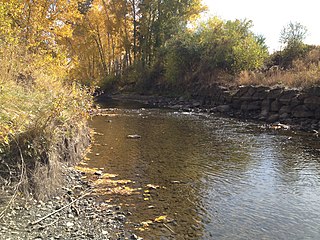
Nooksack River river in the United States of America

The Nooksack River is a river in the northwest part of the U.S. state of Washington. It drains an area of the Cascade Range around Mount Baker, near the Canada–US border. The lower river flows through a fertile agricultural area before emptying into Bellingham Bay and, via the Strait of Juan de Fuca and the Strait of Georgia, the Pacific Ocean. The river begins in three main forks, the North Fork, Middle Fork, and South Fork. The North Fork is sometimes considered the main river. Including the North Fork, the Nooksack is approximately 75 miles (121 km) long. All three forks originate in the Mount Baker Wilderness.

Grays River (Washington) river in the United States of America

Grays River is a tributary of the Columbia River, approximately 30 miles (48 km) long, in southwestern Washington in the United States. One of the last tributaries of the Columbia on the Washington side, it drains an area of low hills north of the mouth of the river.

New York State Route 199 New York state highway in Ulster and Dutchess counties

New York State Route 199 is a 30.91-mile-long (49.74 km) state highway located in the Hudson Valley of the U.S. state of New York. Its western end is in Ulster County, where it begins as the continuation of the short U.S. Route 209 expressway east of its interchange with U.S. Route 9W; after crossing the Kingston–Rhinecliff Bridge over the Hudson River the rest of the highway crosses northern Dutchess County. As it does it passes through downtown Red Hook and Pine Plains, reaching its eastern end at U.S. Route 44 and State Route 22 southwest of Millerton in the upper Harlem Valley.

Petaluma River river in California

The Petaluma River is a river in the California counties of Sonoma and Marin that becomes a tidal slough for the majority of its length. The headwaters are in the area southwest of Cotati. The flow is generally southward through Petaluma's old town, where the waterway becomes navigable, and then flows another 10 mi (16 km) through tidal marshes before emptying into the northwest corner of San Pablo Bay.

New York State Route 52 highway in New York

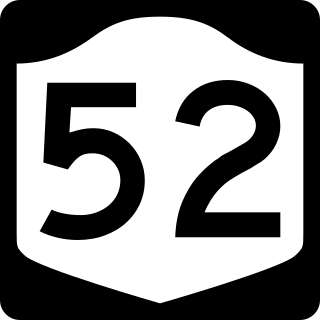
New York State Route 52 (NY 52) is a 108.72-mile (174.97 km) state highway in the southeastern part of the state. It generally runs from west to east, beginning at the Pennsylvania state line in the Delaware River near Narrowsburg, crossing the Hudson River on the Newburgh–Beacon Bridge, and ending in Carmel. NY 52 and NY 55, both major east–west routes of the Mid-Hudson Region, run parallel to each other, intersecting in downtown Liberty.
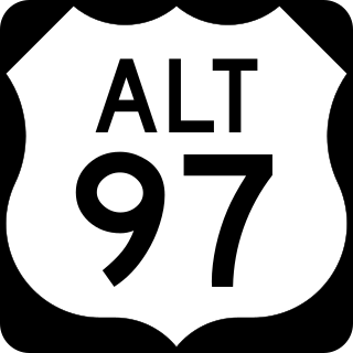
Crooked River (Oregon) tributary of the Deschutes River in the U.S. state of Oregon

The Crooked River is a tributary, 125 miles (201 km) long, of the Deschutes River in the U.S. state of Oregon. The river begins at the confluence of the South Fork Crooked River and Beaver Creek. Of the two tributaries, the South Fork Crooked River is the larger and is sometimes considered part of the Crooked River proper. A variant name of the South Fork Crooked River is simply "Crooked River". The Deschutes River flows north into the Columbia River.

Interstate 84 (I-84) in the U.S. state of Oregon is a major Interstate Highway that traverses the state from west to east. It is concurrent with U.S. Route 30 (US 30) for most of its length and runs 376 miles (605 km) from an interchange with I-5 in Portland to the Idaho state line near Ontario. The highway roughly follows the Columbia River and historic Oregon Trail in northeastern Oregon, and is designated as part of Columbia River Highway No. 2 and all of the Old Oregon Trail Highway No. 6; the entire length is also designated as the Vietnam Veterans Memorial Highway. I-84 intersects several of the state's main north–south roads, including US 97, US 197, I-82, and US 395.

U.S. Route 101 (US 101) is a United States Numbered Highway that runs along the Pacific Coast from Los Angeles, California to Tumwater, Washington. Within the state of Washington, US 101 connects cities on the coast of the Pacific Ocean and encircles the Olympic Peninsula around the Olympic Mountains and Olympic National Park.

Chinook Point United States historic place

Chinook Point is a headland in Pacific County, Washington. Located just northwest of the mouth of the Columbia River, it is historically significant for several reasons. Captain Robert Gray, the first non-native to enter the river, saw it from Chinook Point in 1792. In 1805, it was the site of an encampment by the Lewis and Clark Expedition. It has been the site of military fortifications since 1864, most notably in the late 1890s, when most of the presently surviving Fort Columbia structures were built. The point, which constitutes the most developed portion of Fort Columbia State Park, was designated a National Historic Landmark in 1961.

Blue Lake Regional Park

Blue Lake Regional Park is a public park in Fairview, in the U.S. state of Oregon. The 101-acre (41 ha) park, near the south shore of the Columbia River in Multnomah County, includes many covered and uncovered picnic areas, playing fields for sports such as softball, a cross country course and infrastructure related to lake recreation including swimming, boating, and fishing. Encompassing wooded areas, three ponds, and a wetland in addition to the lake, the park is frequented by migrating birds and other wildlife. Paved paths run through the park, which is near the 40-Mile Loop hiking and biking trail. Park vegetation includes cottonwoods, willows, and other trees and shrubs as well as wetland plants such as cattails.

Bone River river in the United States of America

The Bone River is a short river in the U.S. state of Washington. It is about 6 miles (9.7 km) long.

McNary National Wildlife Refuge

McNary National Wildlife Refuge is a wildlife preserve, one of the national wildlife refuges operated by the United States Fish and Wildlife Service. Extending along the east bank of the Columbia River in southeastern Washington, from the confluence of the Snake River to the mouth of the Walla Walla River, and downstream into Oregon, McNary NWR is located in rural Burbank, but very close to the rapid development of the Tri-Cities. In fact, the refuge meets the definition of an "urban refuge." Few areas in North America support waterfowl populations in the extraordinary numbers found here. Visitors enjoy spectacular concentrations of Canada geese, mallards, and other waterfowl. More than half the mallards in the Pacific Flyway overwinter at some time in this portion of the Columbia River Basin.

Pierce National Wildlife Refuge

Pierce National Wildlife Refuge is located in southwest Washington within the Columbia River Gorge National Scenic Area. It encompasses wetlands and uplands along the north shore of the Columbia River west of the town of North Bonneville. Refuge habitats include wetlands, Columbia River riparian corridor blocks, transitional woodlands from willows to cottonwood/ash to white oak to Douglas fir, improved pastures with some native grasses, and numerous creeks, seeps, and springs.

Bachelor Island (Washington)

Bachelor Island is an island in the U.S. state of Washington. It is located in the Columbia River near Ridgefield, just south of the mouth of the Lewis River and a few miles north of the mouth of the Willamette River. The island stretches from Columbia river mile 88 to 91.5. The northern end of Sauvie Island lies across the Columbia from Bachelor Island.

Johns River (Washington) river in Washington state, United States

Johns River is a short tidal river flowing into the south end of Grays Harbor in the U.S. state of Washington.

Saw Kill (Hudson River tributary)

The Saw Kill is a 14.3-mile-long (23.0 km) tributary of the Hudson River, called the Metambesem by the Algonquin people of the area and sometimes called Sawkill Creek today. It rises in the town of Milan and drains a 22-square-mile (57 km2) area of northwestern Dutchess County, New York, that includes most of the town of Red Hook to the west and part of Rhinebeck to Red Hook's south.

Cedar River (Willapa Bay)

The Cedar River is a short stream flowing into the north end of Willapa Bay in the U.S. state of Washington.

Raft River (Washington)

The Raft River is a stream located entirely within the Quinault Indian Reservation in Grays Harbor County, on the Olympic Peninsula, in the U.S. state of Washington. The river and its tributaries flow west from the Olympic Mountains and empty into the Pacific Ocean. It is situated a few miles north of the Quinault River and a few miles south of the Queets River.

References

  1. 1 2 U.S. Geological Survey Geographic Names Information System: Chinook River
  2. 1 2 USGS topographic maps accessed via https://mapper.acme.com
  3. GeoLocator
  4. Measured using GNIS coordinates, Google Map, and ACME Mapper 2.2
  5. "Chinook River, Washington". The Columbia River - A Photographic Journey. Retrieved 1 September 2019.
  6. "Chinook Wildlife Area Unit". Washington State Department of Fish and Wildlife . Retrieved 1 September 2019.