Chanchamayo or Chanchamayu is a province in northern Junín Region, in central Peru.
The Chiriaco is a river in Peru. It is a tributary of the Marañón and takes Tuntungos, Shushug and Wawas as principal tributaries.
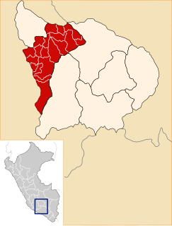
Andahuaylas Province is the second largest of the seven provinces of the Apurímac Region in Peru. The capital of the province is the city of Andahuaylas. The province is located in the north-eastern part of the region and measures 3,987.00 square kilometres (1,539.39 sq mi).

The Pomabamba Province is one of twenty provinces of the Ancash Region in Peru. It was formerly called Pumapampa and today it is also known as "The City of Cedars". It is located at the left bank of the Pomabamba river, at 3,063 meters (10,049 ft) above sea level. It was created by law on February 21, 1861.

Huancaray is one of the nineteen districts of the Andahuaylas Province in Peru.
Santa María de Chicmo District is one of the nineteen districts of the province Andahuaylas in Peru.
Talavera District is one of the nineteen districts of the province Andahuaylas in Peru.
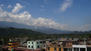
Sivia District is located in the Huanta Province in the Ayacucho Region of Peru. The district was created by "legislative decree" 25845 on November 6, 1992. Its capital, Sivia, is located at an altitude of 551 m. The district had a population of 11,956 inhabitants as of the 2007 census, with an area of 723.39 km2 (279.30 sq mi).
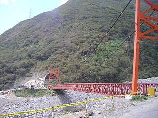
Vitoc District is one of six districts of the province Chanchamayo in Peru.
Lluta District is one of twenty districts of the Caylloma Province in Peru.
Querco District is one of sixteen districts of the Huaytará Province in Peru.
Tintay Puncu District is one of sixteen districts of the Tayacaja Province in Peru.
Yuracyacu is one of nine districts of the province Rioja in Peru.

Allqamarini is a mountain in the northern part of the Apolobamba mountain range in the Andes of Bolivia, about 4,920 m (16,140 ft) high. It is located in the La Paz Department, Franz Tamayo Province, Pelechuco Municipality. Allqamarini is situated northeast of Chuquyu and north of the small lake named Chiri Mach'ay.

Chiriunuyoc is a mountain in the Vilcanota mountain range in the Andes of Peru, about 4,800 metres (15,748 ft) high. It is situated in the Cusco Region, Quispicanchi Province, Marcapata District, east of the lake Singrenacocha. Chiriunuyoc lies northwest of the mountains Aquichua, Quinsachata and Quehuesiri.
Yuracyacu is a mountain in the Cordillera Blanca in the Andes of Peru, about 4,800 m (15,700 ft) high. It is located in the Ancash Region, Huari Province, Chavín de Huantar District. It lies northeast of Queshque.
Yana Yaku is a mountain in the northern part of the Cordillera Negra in the Andes of Peru, about 4,800 metres (15,748 ft) high. It is situated in the Ancash Region, Santa Province, Cáceres del Perú District. Yana Yaku lies between Qarwaqucha in the southeast and Quñuqranra in the northwest, west of Rumi Cruz.
Yuraq Yaku is a 3,232-metre-high (10,604 ft) mountain in the Bolivian Andes. It is located in the Cochabamba Department, Quillacollo Province, Sipe Sipe Municipality. Yuraq Yaku lies southeast of Inka Laqaya.
Yuraq Yaku is a mountain in the Cordillera Negra in the Andes of Peru which reaches a height of approximately 4,400 m (14,436 ft). It is located in the Ancash Region, Aija Province, Aija District.
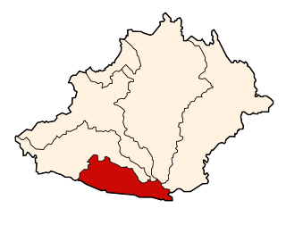
Chiriaco or Chiri Yaku is a mountain in Peru which reaches a height of approximately 3,800 m (12,500 ft). It is located in the Apurímac Region, Andahuaylas Province, on the border of the districts of Chicmo District and Talavera.


