
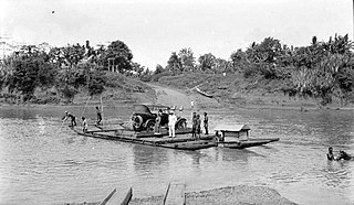
The Indragiri River is a river in Sumatra, in the Indonesian province of Riau, Indonesia, about 800 km northwest of the capital Jakarta. It is formed from the union of the Ombilin River and the Sinamar River, and empties into the Strait of Malacca. The middle part that flows in the Kuantan Singingi Regency is called Batang Kuantan.
The Sadang is a river of Sulawesi in South Sulawesi province, Indonesia. It is one of the major rivers which flow into the Strait of Macassar.
Widas River is a river in northern East Java, Indonesia. It is a tributary of the Brantas River.
Sanen River is a river in southern East Java province, Java island, Indonesia, about 800 km east of the capital Jakarta.
The Wamma River is a river in northern part of Western Papua, Papua province, Indonesia.
Tabai River is a river in northern part of Western Papua, Papua province, Indonesia.
Wiriagar or Aimau River is a river in southern West Papua province, Indonesia.
Jamboaye River is a river in the province of Aceh in northern Sumatra, Indonesia, about 1600 km northwest of the capital Jakarta.
Silau River is a river in northern Sumatra, Indonesia, about 1300 km northwest of the capital Jakarta. It is a tributary of Asahan River.
Kualu River is a river in northern Sumatra, Indonesia, about 1600 km northwest of the capital Jakarta.
Mesuji River is a river in Lampung province, Sumatra island, Indonesia, about 250 km northwest of the capital Jakarta.
Sinamar River is a river in West Sumatra province, in the central part of Sumatra island, Indonesia, about 900 km northwest of the capital Jakarta. It is a tributary of the Ombilin/Indragiri River.
Komering River is a river in South Sumatra, Indonesia. It is a tributary of the Musi River.
Rokan-kiri River is a river in Riau province, central part of Sumatra island, Indonesia, about 1100 km northwest of the capital Jakarta. It is a tributary of the Rokan River.
Rokan-kanan River is a river in Riau province, central part of Sumatra island, Indonesia, about 1100 km northwest of the capital Jakarta. It is a tributary of the Rokan River.
Kumu River is a river in Riau province, central-eastern Sumatra, Indonesia, about 1100 km northwest of the capital Jakarta. It is a tributary of the Rokan River.
Tembesi River is a river in Jambi province, Sumatra island, Indonesia, about 600 km northwest of the capital Jakarta. It is a tributary of the Batang Hari River. Tributaries include the Merangin River.
Krueng Cunda River is a river in Aceh on Sumatra island, in Indonesia, about 1700 km northwest of the capital Jakarta. It forms a strait separating the main part of Lhokseumawe from the island of Sumatra.
The Ingenika River is a river located in the Canadian boreal forest, in the province of British Columbia.
Tetsa River is a river in northeastern British Columbia, Canada. It heads in the Northern Rocky Mountains Provincial Park, and flows northeast and then east into the Muskwa River. In the area around Tetsa River grows mainly pine forests. The area around Tetsa River is almost uninhabited, with less than two inhabitants per square kilometre. Highway 97 / Alaska Highway runs through this place.
