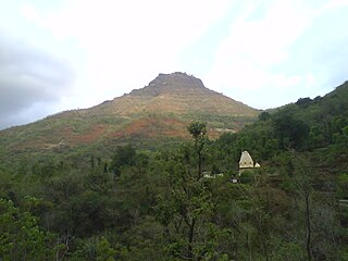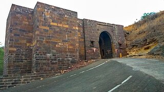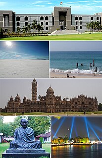
Anjar is a town, a tehsil and a municipality in Kachchh district in the state of Gujarat, India. It is located in southern Kutch. With nearly 1,400 years of history, founded around 650 AD, Anjar is claimed to be the oldest town in Kutch.
Phigalia or Phigaleia or Phigalea, also known as Phialia, is an ancient Greek city in the south-west corner of ancient Arcadia, close to the frontiers of Messenia, and upon the right bank of the Neda, about halfway between the sources and the mouth of this river. It is also the present name of a nearby modern village, known up to the early 20th century as Pavlitsa (Παύλιτσα). In modern geography it is located in southeastern Elis. It is situated on an elevated rocky site, among some of the highest mountains in the Peloponnese, the most conspicuous being Mt Cotylium and Mt Elaeum; the identification of the latter is uncertain.

Annur is a town panchayat and taluk headquarters of Annur Taluk of Coimbatore district. It is a suburb of Coimbatore city located north-east about 30 kilometres from the center of the city. Nearest airport is Coimbatore International Airport, which is about 27 kilometres and the nearest railway station is Coimbatore Central, which is about 30 kilometres away. Other cities/towns nearby Annur are Mettupalayam, which is 21 kilometres away in the west, Avanashi, which is 18 kilometres away in the east and Punjai Puliampatti, which is about 18 kilometres in the north.Annur has police station with Karumathampatti sub division.

Awantipora or Awantipur is a town and a notified area committee in Pulwama district of the Indian state of Jammu & Kashmir. It is situated between Anantnag and Srinagar on NH 44. Awantipora was named after Avanti Varman and had a number of ancient Hindu temples built by the king including the Avantiswami Temple. The ruins of temples constructed by Lalitaditya are also found in Awantipora. The temple sites are protected and maintained by the Archaeological Survey of India.

Lakshmeshwara is a town,and newly created Taluk place with Gajendragarh in Gadag district, in the Indian state of Karnataka. It is about 40 km from Gadag and 55 km from Hubli. Lakshmeshwara is an agricultural trading town.

Maham is a small city, sub-division, tehsil and a municipal committee in Rohtak district in the Indian state of Haryana. The Haryana govt has shown interest in building a Greenfield Cargo Airport at this city to serve the city of Rohtak. AAI has given in-principle consent to this plan in Jan 2014. Maham is one of the two sub-divisions in Rohtak district. Maham tehsil is further divided into two community development blocks, Maham and Lakhan-Majra.

Mangalgad, also known as Kangori, is a fort in Maharashtra near the village of Dudhanewadi. Kangori, or Mangalgad Fort, is in the Mahad sub-division about eleven miles east by south from Mahad town. The fort is built on the top of a steep and treeless spur of the Sahyadris, 2457 feet high, and is reached by a narrow and rugged path about two miles long. The fort is 1485 feet from east to west and 264 from north to south.

Ramappa Temple also known as the Ramalingeswara temple, is located 77 km from Warangal, the ancient capital of the Kakatiya dynasty, 157 km from Hyderabad in the state of Telangana in southern India. It lies in a valley at Palampet village of Venkatapur Mandal, in erstwhile Mulug Taluq of Jayashankar Bhupalpally district, a tiny village long past its days of glory in the 13th and 14th centuries. An inscription in the temple dates it to the year 1213 AD and says it was built by a General Recherla Rudra, during the period of the Kakatiya ruler Ganapati Deva.

Hari Parbat is a hill overlooking Srinagar, the largest city and summer capital of Jammu and Kashmir. It is the site of famous Sharika Devi temple dedicated to goddess Jagadamba Sharika Bhagwati who is regarded as the presiding deity (`isht`-Devi) of Srinagar city. Hari Parbat also has other notable places of worship.

Jyotiba Temple is a holy site of Hinduism near Wadi Ratnagiri in Kolhapur district of Maharashtra state in western India. The deity of the temple is known by the same name, and is held by the locals to be an incarnation of three gods: Brahma, Vishnu, Mahesha, and Jamadagni. An annual fair takes place on the full moon night of the Hindu months of Chaitra and Vaishakha.
Mejorada is a village located in the province of Toledo, Castile-La Mancha, Spain. According to the 2017 census (INE), the municipality has a population of 2,809 inhabitants.

The Louguantai Temple, in Tayu village (塔峪村), Zhouzhi county, Shaanxi province, about 70 km, west of Xian, is the place where tradition says that Lao Tze composed the Tao Te Ching.

Kanthkot fort is located near Kanthkot village, Bhachau Taluka of Vagad area, Kutch, Gujarat.
Anthedon (Ἀνθηδών) was a town in Boeotia, Ancient Greece, located on the coast of the Gulf of Euboea, about 15 kilometres (9.3 mi) west of Chalcis, at the foot of Mount Messapius. It was member of the Amphictyonic League, and served as port for Thebes. In ancient times, it was believed to have had one of the mythical characters named Anthedon as its eponym.
Rav is a village of three hamlets; Rav Moti, Rav Nani and Temple; in an open plain, located nineteen miles from Chobari, in Rapar Taluka of Kutch district of Gujarat, India.
Sikra is a village in Bhachau Taluka of Kutch district of Gujarat, India.

Çatıören is an archaeological site in Mersin Province, Turkey.
Anandpur Bhadla is a village in Chotila Taluka of Surendranagar district, Gujarat, India. It lies about fifteen miles south of Chotila.
Gigasaran is a village and former petty princely state in Gujarat, western India.
Lakhapadar is a village and former non-salute princely state on Saurashtra peninsula in Gujarat, western India. About Lakhapadar


