Chorlton Poor Law Union

Last updated

The Withington Workhouse, opened in 1855, was renamed Withington Hospital in 1915, shown here in 2005. Old Withington hospital - geograph.org.uk - 54894.jpg
The Withington Workhouse, opened in 1855, was renamed Withington Hospital in 1915, shown here in 2005.

Chorlton Poor Law Union was founded in January 1837 in response to the Poor Law Amendment Act 1834, also known as the New Poor Law. [2] It was overseen by an elected board of 19 guardians representing the 12 parishes in the area it served: Ardwick, Burnage, Chorlton-upon-Medlock, Chorlton with Hardy, Didsbury, Gorton, Hulme, Levenshulme, Moss Side, Rusholme, Stretford, and Withington, all (apart from Stretford) in present day south Manchester, England. [1]

Contents

Background

The Poor Law Amendment Act 1834 placed a legal responsibility on parishes to take responsibility for the poor in their areas by organising into poor law unions, each of which was to have at least one workhouse. The Act discouraged the provision of poor relief except through entry into workhouses, [3] and signalled the construction of more than 500 across England and Wales during the next 50 years. [4]

The townships in the union, Ardwick, Burnage, Chorlton-upon-Medlock, Chorlton with Hardy, Didsbury, Gorton, Hulme, Levenshulme, Mosside, Rusholme, Stretford, and Withington were in the ancient parish of Manchester; in 1838 Ardwick, Chorlton-upon-Medlock and Hulme were made part of the town of Manchester. The others, apart from Stretford, subsequently became part of the City of Manchester.

Early history

The Ormond Building, Cavendish Street Ormond Building (14938453242).jpg
The Ormond Building, Cavendish Street

The union's first workhouse, the Stretford Road Workhouse, offered accommodation for 300 inmates, with segregated living areas for various categories of paupers, such as children, lunatics, the elderly, and the sick; female inmates were housed in the west of the building and males in the east, separated by a central communal dining hall and chapel. [1] The population of the area served by the Chorlton Poor Law Union had been 46,465 at the time of the 1831 census, but as it rapidly increased during Manchester's industrialisation it became clear that the capacity of the Stretford Road Workhouse was inadequate for the demands placed on it. As the Stretford Road site offered no scope for expansion the guardians decided to commission the construction of a second workhouse, the Withington Workhouse. [1] Opened in 1855, [5] and costing £53,000 to build, the new workhouse was able to accommodate up to 1500 inmates. [1] The site also included a new cemetery to serve the union's area, the Chorlton Union Cemetery, which remained in use until 1920. [5]

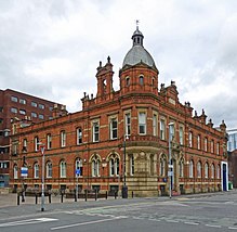
The Offices of the Poor Law Guardians were built in 1881. The building was designed by Mangnall & Littlewood and also included a registry office. Since 1970 it has been used by Manchester Metropolitan University. [6]

Emmeline Pankhurst was a member of the Board of Guardians. [7]

Later developments

In 1910 the Chorlton Union was consolidated into the South Manchester Township, [8] which in turn became part of a unified Manchester Union in 1915, and the workhouse was renamed Withington Hospital. [1]

Related Research Articles

<span class="mw-page-title-main">Chorlton-cum-Hardy</span> Area of Manchester, England

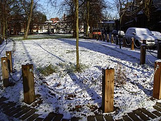
Chorlton-cum-Hardy is a suburban area of Manchester, England, three miles (4.8 km) southwest of the city centre. Chorlton ward had a population of 14,138 at the 2011 census, and Chorlton Park 15,147.

<span class="mw-page-title-main">Withington</span> Human settlement in England

Withington is a suburb of Manchester, Greater Manchester, England. Historically part of Lancashire, it lies 4 miles (6.4 km) from Manchester city centre, about 0.4 miles (0.6 km) south of Fallowfield, 0.5 miles (0.8 km) north-east of Didsbury and also 1 mile (1.6 km) east of Chorlton-cum-Hardy. Withington has a population of just over 14,000 people, reducing at the 2011 census to 13,422.

<span class="mw-page-title-main">Fallowfield</span> Suburb of Manchester

Fallowfield is a bustling area of Manchester with a population of 14,869 at the 2021 census. Historically in Lancashire, it lies 3 miles (5 km) south of Manchester city centre and is bisected east–west by Wilbraham Road and north–south by Wilmslow Road. The former Fallowfield Loop railway line, now a shared use path, follows a route nearly parallel with the east–west main road.
<span class="mw-page-title-main">Chorlton-on-Medlock</span> Human settlement in Manchester, England

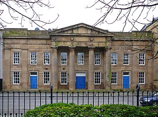
Chorlton-on-Medlock is an inner city area of Manchester, England.

<span class="mw-page-title-main">Hulme</span> Area of Manchester, England

Hulme is an inner city area and electoral ward of Manchester, in Greater Manchester, England, immediately south of Manchester city centre. It has a significant industrial heritage.
<span class="mw-page-title-main">Didsbury</span> Suburban village of Manchester

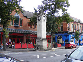
Didsbury is a suburb of Manchester, in Greater Manchester, England, on the north bank of the River Mersey, 5 miles south of Manchester city centre. The population at the 2011 census was 26,788.
<span class="mw-page-title-main">Longsight</span> Suburb of Manchester

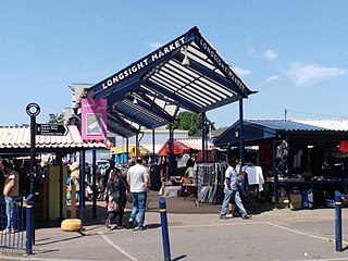
Longsight is an inner city area of Manchester, England, 3 miles (4.8 km) south of the city centre, bounded by Ardwick and West Gorton to the north and east; Levenshulme to the south; and Chorlton-on-Medlock, Victoria Park and Fallowfield to the west. Historically in Lancashire, it had a population of 15,429 at the 2011 census.
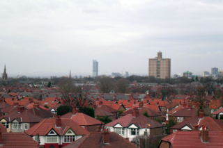
<span class="mw-page-title-main">Burnage</span> Human settlement in England

Burnage is an area of Manchester, in Greater Manchester, England, 4 miles (6.4 km) south of the city centre and bisected by Kingsway. The population at the 2011 census was 15,227. It lies within the Greater Manchester Metropolitan area, in the historic county of Lancashire, between Withington to the west, Levenshulme to the north, Heaton Chapel to the east and Didsbury and Heaton Mersey to the south.

<span class="mw-page-title-main">Levenshulme</span> Suburb of Manchester, England

Levenshulme is an area of Manchester, in Greater Manchester, England, bordering Fallowfield, Longsight, Gorton, Burnage, Heaton Chapel and Reddish, halfway between Stockport and Manchester city centre on the A6. Levenshulme is predominantly residential with numerous fast food shops, public houses and antique stores. It has a multi-cultural and multi-ethnic population of 15,430 at the 2011 Census. The Manchester to London railway line passes through Levenshulme railway station.

<span class="mw-page-title-main">Manchester Withington (UK Parliament constituency)</span> Parliamentary constituency in the United Kingdom, 1918 onwards

Manchester Withington is a constituency represented in the House of Commons of the UK Parliament since 2015 by Jeff Smith of Labour.

Stretford was a parliamentary constituency in North West England, which returned one Member of Parliament (MP) to the House of Commons of the Parliament of the United Kingdom.

<span class="mw-page-title-main">Manchester (ancient parish)</span>

Manchester was an ancient ecclesiastical parish of the hundred of Salford, in Lancashire, England. It encompassed several townships and chapelries, including the then township of Manchester. Other townships are now parts of the Anglican Diocese of Manchester and/or Greater Manchester.

<span class="mw-page-title-main">Nico Ditch</span> Earthwork in England

Nico Ditch is a six-mile (9.7 km) long linear earthwork between Ashton-under-Lyne and Stretford in Greater Manchester, England. It was dug as a defensive fortification, or possibly a boundary marker, between the 5th and 11th century. The ditch is still visible in short sections, such as a 330-yard (300 m) stretch in Denton Golf Course. For the parts which survived, the ditch is 4–5 yards (3.7–4.6 m) wide and up to 5 feet (1.5 m) deep. Part of the earthwork is protected as a Scheduled Ancient Monument.
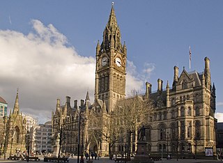
<span class="mw-page-title-main">Politics in Manchester</span>

The City of Manchester forms part of the metropolitan county of Greater Manchester, which had its county council abolished in 1986. Manchester consists of several districts, but these districts do not represent a tier of government.

<span class="mw-page-title-main">Manchester Rusholme (UK Parliament constituency)</span> Parliamentary constituency in the United Kingdom, 1918–1950 and 2024 onwards

Manchester Rusholme is a parliamentary constituency centred on the Rusholme district of Manchester. It returns one Member of Parliament (MP) to the House of Commons of the Parliament of the United Kingdom, elected by the first past the post system. Since 2024, it has been represented by Labour's Afzal Khan, who was MP for Manchester Gorton from 2017 to 2024.

William Hulme was an English lawyer and landowner from Lancashire responsible for the creation of the Hulme Trust.

<span class="mw-page-title-main">Wilmslow Road bus corridor</span> Transport route in Manchester, United Kingdom

The Wilmslow Road bus corridor is a 5.5-mile-long section of road in Manchester that is served by a large number of bus services. The corridor runs from Parrs Wood to Manchester city centre along Wilmslow and Oxford Roads, serving Didsbury, Withington, Fallowfield and Rusholme.
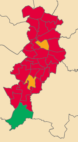
<span class="mw-page-title-main">2023 Manchester City Council election</span> 2023 local government election in Manchester

The 2023 Manchester City Council elections took place on 4 May 2023 alongside other local elections across the United Kingdom. One third of councillors (32) on Manchester City Council were elected, along with a mid-term vacancy in the Ardwick ward.

References

Citations

  1. 1 2 3 4 5 6 "Chorlton, Lancashire", workhouses.org.uk, retrieved 5 November 2011
  2. "Poor Law and Workhouse Records: The Poor Law Unions 1834–1929", Manchester City Council, archived from the original on 3 October 2012, retrieved 5 November 2011
  3. Fowler (2007), p. 242
  4. Fraser (2009), pp. 63–64
  5. 1 2 "Withington Workhouse and Hospital", National Archives, retrieved 5 November 2011
  6. Hartwell, Clare (2001), Manchester, Pevsner Architectural Guides, Penguin Books, pp. 130–131
  7. Holman, Bob (1996). The Corporate Parent. NISM. p. 17. ISBN   1-899942-09-2.
  8. Simon (1938), p. 136

Bibliography

  • Fowler, Simon (2007), Workhouse: The People: The Places: The Life Behind Closed Doors, The National Archives, ISBN   978-1-905615-28-5
  • Fraser, Derek (2009), The Evolution of the British Welfare State (4th ed.), Palgrave Macmillan, ISBN   978-0-230-22466-7
  • Simon, Sheena D. (1938), A Century of City Government; Manchester, 1838–1938, G. Allen & Unwin

53°26′N2°17′W / 53.44°N 2.28°W / 53.44; -2.28