
The Pennsylvania Turnpike, sometimes shortened to Penna Turnpike or PA Turnpike, is a controlled-access toll road which is operated by the Pennsylvania Turnpike Commission (PTC) in Pennsylvania. It runs for 360 miles (580 km) across the southern part of the state, connecting Pittsburgh and Philadelphia, and passes through four tunnels as it crosses the Appalachian Mountains. A component of the Interstate Highway System, it is part of Interstate 76 (I-76) between the Ohio state line and Valley Forge. I-70 runs concurrently with I-76 between New Stanton and Breezewood, Interstate 276 (I-276) between Valley Forge and Bristol Township, and I-95 from Bristol Township to the New Jersey state line.

Interstate 35 (I-35) is a major Interstate Highway in the central United States. As with most primary Interstates that end in a five, it is a major cross-country, north–south route. It stretches from Laredo, Texas, near the Mexican border to Duluth, Minnesota, at Minnesota State Highway 61 and 26th Avenue East. The highway splits into I-35E and I-35W in two separate places, the Dallas–Fort Worth metroplex in Texas and at the Minnesota twin cities of Minneapolis–Saint Paul.
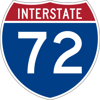
Interstate 72 (I-72) is an Interstate Highway in the Midwestern United States. Its western terminus is in Hannibal, Missouri, at an intersection with U.S. Route 61 (US 61); its eastern terminus is at Country Fair Drive in Champaign, Illinois. The route runs through the major cities of Decatur, Illinois, and Springfield, Illinois. In 2006, the Illinois General Assembly dedicated all of I-72 as Purple Heart Memorial Highway. The stretch between Springfield and Decatur is also called Penny Severns Memorial Expressway, and the section between mile 35 and the Mississippi River is known as the Free Frank McWorter Historic Highway.

U.S. Route 90 or U.S. Highway 90 (US 90) is an east–west major United States highway in the Southern United States. Despite the "0" in its route number, US 90 never was a full coast-to-coast route. It generally travels near Interstate 10 (I-10) and passes through the southern states of Texas, Louisiana, Mississippi, Alabama, and Florida. US 90 also includes part of the DeSoto Trail between Tallahassee and Lake City, Florida.

U.S. Route 71 or U.S. Highway 71 is a major north–south United States highway that extends for over 1500 miles (2500 km) in the central United States. This original 1926 route has remained largely unchanged by encroaching Interstate highways. Currently, the highway's northern terminus is in International Falls, Minnesota at the Canada–US border, at the southern end of the Fort Frances-International Falls International Bridge to Fort Frances, Ontario. U.S. Route 53 also ends here. On the other side of the bridge, Trans-Canada Highway is an east–west route while Ontario Highway 71 is a north–south route. US 71's southern terminus is between Port Barre and Krotz Springs, Louisiana at an intersection with U.S. Route 190. For the entirety south of Kansas City, Missouri, US 71 runs parallel and concurrent with the existing and future Interstate 49. North of Kansas City, US 71 runs halfway between Interstate 29 and Interstate 35, which they split in the city at an interchange with Interstate 70.

The Governor Harry W. Nice Memorial/Senator Thomas "Mac" Middleton Bridge, also known as the Potomac River Bridge, is a 1.7-mile (2.7 km), four-lane continuous truss bridge that spans the Potomac River between Newburg in Charles County, Maryland and Dahlgren in King George County, Virginia, United States. It is one of eight toll facilities operated by the Maryland Transportation Authority, and is one of two toll bridges over the Potomac River. The other, the privately owned Oldtown Low Water Toll Bridge, connects Maryland and West Virginia, far upstream. The new Nice Bridge opened to traffic in October 2022. Demolition of the original bridge began on March 21, 2023.

Route 364, known locally as the Page Extension, the Page Avenue Freeway, the Page Expressway, or simply the Extension, is a freeway that connects St. Louis County in Maryland Heights with St. Charles County in Lake St. Louis via the Veterans Memorial Bridge over the Missouri River. The highway is a designated auxiliary state route of I-64.

The Cooper River Bridges were a pair of cantilever truss bridges that carried traffic over the Cooper River in Charleston, South Carolina, United States. The first bridge opened in 1929, a second one opened in 1966 to relieve traffic congestion. The Grace Memorial Bridge was designed and constructed by a private company known as Cooper River Bridge, Inc, and the Pearman Bridge was designed by HNTB Corporation and constructed by SCDOT.

The Edison Bridge and the Vieser bridge are a pair of bridges that carry U.S. Route 9 in the state of New Jersey, spanning the Raritan River near its mouth in Raritan Bay. The bridge, which connects Woodbridge on the north with Sayreville on the south, was opened to weekend traffic starting on October 11, 1940, and was opened permanently on November 15, 1940. As of 2003, the bridge carries more than 82,000 vehicles daily and is owned and operated by the New Jersey Department of Transportation. It also runs directly parallel to the Driscoll Bridge, which carries the Garden State Parkway.
The Daniel Boone Bridge is the name for two bridges carrying Interstate 64, U.S. Route 40, U.S. Route 61 and the Avenue of the Saints across the Missouri River between St. Louis County and St. Charles County, Missouri. The older bridge, which carries westbound traffic, is a continuous truss bridge, while the newer bridge, which carries eastbound traffic, is a deck girder bridge.

The I-10 Twin Span Bridge, a nearly 5.5-mile (8.9 km) causeway officially known as the Frank Davis "Naturally N'Awlins" Memorial Bridge, consists of two parallel trestle bridges. These parallel bridges cross the eastern end of Lake Pontchartrain in southern Louisiana from New Orleans to Slidell. The current bridge spans were constructed in the second half of the 2000s after the original bridges were extensively damaged by Hurricane Katrina on August 29, 2005. The first span opened to eastbound traffic on July 9, 2009. On April 7, 2010, the second span was opened to traffic and the old twin spans were permanently closed to traffic.
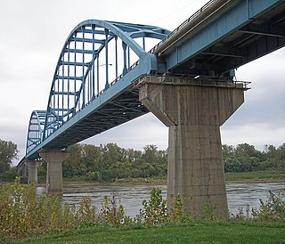
The Centennial Bridge is a through arch bridge road bridge over the Missouri River connecting Leavenworth, Kansas, and Platte County, Missouri. Constructed in 1955, it was initially a toll bridge. The bridge opened in 1955, a year after Leavenworth celebrated its centennial as the first city incorporated in Kansas. It is a two-span arch bridge connecting K-92 and Missouri Route 92. Its main span is 419.8 feet, and its total length is 2,571.2 feet. During the construction a spur of Route 45 called the "Leavenworth cutoff" was built to speed traffic to Kansas City, Missouri. The two-mile spur, even though it is in Missouri, was maintained by the city of Leavenworth until the tolls were removed from the Centennial Bridge in May 1977. The bridge is now maintained by the Kansas Department of Transportation.
The Plattsmouth Bridge is a truss bridge over the Missouri River connecting Cass County, Nebraska, and Mills County, Iowa at Plattsmouth, Nebraska. Until 2014, it carried U.S. Highway 34 across the river.

The South Omaha Veterans Memorial Bridge was a continuous warren through truss bridge over the Missouri River connecting Omaha, Nebraska with Council Bluffs, Iowa via U.S. Highway 275.
The Ike Skelton Bridge is a set of girder bridges on Route 13 over the Missouri River at Lexington, Missouri between Ray County and Lafayette County.

The Hermann Bridge was a cantilevered truss bridge over the Missouri River at Hermann, Missouri, between Gasconade County, Missouri, and Montgomery County, Missouri. The bridge formerly carried Route 19 traffic and was closed on July 23, 2007, when the Christopher S. Bond Bridge was opened to traffic.
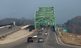
The Christopher S. Bond Bridge in Kansas City, Missouri is a cable-stayed bridge across the Missouri River. It carries I-29/I-35/US 71. The bridge opened to limited traffic on September 27, 2010, and all lanes opened on December 18, 2010. The Bond bridge is a replacement for the Paseo Bridge.

US Highway 41 (US 41) is a part of the United States Numbered Highway System that runs from Miami, Florida, to the Upper Peninsula of the US state of Michigan. In Michigan, it is a state trunkline highway that enters the state via the Interstate Bridge between Marinette, Wisconsin, and Menominee, Michigan. The 278.769 miles (448.635 km) of US 41 that lie within Michigan serve as a major conduit. Most of the highway is listed on the National Highway System. Various sections are rural two-lane highway, urbanized four-lane divided expressway and the Copper Country Trail National Scenic Byway. The northernmost community along the highway is Copper Harbor at the tip of the Keweenaw Peninsula. The trunkline ends at a cul-de-sac east of Fort Wilkins State Park after serving the Central Upper Peninsula and Copper Country regions of Michigan.

U.S. Highway 136 (US 136) is a short U.S. Highway in Keokuk, Iowa. The route was designated nationally in 1951 and has remained largely unchanged through Keokuk since then. The highway originally crossed the Mississippi on the Keokuk Rail Bridge, which was the second bridge built and operated by Andrew Carnegie's Keokuk & Hamilton Bridge Company in that location. While it was designed for wagons and early automobiles, crossing the rail bridge became difficult in larger modern vehicles, specifically semi trucks. As a result, a new automobile-only bridge was built directly to the south of the older span. The Keokuk–Hamilton Bridge opened in 1985 eight months early and under budget.

U.S. Highway 34 (US 34) is a United States Highway that runs across the southern third of Iowa. It begins on a bridge over the Missouri River west of Glenwood and travels east where it meets Interstate 29 (I-29) and US 275. Through southwestern Iowa, the highway is, for the most part, a two-lane rural road with at-grade intersections; there are interchanges with US 59 near Emerson and US 71 near Stanton and Villisca. At Osceola, the highway intersects I-35 and US 69. Just east of Ottumwa, where the road meets US 63, the road joins the four-lane Iowa 163 for the remainder of its trek through the state. At Mount Pleasant, it overlaps US 218 and Iowa 27, the Avenue of the Saints Highway. From there, the road heads to the southeast where it crosses the Mississippi River on the Great River Bridge at Burlington.

