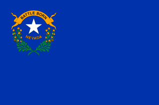
Fallon is a city in Churchill County, Nevada, United States. The population was 8,606 at time of the 2010 census. Fallon is the county seat of Churchill County and is located in the Lahontan Valley.
There are several lakes named Mud Lake within the U.S. state of Nevada.

Centerville is an unincorporated community in Butte County, California along Butte Creek. It was midway between Helltown and Diamondville. The area is about one and three quarters miles, straight-line distance, west of Paradise.

Inskip is an unincorporated community in Butte County, California. It lies at an elevation of 4,777 feet in the northern Sierra Nevada.

Merrimac is an unincorporated community in Butte County, California located along Oroville-Quincy Road about 2.1 miles (3.4 km) south of the Plumas County line. It lies at an elevation of 3999 feet. While the location is shown as official in the National Geographic Names Database, it is not known if locals use this name to describe the place today. Nearby is Rogers Cow Camp, a campground in Lassen National Forest. The USGS feature ID for this populated place is 1659117. The US Postal Service does not show a ZIP Code for this community. The location is within area code 530.
Ingleside is an unincorporated community in northern Franklin County, North Carolina, United States. It lies at the intersection of U.S. Route 401, and North Carolina Highway 39, north of Louisburg, at an elevation of 394 feet.

Big Bar is an unincorporated community in Butte County, California, on the North Fork of the Feather River, 0.5 mi (0.8 km) east of Pulga. It lies at an elevation of 1414 feet.

Big Bend is an unincorporated community in Butte County, California, United States. It lies at an elevation of 2310 feet. A post office operated in Big Bend from 1883 to 1891.

Craig is a former settlement in Butte County, California. It was located 3 miles (4.8 km) east-southeast of Bidwell's Bar on the Feather River Railway, at an elevation of 981 feet. Craig still appeared on maps as of 1947.

Hume is a former settlement in Butte County, California. It was located 3.5 miles (5.6 km) east-northeast of Biggs on the now-abandoned Northern Electric Railroad (which became the Sacramento Northern, at an elevation of 112 feet. The settlement still appeared on maps as of 1912.

The Pines is an unincorporated community in Butte County, California, United States.

Trimmer is an unincorporated community in Fresno County, California. It is located 8 miles (13 km) north-northeast of Piedra, at an elevation of 1030 feet.

Stillwater is a 19th-century ghost town of Churchill County, Nevada. Stillwater became the county seat of Churchill County in 1868, when the town was an important mail stage stop. In 1903 the seat of government moved to Fallon, Nevada.

Hazen is an unincorporated community in Churchill County, Nevada, United States, about 12 miles (19 km) southeast of Fernley and 16 miles (26 km) northwest of Fallon, on U.S. Route 50 Alternate.
Fort Churchill Generating Station is a 226 megawatt plant located at Wabuska, Nevada owned by NV Energy. The plant consists of 2 units and first went into service in 1968. The plant is capable of limited operations using fuel oil on a temporary basis. It is located in Lyon County, north of Yerington.

Washoe Valley is a census-designated place (CDP) in Washoe County, Nevada, United States. It corresponds closely to the unincorporated community of New Washoe City. The population was 3,019 at the 2010 census. It is part of the Reno–Sparks Metropolitan Statistical Area. The CDP takes its name from the Washoe Valley, a region between Reno and Carson City centered on Washoe Lake.

Gold Butte is the name of a ghost town and nearby mountain peak in Clark County, Nevada. Both are protected as part of the Gold Butte National Monument, managed by the Bureau of Land Management. Gold Butte, the mountain, is 5,013 feet (1,528 m) high and rises 1,280 feet (390 m) above the town of Gold Butte. This peak lies within the Virgin Mountains and its name apparently refers to the Gold Butte Mining District.
Holmquist is an unincorporated community in Day County, in the U.S. state of South Dakota.
Bernice is an extinct town in Churchill County, in the U.S. state of Nevada. It was approximately 20 miles (32 km) northeast of Dixie Valley.
Boyer is an extinct town in Churchill County, in the U.S. state of Nevada. The GNIS classifies it as a populated place.


