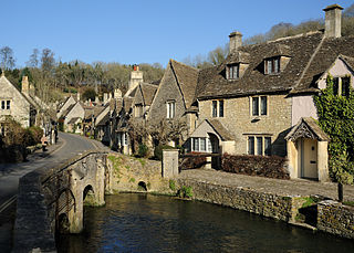
The Cotswolds is a region of central South West England, along a range of rolling hills that rise from the meadows of the upper River Thames to an escarpment above the Severn Valley and the Vale of Evesham. The area is defined by the bedrock of Jurassic limestone that creates a type of grassland habitat that is quarried for the golden-coloured Cotswold stone. It lies across the boundaries of several English counties: mainly Gloucestershire and Oxfordshire, and parts of Wiltshire, Somerset, Worcestershire, and Warwickshire. The highest point is Cleeve Hill at 1,083 ft (330 m), just east of Cheltenham. The predominantly rural landscape contains stone-built villages, towns, stately homes and gardens featuring the local stone.
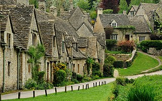
Gloucestershire is a ceremonial county in South West England. It is bordered by Herefordshire to the north-west, Worcestershire to the north, Warwickshire to the north-east, Oxfordshire to the east, Wiltshire to the south, Bristol and Somerset to the south-west, and the Welsh county of Monmouthshire to the west. The city of Gloucester is the largest settlement and the county town.
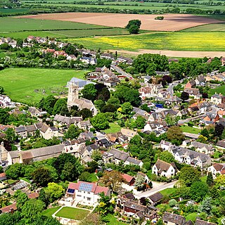
Oxfordshire is a ceremonial county in South East England. The county is bordered by Northamptonshire and Warwickshire to the north, Buckinghamshire to the east, Berkshire to the south, and Wiltshire and Gloucestershire to the west. The city of Oxford is the largest settlement and county town.
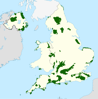
An Area of Outstanding Natural Beauty is one of 46 areas of countryside in England, Wales, or Northern Ireland that has been designated for conservation due to its significant landscape value. Since 2023, the areas in England and Wales have also adopted the name National Landscapes.

Cirencester is a market town and civil parish in the Cotswold District of Gloucestershire, England. Cirencester lies on the River Churn, a tributary of the River Thames. It is the eighth largest settlement in Gloucestershire and the largest town within the Cotswolds. It is the home of the Royal Agricultural University, the oldest agricultural college in the English-speaking world, founded in 1840. The town had a population of 20,229 in 2021. The town is 18 miles (29 km) northwest of Swindon, 18 miles (29 km) southeast of Gloucester, 37 miles (60 km) west of Oxford and 39 miles (63 km) northeast of Bristol.
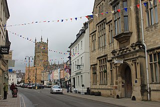
Cotswold is a local government district in Gloucestershire, England. It is named after the wider Cotswolds region and range of hills. The council is based in the district's largest town of Cirencester. The district also includes the towns of Chipping Campden, Fairford, Lechlade, Moreton-in-Marsh, Northleach, Stow-on-the-Wold and Tetbury, along with numerous villages and surrounding rural areas.

The A417 is a main road in England, running from Streatley, Berkshire to Hope under Dinmore, Herefordshire. It is best known for its section between Cirencester and Gloucester where it has primary status and forms part of the link between the major settlements of Swindon and Gloucester.
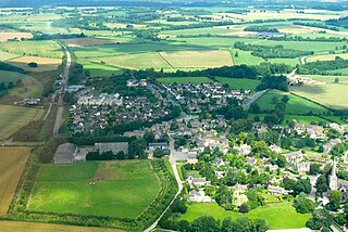
Kemble is a village in the civil parish of Kemble and Ewen, in the Cotswold district of Gloucestershire, England. Historically part of Wiltshire, it lies 4 miles (6.4 km) from Cirencester and is the settlement closest to Thames Head, the source of the River Thames. In 2020 it had an estimated population of 940. At the 2011 census the parish had a population of 1,036.

Bagendon is a village and civil parish in the Cotswold district of Gloucestershire, England, about four miles (6 km) north of Cirencester. According to the 2001 census it had a population of 265, decreasing to 239 at the 2011 census. The hamlet of Perrott's Brook is adjacent to Bagendon's southeast.

Baunton is a village and civil parish in the Cotswold district of Gloucestershire, England, located about two miles north of Cirencester on the River Churn.
Cirencester and Tewkesbury was a parliamentary constituency in Gloucestershire which returned one Member of Parliament (MP) to the House of Commons of the Parliament of the United Kingdom. It was created for the 1918 general election and abolished for the 1997 general election when it was partly replaced by the new constituencies of Cotswold and Tewkesbury.

Rendcomb is a village in the Cotswold local authority area of the English county of Gloucestershire. It is about five miles north of Cirencester in the Churn Valley.

Coberley is a village and civil parish in the Cotswold District of Gloucestershire in England, 4 miles (6.4 km) south of Cheltenham. It lies at the confluence of several streams that form the River Churn, a tributary of the River Thames. The medieval village was closer to the main road, near a spring to the east of Coberley Court. The sites of the medieval and modern villages of Upper Coberley are a short distance to the east.

Siddington is a village and civil parish in Gloucestershire, England. It is located immediately south of Cirencester. At the 2011 United Kingdom Census, the parish had a population of 1,249.

Gloucestershire Victoria County History is an encyclopaedic history of the county of Gloucestershire in England. It forms part of the overall Victoria County History of England founded in 1899 in honour of Queen Victoria. With twelve volumes published in the series A History of the County of Gloucestershire, the Gloucestershire Victoria County History is about halfway through its history of all the parishes in the county. Ten volumes have been published to date, and a further four volumes are in preparation.

National Cycle Route 57 is part of the United Kingdom's National Cycle Network. When complete, it will run west to east from Farmington, Gloucestershire near Northleach to Welwyn Garden City in Hertfordshire.

North Cerney is a village and civil parish in the English county of Gloucestershire, and lies within the Cotswolds, a range of hills designated an Area of Outstanding Natural Beauty. The village is 4 miles (6.4 km) north of Cirencester within the Churn Valley.

Seven Springs is a hamlet in the heavily wooded parish of Coberley in the Cotswold District of Gloucestershire in England, 4 miles (6.4 km) south of Cheltenham. Including the intersection of the A435 and A436 roads, it has the sources of the River Churn, which flows south across almost a full cross-section of the Cotswolds, through Cirencester, and joins the Thames near Cricklade.

The Anglican Church of St Margaret at Bagendon in the Cotswold District of Gloucestershire, England was built in the 12th century. It is a grade I listed building.


