
Outagamie is a county in the northeast region of the U.S. state of Wisconsin. As of the 2010 census, the population was 176,695. Its county seat is Appleton.

Dodge County is a county located in the U.S. state of Wisconsin. As of the 2010 census, the population was 88,759. Its county seat is Juneau. The county was created from the Wisconsin Territory in 1836 and organized in 1844.

De Pere, is a city located in Brown County, Wisconsin, United States. The population was 23,800 at the 2010 census. De Pere is part of the Green Bay Metropolitan Statistical Area.
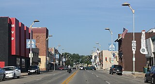
Beaver Dam is a city in Dodge County, Wisconsin, United States, along Beaver Dam Lake and the Beaver Dam River. The estimated population was 16,564 in 2016, making it the largest city primarily located in Dodge County. It is the principal city of the Beaver Dam Micropolitan Statistical area. The city is adjacent to the Town of Beaver Dam.

Amherst is a village in Portage County, Wisconsin, United States. The population was 1,035 at the 2010 census. Amherst is at the core of the Tomorrow Valley area.

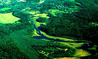
The Crawfish River is a tributary of the Rock River, 80 miles (130 km) long, in south-central Wisconsin in the United States. Via the Rock River, it is part of the watershed of the Mississippi River.
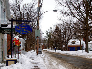
Ormstown is a municipality in Quebec, Canada, which is situated on the Chateauguay River in the heart of the Chateauguay Valley. It is approximately one hour southwest of Montreal and 20 minutes north of New York State in the United States. The population as of the Canada 2011 Census was 3,595 of which Francophones comprise about 65%.

Southridge Mall is a regional shopping mall located in the Milwaukee County suburbs of Greendale and Greenfield, Wisconsin. At 1,177,783 square feet it is tied with the Fox River Mall in Grand Chute as the largest mall in the state. The mall is anchored by JCPenney and Macy's. The third anchor, Sears closed in September 2017, The fourth anchor, Kohl's relocated to a mixed use development on September 29, 2018, and the fifth anchor Boston Store closed in Summer 2018 as parent company Bon-Ton went out of business. The former Sears will be replaced by Dick's Sporting Goods, Golf Galaxy, Round One Entertainment bowling alley, and TJ Maxx.

The Brule River is a 52.3-mile-long (84.2 km) river in the U.S. states of Michigan and Wisconsin. Nearly the entire course forms a portion of the boundary between the two states.

The Quaboag River is a 25.7-mile-long (41.4 km) river in Massachusetts that heads at Quaboag Pond in Brookfield at an elevation of 594 feet (181 m) above sea level. It flows west to the village of Three Rivers, Massachusetts, at an elevation of 290 feet (88 m).
The East Brookfield River is a 2.4-mile-long (3.9 km) river in Massachusetts that heads at Lake Lashaway in East Brookfield at an elevation of 614 feet (187 m) above sea level. It continues to Quaboag Pond, at an elevation of 594 feet (181 m).

Allen's Grove is an unincorporated community in Walworth County, Wisconsin, United States. It is located approximately two miles west of Darien, Wisconsin, in the Towns of Darien and Sharon, Wisconsin, at 42°34′49″N88°45′45″W.

Three Harbors Council is a local council of the Boy Scouts of America serving three southeastern Wisconsin counties: Milwaukee County, Racine County, and Kenosha County. Its name and logo refer to the three major port cities of Milwaukee, Racine, and Kenosha on Lake Michigan.
The Glen D. Palmer Dam is a 6-foot-high (1.8 m) dam across the Fox River in Yorkville, Illinois, about 35.9 miles (58.2 km) upstream from the confluence with the Illinois River, and 940 feet upstream from the Route-47 bridge. The dam is named after the original manager of the State Game Farm, formerly located in Yorkville.
Apple Creek is an unincorporated community located in the towns of Grand Chute and Freedom in Outagamie County, Wisconsin, United States. It is in the Appleton, Wisconsin Metropolitan Statistical Area and the Appleton-Oshkosh-Neenah, Wisconsin Combined Statistical Area.

Golden Pond is a ghost town in western Trigg County, Kentucky, United States. The town is located in the Land Between the Lakes National Recreation Area 11 miles (18 km) west-southwest of Cadiz. Golden Pond was established in the 19th century and became known for its moonshining activity during Prohibition. The settlement was abandoned in 1969 when the land in the recreation area was evacuated.
Lawesburg was an unincorporated village in Outagamie County, Wisconsin, United States. Located in the town of Grand Chute, the site was incorporated into the Village of Appleton in 1853 and is now part of the city of Appleton. The surviving buildings from Lawesburg are protected and are listed on the National Register of Historic Places.
Grand Chute is a ghost neighborhood in the town of Grand Chute in Outagamie County, Wisconsin.
The White River in Wisconsin flows out of Geneva Lake, roughly 19 miles, to the Fox River in Burlington, Wisconsin. There is a dam in Burlington that forms Echo Lake. The river goes through the small town of Lyons on its way to Burlington. White River floods often and is a popular canoe/kayak river in the region. The remains of an 1800s dam are visible on Sheridan Springs Road where it crosses the river entering Lyons from the west. This formed a mill pond that is still shown on maps today even though it was drained several decades ago.


