City Plan for Cincinnati

Last updated

The City Plan for Cincinnati is a set of plans to guide the development of Cincinnati. Cincinnati was first surveyed and laid out by Israel Ludlow in 1794. The earliest modern plan was the 1907 Park Plan created by George Kessler. Every 20 or 30 years since then new comprehensive plans have been created as the city has grown.

Contents

Ludlow Layout

Israel Ludlow bought land from John Cleves Symmes and was the first surveyor and town planner in Cincinnati. [1] He laid out the city with a north-south, east-west grid like many towns in the Northwest Territory. This grid unfortunately ignored topography, and no space was reserved for parks or open space except the public landing on the river. [2]

1907 Park Plan

In 1907 George Kessler, a nationally-known landscape architect, was hired to create a park plan for the city. His plan, however, dealt not only with the 18 parks and 17 public squares/recreational areas contained in it, but, as historian Zane Miller wrote, it was "to inspire civic patriotism by encouraging the construction of monumental public and quasi-public buildings in an impressive downtown setting, to bring all the neighborhoods of the city closer together by improving cross-town and downtown commuter circulation, and to mitigate the problems of traffic congestion and children playing in the streets." [3]

1925: Official Plan of the City of Cincinnati

Cincinnati was the first city in the United States to have a comprehensive plan approved by City Council. Sponsored by the United City Planning Committee and paid for by donations, the plan was started in 1922 and finished in 1925. It was led by Alfred Bettman, a Cincinnati lawyer; Ladislas Segoe, an immigrant planner from Hungary; and George B. Ford and Ernest P. Goodrich, of New York, the owners of the first American planning consulting firm. The plan was long range, seeking to reduce the influence of machine politicians on the city government. The plan built on previous transportation, park, and utilities plans. The 1925 plan called for the construction of the Western Hills Viaduct and what is now Cincinnati Union Terminal. It was unique in controlling the growth of new subdivisions by requiring installation of utilities prior to approval.

Of the 135 structures existing in Cincinnati parks today, nearly half were produced during the period from 1929 to 1943. [4]

The original plan was for the United City Planning Committee to raise $70,000 and the City to contribute $30,000. Donations were sufficient that in the end the city did not contribute anything.

The 1925 Plan has two parts: Zoning (1924) and Capital Improvements (1925)

The Charter Party and Murray Seasongood came to power shortly after the 1925 plan was adopted. Both were seen as reactions to boss rule in Cincinnati.

1948: Cincinnati Metropolitan Master Plan

1948 master plan Cincinnati Metropolitan Master Plan 1948.pdf
1948 master plan

Alfred Bettman also led the development of the 1948 plan. This plan was part of the urban renewal movement and attempted to modernize the inner city. The 1948 plan called for the large-scale demolition of the historic Kenyon-Barr and Central Bottoms neighborhoods, to be replaced by Fort Washington Way, a redeveloped central riverfront, and the industrial district newly named as Queensgate. [5] [6] It extended the scope of the plan to include Kentucky and Indiana as well as new topics, such as employment. The 1948 Plan was well timed to take advantage of the Federal Housing Act of 1949.

1980: Coordinated City Plan

The 1980 plan consisted of three volumes and a fourth summary volume.

Volume I: "Strategies for Current Physical Development"

Volume II: "Strategies for Comprehensive Land Use"

Volume III: Details plans for vision from volume II

Volume IV: Goals, policies, projects

1986: Cincinnati 2000 Urban Renewal Plan

1992: The Cincinnati Parks and Greenways Plan

The Cincinnati Parks and Greenways Plan was approved by the city council in December 1992. [4]

The Banks

The Banks is an urban neighborhood on the Cincinnati Riverfront. Planned in the late 1990s, it includes two sports stadiums and the National Underground Railroad Freedom Center.

2012: Plan Cincinnati

The City reformed the Planning Department in 2007. In 2009 it launched an effort to create a new plan. It set aside half a million dollars in 2009-2010 for the effort. It includes: [7]

See also

Related Research Articles

<span class="mw-page-title-main">Smart growth</span> Urban planning philosophy

Smart growth is an urban planning and transportation theory that concentrates growth in compact walkable urban centers to avoid sprawl. It also advocates compact, transit-oriented, walkable, bicycle-friendly land use, including neighborhood schools, complete streets, and mixed-use development with a range of housing choices. The term "smart growth" is particularly used in North America. In Europe and particularly the UK, the terms "compact city", "urban densification" or "urban intensification" have often been used to describe similar concepts, which have influenced government planning policies in the UK, the Netherlands and several other European countries.

<span class="mw-page-title-main">Ludlow, Kentucky</span> City in Kentucky, United States

Ludlow is a home rule-class city in Kenton County, Kentucky, United States, along the Ohio River. The population was 4,385 at the 2020 census. It is a suburb of the Cincinnati metropolitan area. It received its greatest period of early growth as a rail station.

George Hargreaves is a landscape architect. Under his design direction, the work of his firm has received numerous national awards and has been published and exhibited nationally and internationally. He was an artist in residence at the American Academy of Rome in 2009. Hargreaves and his firm designed numerous sites including the master plan for the Sydney 2000 Olympics, The Brightwater Waste Water Treatment Facility in Seattle, Washington, and University of Cincinnati Master Plan.

<span class="mw-page-title-main">George Kessler</span> American pioneer city planner and landscape architect

George Edward Kessler was an American pioneer city planner and landscape architect.

<span class="mw-page-title-main">Environmental planning</span> Considering environment in developing land

Environmental planning is the process of facilitating decision making to carry out land development with the consideration given to the natural environment, social, political, economic and governance factors and provides a holistic framework to achieve sustainable outcomes. A major goal of environmental planning is to create sustainable communities, which aim to conserve and protect undeveloped land.

<span class="mw-page-title-main">Daylighting (streams)</span> Restoring covered streams to more natural conditions

Daylighting is the opening up and restoration of a previously buried watercourse, one which had at some point been diverted below ground. Typically, the rationale behind returning the riparian environment of a stream, wash, or river to a more natural above-ground state is to reduce runoff, create habitat for species in need of it, or improve an area's aesthetics. In the United Kingdom, the practice is also known as deculverting.

<span class="mw-page-title-main">Frederick Todd</span>

Frederick Gage Todd was the first resident landscape architect in Canada. For the majority of his life he was one of a small group committed to the art and practice of structuring urban growth in the first half of the century. His projects ranged from Vancouver, B.C. to St John's, Newfoundland, from the smallest scale details of garden design to a study of the nation's capital.

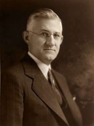
Alfred Bettman was one of the key founders of modern urban planning. Zoning, as it is known today, can be attributed to his successful arguments before the U.S. Supreme Court, which resulted in the 1926 decision in favor of the Village of Euclid, Ohio versus Ambler Realty Company.

<span class="mw-page-title-main">Harland Bartholomew</span> American urban planner

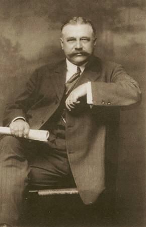
Harland Bartholomew was the first full-time urban planner employed by an American city. A civil engineer by training, Harland was a planner with St. Louis, Missouri, for 37 years. His work and teachings were widely influential, particularly on the use of government to enforce racial segregation in land use.

<span class="mw-page-title-main">Fort Washington Way</span>

Fort Washington Way is an approximately 0.9-mile-long (1.4 km) section of freeway in downtown Cincinnati, Ohio, United States. The eight-lane divided highway is a concurrent section of Interstate 71 (I-71) and U.S. Route 50 (US 50) that runs from west to east from an interchange with I-75 at the Brent Spence Bridge to the Lytle Tunnel and Columbia Parkway.

<span class="mw-page-title-main">East Walnut Hills, Cincinnati</span> Place in Ohio, United States

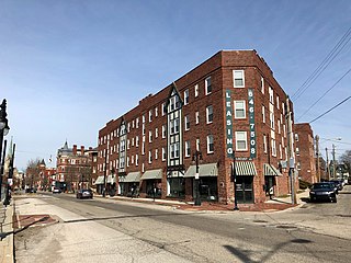
East Walnut Hills is one of the 52 neighborhoods of Cincinnati, Ohio. Established in 1867 and annexed in 1873, it is located in the eastern side of the city. The population was 4,103 at the 2020 census.

<span class="mw-page-title-main">The Banks, Cincinnati</span> Mixed-use commercial, entertainment, retail, office in Ohio, United States

The Banks is a mixed-use development along the Ohio River in downtown Cincinnati, Ohio, on the land between Paycor Stadium and Great American Ball Park.

Comprehensive planning is an ordered process that determines community goals and aspirations in terms of community development. The end product is called a comprehensive plan, also known as a general plan, or master plan. This resulting document expresses and regulates public policies on transportation, utilities, land use, recreation, and housing. Comprehensive plans typically encompass large geographical areas, a broad range of topics, and cover a long-term time horizon. The term comprehensive plan is most often used by urban planners in the United States.

<span class="mw-page-title-main">Percival Goodman</span> American architect

Percival Goodman was an American urban theorist and architect who designed more than 50 synagogues between 1948 and 1983. He has been called the "leading theorist" of modern synagogue design, and "the most prolific architect in Jewish history."

Design Workshop is an international landscape architecture, land planning, urban design and strategic services firm that began in 1969. The firm was named ASLA's Firm of the Year in 2008 for its work in new communities, urban centers, resorts, public parks, golf courses and residences.

Based in southwest Ohio, the Eastern Corridor Program is a regional effort that integrates roadway network improvements, new rail transit, expanded bus service, bikeways and walking paths to improve travel and access between Greater Cincinnati's eastern communities and its central employment, economic and social centers. The Program is designed to address the long-standing transportation needs of the region and to provide additional opportunity for community enhancement, economic development and regional growth.

Eugenie L. Birch is an American scholar and city planner specializing in international and domestic planning history and urban revitalization.

Urban Design Associates is an international urban design and architecture firm headquartered in Pittsburgh, Pennsylvania, United States.

References

  1. "Israel Ludlow - Ohio History Central".
  2. "Cincinnati". Archived from the original on 2015-08-08. Retrieved 2015-08-18.
  3. Wright, Steven (August 18, 1997). "Lessons from a pioneer in planning". Business Courier. American City Business Journals. Retrieved 14 November 2011.
  4. 1 2 Cincinnati Parks History (City of Cincinnati)
  5. Singer, Allen J. (2005). Stepping Out in Cincinnati: Queen City Entertainment 1900-1960. Arcadia Publishing. p. 100. ISBN   9780738534329 . Retrieved 9 December 2013.
  6. Seuss, Jeff (2015). Lost Cincinnati. Charleston, South Carolina: The History Press. pp. 144–146. ISBN   978-1-62619-575-2 via Google Books.
  7. "Archived copy" (PDF). Archived from the original (PDF) on 2015-09-08. Retrieved 2015-08-18.{{cite web}}: CS1 maint: archived copy as title (link)