The Banks, Cincinnati

Last updated
The Banks
The Banks Cincinnati logo.svg
The Banks, Cincinnati
General information
Type Mixed-use commercial, entertainment, retail, office
Location Cincinnati, Ohio, United States
GroundbreakingApril 2, 2008
OpeningSpring 2011
Design and construction
DeveloperCarter [1]
The Dawson Co. [2]

The Banks is a mixed-use development along the Ohio River in downtown Cincinnati, Ohio, on the land between Paycor Stadium and Great American Ball Park. [3]

Contents

History

The Moerlein Lager House in The Banks Moerlein Lager House foto by Andy Hemmer Cincinnati.jpg
The Moerlein Lager House in The Banks
The Banks on Opening Day 2012 The Banks on Opening Day for The Cincinnati Reds April 2012.jpg
The Banks on Opening Day 2012

The construction for a new riverfront area between the two stadiums is the result of a public participation planning process begun in October 1996. Hamilton County and the City of Cincinnati engaged Urban Design Associates to prepare a plan to give direction in two public policy areas:

  1. To site the two new stadiums for the Cincinnati Reds and the Cincinnati Bengals
  2. To develop an overall urban design framework for the development of the central riverfront which would capitalize on the major public investment in the stadiums and structured parking.

A Riverfront Steering Committee made up of City and County elected officials and staff was formed as a joint policy board for the Central Riverfront Plan. Focus groups, interviews, and public meetings were held throughout the planning process.

A Concept Plan was published in April 1997 which identified three possible scenarios for the siting of the stadiums and the development of the riverfront. The preparation of a final Master Plan was delayed due to a November 1998 public referendum on the siting of the Reds Stadium. Once the decision on the Reds Stadium was made by the voters in favor of a riverfront site, Hamilton County and the City of Cincinnati appointed sixteen prominent citizens to the Riverfront Advisors Commission who were charged to "recommend mixed usage for the Riverfront that guarantees public investment will create sustainable development on the site most valued by our community". The result of that effort was The Banks, a September 1999 report from the Advisors which contained recommendations on land use, parking, finance, phasing, and developer selection for the Central Riverfront. The final Master Plan includes The Banks recommendations from the advisors. [4]

Carter and The Dawson Co. were selected by the City of Cincinnati and Hamilton County as master developers for the 18-acre mixed-use project. [5] Carter has also served as program manager for the construction of the city and county-funded parking garage and infrastructure components of The Banks project, including accommodation of parking for the Cincinnati Reds stadium. Bob Castellini, CEO of the Cincinnati Reds, was a chair of Joint Banks Steering Committee.

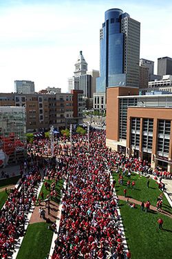
On November 1, 2007, Cincinnati City Council and Hamilton County approved of the project. Groundbreaking took place on April 2, 2008. The first phase, which opened in summer of 2011, [6] included Current at the Banks, [7] a building containing 300 apartment units atop 96,000 square feet of street-level retail space.

Phase II of The Banks broke ground in the summer of 2013, including projects with 300 apartment units, more than 60,000 square feet of street level retail, and more than 400 parking spaces along Vine Street between Second Street and Freedom Way. [8] [9]

According to a 2012 study of Phase I by The University of Cincinnati Economic Center, it was estimated that The Banks would have an ongoing economic impact of $91.6 million, as well as generating $556 million in construction-based impact. [10] Upon completion, The Banks would be the region's largest mixed-use development and would house more than 3,000 residents. [11] The City of Cincinnati, Hamilton County, and a joint venture between Carter and The Dawson Co. formed The Banks Public Private Partnership to secure funding and develop the project. [12]

The SkyStar Wheel was scheduled to open at The Banks on August 31, 2018, but was delayed until September 1, 2018 due to weather. [13] It opened to help celebrate the Banks' ten-year anniversary and was located across from the National Underground Railroad Freedom Center. [13] The wheel remained open at this location until March 1, 2020. [14] [15] [16] On July 2, 2019, it was announced that the owners, SkyView Partners, planned to return to the area and install a permanent 180-foot tall (54.9 m) observation wheel set to open by March 5, 2021. [17] [18] However, the company indicated in December 2020 they had put the plans on hold due to the COVID-19 pandemic. [14] [18]

Smale Riverfront Park

Smale Riverfront Park spans over 40 acres (160,000 m2) of land along the Ohio River between Broadway and Central Avenue in Cincinnati, Ohio. It is named after John G. Smale, who gave $20 million for its construction in memory of his wife, Phyllis W. Smale. [19]

Design

The park connects Bicentennial Commons and Sawyer Point to form an almost 3-mile (5 km) corridor of public park along the river.

The park includes:

Additionally, the park contains a historical marker indicating the position of home plate of the former Riverfront Stadium. The area occupied by the Banks and the Riverfront Park is the former site of this storied facility, razed in 2002 after the completion of Great American Ball Park to the east.

Transportation

The master plan for The Banks project included the project as the southern terminus of the first phase of the then-proposed Cincinnati Streetcar system, linking Over-the-Rhine and Downtown to the riverfront and the new development. [20] The proposed system came to fruition in 2016 as the Cincinnati Bell Connector.

Neighborhood landmarks

In existence prior to development

Completed development projects

Awards

Notes

  1. "Carter". www.carterusa.com. Retrieved 14 February 2018.
  2. "The Dawson Company - Real Estate Services Firm". The Dawson Company. Retrieved 14 February 2018.
  3. "Cincinnati Enquirer - cincinnati.com". Cincinnati.com. Retrieved 14 February 2018.
  4. "Home". www.cincinnati-oh.gov. Retrieved 14 February 2018.
  5. City of Cincinnati development projects
  6. Mayor Mark Mallory's biography
  7. Current at The Banks
  8. Banks next phase set for winter start
  9. "An Ohio River City Comes Back to Its Shoreline (Published 2012)". The New York Times .
  10. Study: Current phase of The Banks to have $91.6M annual economic impact
  11. The Banks gearing up for next wave of construction
  12. Cinci riverfront development among best in the country
  13. 1 2 "SkyStar wheel opens to great views, reviews". WCPO 9 Cincinnati. 2018-08-31. Retrieved 2024-01-28.
  14. 1 2 Wartman, Scott; Fair, Julia (2021-07-08). "No Ferris wheels for Newport, Cincinnati anytime soon". The Enquirer. Retrieved 2024-01-28.
  15. "SkyStar Ferris Wheel Moving- Permanent Ferris Wheel Coming". spectrumnews1.com. 2020-03-02. Retrieved 2024-01-28.
  16. "Out with the old, in with the new: Cincinnati's SkyStar being dismantled". WLWT. 2020-03-02. Retrieved 2024-01-28.
  17. Brookbank, Sarah; Wartman, Scott. "It's (mostly) official: SkyStar Wheel will stay in Cincinnati". USA TODAY. Retrieved 2024-01-28.
  18. 1 2 Wartman, Scott (2021-01-26). "SkyStar return? Maybe, but owner tells county they understand 'if something else comes along'". The Enquirer. Retrieved 2024-01-28.
  19. "John G. Smale, Procter & Gamble Chief, Dies at 84". The New York Times. 21 November 2011. Retrieved 14 February 2018.
  20. Connect the Dots, Cincinnati Streetcar
  21. NAIOP Impact Award
  22. National Planning Excellence Award for Implementation

39°5′48″N84°30′42″W / 39.09667°N 84.51167°W / 39.09667; -84.51167

Related Research Articles

<span class="mw-page-title-main">Great American Ball Park</span> Baseball park in Cincinnati, Ohio

Great American Ball Park is a baseball stadium in Cincinnati, Ohio. It serves as the ballpark of Major League Baseball's Cincinnati Reds, and opened on March 31, 2003, replacing Cinergy Field, the Reds' former ballpark from 1970 to 2002. Great American Insurance bought the naming rights to the new stadium at US$75 million for 30 years.

<span class="mw-page-title-main">Riverfront Stadium</span> Former multi-purpose stadium in Cincinnati, Ohio

Riverfront Stadium, also known as Cinergy Field from 1996 to 2002, was a multi-purpose stadium in Cincinnati, Ohio. It was the home of the Cincinnati Reds of Major League Baseball (MLB) from 1970 through 2002 and the Cincinnati Bengals of the National Football League (NFL) from 1970 to 1999. Located on the Ohio River in downtown Cincinnati, the stadium was best known as the home of "The Big Red Machine", as the Reds were often called in the 1970s.

George Hargreaves is a landscape architect. Under his design direction, the work of his firm has received numerous national awards and has been published and exhibited nationally and internationally. He was an artist in residence at the American Academy of Rome in 2009. Hargreaves and his firm designed numerous sites including the master plan for the Sydney 2000 Olympics, The Brightwater Waste Water Treatment Facility in Seattle, Washington, and University of Cincinnati Master Plan.

<span class="mw-page-title-main">Paycor Stadium</span> Stadium in Cincinnati, Ohio, United States

Paycor Stadium, previously known as Paul Brown Stadium, is an outdoor football stadium in Cincinnati, Ohio. It is the home venue of the Cincinnati Bengals of the National Football League (NFL) and opened on August 19, 2000.

<span class="mw-page-title-main">Nippert Stadium</span> Football stadium at the University of Cincinnati

James Gamble Nippert Memorial Stadium is an outdoor stadium in Cincinnati, Ohio, on the campus of the University of Cincinnati. Primarily used for American football, it is the home field of the Cincinnati Bearcats football team. The stadium has also been used as a soccer venue, serving as the home of FC Cincinnati of Major League Soccer from their inaugural 2016 USL season through the 2020 MLS season, following which they moved to TQL Stadium. Nippert Stadium has a current seating capacity of 38,088 following the expansion and renovation performed in 2014, and the 2017 removal of corner seats to accommodate FC Cincinnati during their transition to the MLS. The stadium began in 1901 with a rudimentary for and field surface, with permanent concrete stands built along each sideline for the 1915 season and a complete horseshoe stadium completed in 1924, making it the fourth-oldest playing site and fifth-oldest stadium in college football, respectively.

<span class="mw-page-title-main">Louisville Waterfront Park</span>

Louisville Waterfront Park is both a non-profit organization and an 85-acre (340,000 m2) public park adjacent to the downtown area of Louisville, Kentucky and the Ohio River. Specifically, it is adjacent to Louisville's wharf and Riverfront Plaza/Belvedere, which are situated to the west of the park. Once a wasteland of scrap yards and abandoned industrial buildings, Waterfront Park is now a vibrant green space that welcomes over 2.2 million visitors each year. Located in the park is the Big Four Bridge which connects the city of Louisville with the City of Jeffersonville, Indiana. Waterfront Park is home to some of Louisville's most exciting celebrations, such as the Fourth of July at Waterfront Park, Forecastle Festival, WFPK Waterfront Wednesdays and Thunder Over Louisville. In 2013 the park won the Rudy Bruner Award for Urban Excellence a national design award that seeks to identify and honor places that address economic and social concerns in urban design.

<span class="mw-page-title-main">Cityscape of Cincinnati</span>

Cincinnati, Ohio is home to numerous structures that are noteworthy due to their architectural characteristics or historic associations. The city also boasts Fountain Square and a riverfront that is being revitalized under The Banks project.

<span class="mw-page-title-main">Navy Yard (Washington, D.C.)</span> Place in the United States

Navy Yard, also known as Near Southeast, is a neighborhood on the Anacostia River in Southeast Washington, D.C. Navy Yard is bounded by Interstate 695 to the north and east, South Capitol Street to the west, and the Anacostia River to the south. Approximately half of its area is occupied by the Washington Navy Yard, which gives the neighborhood its name. The neighborhood is located in D.C.'s Ward 8, currently represented by Trayon White. It is served by the Navy Yard – Ballpark Metro station on the Green Line.

<span class="mw-page-title-main">Fort Washington Way</span>

Fort Washington Way is an approximately 0.9-mile-long (1.4 km) section of freeway in downtown Cincinnati, Ohio, United States. The eight-lane divided highway is a concurrent section of Interstate 71 (I-71) and U.S. Route 50 (US 50) that runs from west to east from an interchange with I-75 at the Brent Spence Bridge to the Lytle Tunnel and Columbia Parkway.

<span class="mw-page-title-main">West End, Cincinnati</span> Neighborhood of Cincinnati in Ohio, United States

West End is one of the 52 neighborhoods of Cincinnati, Ohio. Originally a large residential neighborhood, the majority of the area was demolished in the mid-20th century for the construction of highway interchanges and an industrial park known as Queensgate. The population was 6,824 at the 2020 census.

<span class="mw-page-title-main">Connector (Cincinnati)</span> Streetcar system in Cincinnati, Ohio, U.S.

The Connector is a streetcar system in Cincinnati, Ohio, United States. The system opened to passengers on September 9, 2016. The streetcar operates on a 3.6-mile (5.8 km) loop from The Banks, Great American Ball Park, and Smale Riverfront Park through Downtown Cincinnati and north to Findlay Market in the northern edge of the Over-the-Rhine neighborhood. Future extensions have been proposed to the Uptown area, home to the University of Cincinnati, the regional hospitals on Pill Hill, and the Cincinnati Zoo; and to Northern Kentucky.

<span class="mw-page-title-main">U.S. Route 27 in Ohio</span>

U.S. Route 27 (US 27) in Ohio runs for 40.58 miles (65.31 km) between the Kentucky and Indiana state lines: 18.5 miles (29.8 km) in Hamilton County and another 22.1 miles (35.6 km) in Butler County. The route crosses into Ohio and Downtown Cincinnati via the Taylor–Southgate Bridge over the Ohio River. US 27 follows Mehring Way, Central Avenue, Ezzard Charles Drive, and Central Parkway through Downtown Cincinnati. US 27 briefly runs concurrent with Interstate 75 (I-75), exiting at I-74 for another brief concurrency before exiting onto Colerain Road. US 27 then continues northwest eventually to Oxford and then reaches the Indiana border another six miles (9.7 km) northwest at College Corner.

The Sports & Exhibition Authority of Pittsburgh and Allegheny County is a municipal authority that owns and operates public sports and entertainment venues in Allegheny County, Pennsylvania and the City of Pittsburgh.

<span class="mw-page-title-main">Downtown Cincinnati</span> Neighborhood in Cincinnati, Ohio, United States

Downtown Cincinnati is one of the 52 neighborhoods of Cincinnati, Ohio. It is the central business district of the city, as well the economic and symbiotic center of the Cincinnati metropolitan area. Originally the densely populated core of the city, the neighborhood was transformed into a commercial zone in the mid-20th century. The population was 5,835 at the 2020 census.

Based in southwest Ohio, the Eastern Corridor Program is a regional effort that integrates roadway network improvements, new rail transit, expanded bus service, bikeways and walking paths to improve travel and access between Greater Cincinnati's eastern communities and its central employment, economic and social centers. The Program is designed to address the long-standing transportation needs of the region and to provide additional opportunity for community enhancement, economic development and regional growth.

<span class="mw-page-title-main">Marian Spencer</span> American politician (1920–2019)

Marian Regelia Alexander Spencer was an American politician who served as Vice Mayor of the Cincinnati City Council in Cincinnati, Ohio. She was the first African American woman to be elected to the Council. The granddaughter of a former slave, she was active in the civil rights movement to desegregate schools and end discrimination, and became the first female president of the Cincinnati NAACP chapter. She also served on the University of Cincinnati board of trustees.

<span class="mw-page-title-main">TQL Stadium</span> Soccer stadium in Cincinnati, Ohio

TQL Stadium is a soccer-specific stadium in Cincinnati, Ohio, United States. It is the home of FC Cincinnati, a Major League Soccer (MLS) team that has played there since the stadium opened on May 16, 2021. The stadium holds approximately 26,000 spectators and is located in the West End neighborhood, at the former site of Stargel Stadium on Central Parkway at Wade Street. It has a hybrid grass surface. During construction, it was also known as the West End Stadium.

<span class="mw-page-title-main">Andrew J. Brady Music Center</span>

The Andrew J. Brady Music Center is a music venue in Cincinnati, Ohio, located in The Banks neighborhood on the Ohio River. The venue opened in July 2021. The year-round facility includes an outdoor stage for concerts and festivals in the park adjacent to the venue.

<span class="mw-page-title-main">Black Lives Matter street mural (Cincinnati)</span> Mural in Cincinnati, Ohio, U.S.

A "Black Lives Matter" street mural has been painted in Cincinnati, in the U.S. state of Ohio.

<span class="mw-page-title-main">SkyStar Wheel</span> Ferris wheel in Fishermans Wharf, San Francisco, California, United States

SkyStar Wheel is a 150-foot tall (45.7 m) 137-foot (41.8 m) diameter traveling observation wheel located in San Francisco's Fisherman's Wharf since November 13, 2023. It has previously operated in San Francisco's Music Concourse, Cincinnati's The Banks, Louisville's Waterfront Park (2018), and Norfolk (2018).