Pleasant Ridge, Cincinnati

Last updated
Pleasant Ridge
Flag of Pleasant Ridge, Cincinnati, Ohio.svg
Pleasant-Ridge-Cincinnati-map.jpg
Pleasant Ridge (red) within Cincinnati, Ohio
Country United States
State Ohio
County Hamilton
City Cincinnati
Population
 (2020)
  Total8,895
ZIP code
45213, 45212

Pleasant Ridge is one of the 52 neighborhoods of Cincinnati, Ohio. Annexed in 1911, the neighborhood is predominately residential. The population was 8,895 at the 2020 census. [1]

Contents

History

John Cleves Symmes, congressman from New Jersey, purchased a vast tract of land between the two Miami rivers for less than a $1.00 an acre. Pleasant Ridge marks its beginning as a community in 1795, when land agent Colonel John McFarland bought nearly 1,000 acres (4.0 km2) from Symmes and built a small fort to protect early settlers from Native American attacks. This was one of a series of forts built in the Symmes purchase. McFarland's Station was located on the border of what is now the neighborhoods of Kennedy Heights and Pleasant Ridge.

McFarland's Station's surrounds had few settlers in the late 18th century and early 19th century. Its subsequent settlement, Pleasant Ridge, first developed due to the construction of county roads. One road, an old Native American trail, wound between the mouth of the Little Miami River and what is now Reading. Originally called Columbia Road, this trail became Ridge Road. The other road, a turnpike, was built by early settlers to connect Cincinnati to Zanesville. In 1803, when the road was extended from Sharpsburg (Norwood) to Montgomery, it became known as the Montgomery Turnpike. With the arrival of the turnpike, Pleasant Ridge developed some stopping places for travelers, such as Sudler's Tavern and Auten's Tavern. The area was originally known as Cross Roads, because of the intersection of the Montgomery Pike and Columbia Road (Ridge). Ridge Road connected McFarland's Station with other forts in Carthage and Lockland.

The Presbyterian Church moved from Duck Creek to its present site in 1800 with a school built nearby around 1819. The Church took the name Pleasant Ridge around 1818, and the community is said to have changed from Cross Roads to Pleasant Ridge in 1850.

The first permanent settler of Pleasant Ridge was James C. Wood in 1809. [2] Wood bought 660 acres (2.7 km2) from Colonel McFarland in 1809 for $4.00 per acre. The family, including 10 children, lived in "the fort" until they built a house off Montgomery Pike, with brick burned on site. When James died in 1824, the land was divided among his heirs, and Pleasant Ridge was first platted.

The community of Pleasant Ridge grew slowly. In 1832, the year the post office opened, [3] population was only 100. The community was basically a farming community with a few businesses to serve farmers or travelers passing through the turnpike.

Pleasant Ridge was incorporated as a village in 1891 when its population exceeded 1,000. John H. Durrell, businessman and descendant of the original Wood family, became the first mayor. The village enacted certain improvements, such as board sidewalks and oil street lamps. The village had a council, policeman, lamplighter, and fireman.

The petition to be annexed by Cincinnati 20 years later had several opponents, but the proponents believed the added services would outweigh other disadvantages. Pleasant Ridge became part of Cincinnati on a vote of 260-174.

In 1904 the village made national news when the floor of the school's outhouse collapsed, and nine young girls drowned in the waste of the vault beneath. [4]

Geography

The neighborhood is bordered by the cities of Norwood and Golf Manor, Amberley Village, the neighborhoods of Kennedy Heights and Oakley, and unincorporated Columbia Township.[ citation needed ]

Demographics

As of the census of 2020, there were 8,895 people living in the neighborhood. There were 4,636 housing units. The racial makeup of the neighborhood was 61.1% White, 27.7% Black or African American, 0.3% Native American, 2.1% Asian, 0.1% Pacific Islander, 2.5% from some other race, and 6.3% from two or more races. 5.2% of the population were Hispanic or Latino of any race. [1]

There were 4,162 households, out of which 51.2% were families. 44.6% of all households were made up of individuals. [1]

18.9% of the neighborhood's population were under the age of 18, 69.3% were 18 to 64, and 11.8% were 65 years of age or older. 49.1% of the population were male and 50.9% were female. [1]

According to the U.S. Census American Community Survey, for the period 2016-2020 the estimated median annual income for a household in the neighborhood was $62,150. About 11.9% of family households were living below the poverty line. About 50.9% of adults had a bachelor's degree or higher. [1]

Culture

Pleasant Ridge is home to many artists and musicians. On October 11, 2008 Pleasant Ridge and neighboring community Kennedy Heights formed an Alliance called District A, a grassroots effort to build community partnerships and fuel economic development through the arts along the Montgomery Road corridor that is the main thoroughfare for both communities. [5]

Notable people

Related Research Articles

<span class="mw-page-title-main">Fairfield, Ohio</span> City in Ohio, United States

Fairfield is a city in southern Butler County, Ohio, United States. It is a suburb located about 25 miles (40 km) north of Cincinnati and is situated on the east bank of the Great Miami River. The population was 44,907 as of the 2020 census. Incorporated in 1955 from portions of Fairfield Township, it includes the former hamlets of Symmes Corner, Fair Play, Furmandale, and Stockton. The Fairfield City School District is one of the largest in Ohio and serves both the City of Fairfield and Fairfield Township.

<span class="mw-page-title-main">Hamilton County, Ohio</span> County in Ohio, United States

Hamilton County is located in the southwestern corner of the U.S. state of Ohio. As of the 2020 census, the population was 830,639, making it the third-most populous county in Ohio. The county seat and largest city is Cincinnati. The county is named for the first Secretary of the Treasury, Alexander Hamilton. Hamilton County is part of the Cincinnati-Middletown, OH-KY-IN Metropolitan Statistical Area.

<span class="mw-page-title-main">North Decatur, Georgia</span> Place in Georgia, United States

North Decatur is an unincorporated community and census-designated place (CDP) in DeKalb County, Georgia, United States. The population was 16,698 at the 2010 census.

<span class="mw-page-title-main">Montgomery, Ohio</span> City in Ohio, United States

Montgomery is a city in Hamilton County, Ohio, United States. It is an eastern suburb of Cincinnati. The population was 10,853 at the 2020 census.

<span class="mw-page-title-main">Norwood, Ohio</span> City in Ohio, United States

Norwood is the third most populous city in Hamilton County, Ohio, United States, and an enclave of the larger city of Cincinnati. The population was 19,043 at the 2020 census. Originally settled as an early suburb of Cincinnati in the wooded countryside north of the city, the area is characterized by older homes and tree-lined streets.

<span class="mw-page-title-main">Wyoming, Ohio</span> City in Ohio, United States

Wyoming is a city in Hamilton County, Ohio; located approximately 12 miles north of downtown Cincinnati and part of the Cincinnati metropolitan area. The population was 8,756 at the 2020 census.

<span class="mw-page-title-main">Whitemarsh Township, Pennsylvania</span> Home rule municipality in Pennsylvania, United States

Whitemarsh Township is a Home rule municipality in Montgomery County, Pennsylvania. It retains its former classification of "Township" in its official name despite being a home rule municipality. The population was 19,707 at the 2020 census. Whitemarsh is adjacent to the neighborhood of Andorra in the Roxborough section of Philadelphia, and is bordered in Montgomery County by Springfield, Upper Dublin, Whitpain, and Plymouth townships, Conshohocken, and the Schuylkill River, which separates it from Lower Merion Township.

<span class="mw-page-title-main">Columbia Township, Hamilton County, Ohio</span> Township in Ohio, United States

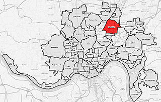
Columbia Township is one of the twelve townships of Hamilton County, Ohio, United States. The 2020 census found 4,446 people in the township. Originally one of Ohio's largest townships by area at its inception in 1791, it gradually shrank to one of the smallest by the early 1950s.

<span class="mw-page-title-main">Bond Hill, Cincinnati</span> Neighborhood of Cincinnati in Hamilton, Ohio, United States

Bond Hill is one of the 52 neighborhoods of Cincinnati, Ohio. Founded as a railroad suburb and temperance community in 1870 in northeastern Millcreek Township, it is one of a number of neighborhoods lining the Mill Creek. The population was 7,002 at the 2020 census.

<span class="mw-page-title-main">Evanston, Cincinnati</span> Neighborhood of Cincinnati in Ohio, United States

Evanston is one of the 52 neighborhoods of Cincinnati, Ohio. A mostly African-American neighborhood since the 1960s, it is known as "the educating community," and is bordered by the neighborhoods of East Walnut Hills, Hyde Park, North Avondale, and Walnut Hills, as well as the City of Norwood. The population was 8,838 at the 2020 census.

<span class="mw-page-title-main">Clifton, Cincinnati</span> Neighborhood of Cincinnati in Ohio, United States

Clifton is is one of the 52 neighborhoods of Cincinnati, Ohio. The population was 8,408 in the 2020 census.

<span class="mw-page-title-main">Daniel C. Cooper</span> American politician

Daniel C. Cooper was an American surveyor, farmer, miller and political leader.

<span class="mw-page-title-main">Oakley, Cincinnati</span> Neighborhood of Cincinnati in Hamilton, Ohio, United States

Oakley is one of the 52 neighborhoods of Cincinnati, Ohio. Located in the eastern part of the city, it borders Pleasant Ridge, Madisonville, and Hyde Park. Oakley is a primary thoroughfare and a major crosstown artery in Cincinnati, and contains multiple shopping centers. The population was 11,761 at the 2020 census.

<span class="mw-page-title-main">Kennedy Heights, Cincinnati</span> Neighborhood of Cincinnati in Hamilton, Ohio, United States

Kennedy Heights is one of the 52 neighborhoods of Cincinnati, Ohio. The population was 5,166 at the 2020 census.

<span class="mw-page-title-main">Madisonville, Cincinnati</span> Neighborhood of Cincinnati in Ohio, United States

Madisonville is one of the 52 neighborhoods of Cincinnati, Ohio. Established in 1809 and annexed in 1911, it is located in the northeastern part of the city. The population was 17,898 at the 2020 census.

<span class="mw-page-title-main">Mount Airy, Cincinnati</span> Neighborhood of Cincinnati in Hamilton, Ohio, United States

Mount Airy is one of the 52 neighborhoods of Cincinnati, Ohio. The neighborhood is home to Mount Airy Forest, one of the oldest urban reforestation projects in the country. The population was 9,210 at the 2020 census.

<span class="mw-page-title-main">Riverside, Cincinnati</span> Neighborhood of Cincinnati in Hamilton, Ohio, United States

Riverside is one of the 52 neighborhoods of Cincinnati, Ohio. The neighborhood is contained in a narrow strip of land along the Ohio River on the city's west side, between Sayler Park and Sedamsville. Predominately industrial, the neighborhood has few residential areas, with a population of 1,257 at the 2020 census.

Israel Ludlow was a government surveyor who helped found Cincinnati, Dayton and Hamilton in southwest Ohio.

<span class="mw-page-title-main">Hartwell, Cincinnati</span> Neighborhood of Cincinnati in Hamilton, Ohio, United States

Hartwell is one of the 52 neighborhoods of Cincinnati, Ohio. Established in 1868 and annexed in 1912, it is the city's northernmost neighborhood, centered roughly on the intersections of I-75 and Ronald Reagan Cross County Highway. Its boundaries are a combination of Caldwell Park and Ronald Reagan Cross County Highway to the south, I-75 to the east, and a combination of Millsdale Street and Compton Road to the North. The population was 5,806 at the 2020 census.

References

  1. 1 2 3 4 5 "Pleasant Ridge 2020 Statistical Neighborhood Approximation" (PDF). City of Cincinnati. Retrieved 29 December 2023.
  2. Clarke, S. J. (1912). Cincinnati, the Queen City, 1788-1912, Volume 2. The S. J. Clarke Publishing Company. p. 531. Retrieved 2013-05-20.
  3. Clarke, S. J. (1912). Cincinnati, the Queen City, 1788-1912, Volume 2. The S. J. Clarke Publishing Company. p. 531. Retrieved 2013-05-20.
  4. https://www.gendisasters.com/ohio/17040/pleasant-ridge-oh-outhouse-floor-collapses-sep-1904 [ bare URL ]
  5. Bernard-Kuhn, Lisa, Neighborhoods team for the arts, Cincinnati Enquirer, October 12, 2008