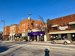
College Hill, Cincinnati

Last updated
College Hill
Hamilton Avenue, College Hill, Cincinnati, OH (31976615497).jpg
Hamilton Avenue in College Hill, Cincinnati
Flag of College Hill, Cincinnati, Ohio.jpg
College-Hill-Cincinnati-map.jpg
College Hill (red) within Cincinnati, Ohio
Country United States
State Ohio
County Hamilton
City Cincinnati
Population
 (2020)
  Total16,039

College Hill is a residential neighborhood of Cincinnati, Ohio. Originally a wealthy suburb called Pleasant Hill due to its prime location, it was renamed College Hill because of the two colleges that were established there in the mid-nineteenth century. The neighborhood is not to be confused with North College Hill, which borders College Hill to the north but is not part of Cincinnati. [1] The population was 16,039 at the 2020 census. [2]

Contents

History

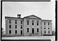
In 1813-14, William Cary, having migrated from New Hampshire to Cincinnati in 1802, [3] purchased 491 acres (1.99 km2) north of Cincinnati along what is now Hamilton Avenue (U.S. Route 127). Cary built a log cabin and moved his family to this “wilderness,” then known as Mill Creek Township. [4] In 1833, Cary's son Freeman G. Cary established Pleasant Hill Academy for boys on part of his land. The academy became an agricultural school called Farmer's College (for which the area was renamed) in 1846. That school became Belmont College in 1885, and then formed the core of the Ohio Military Institute in 1890. A separate school, the Ohio Female College, was founded in 1852 by Reverend John Covert and operated until 1873 [5] [6] when it was sold to build the Cincinnati Sanitarium, the first private US psychiatric facility not on the East Coast. [7]

The development of the area was expedited by the introduction of a railroad line in 1851 and horsecar service in the 1860s. College Hill was incorporated as a village in 1866, then annexed to the city of Cincinnati in stages in 1911, 1915 and 1923. [6]

The town was the birthplace of Samuel Fenton Cary and still features several historic buildings, including Laurel Court, College Hill Town Hall and the Old College Hill Post Office.

Demographics

Population of College Hill 1950-2020
YearPop.±%
1950 10,492    
1960 15,198+44.9%
196519,632+29.2%
1970 21,590+10.0%
1980 17,327−19.7%
1990 15,785−8.9%
2000 15,269−3.3%
2010 14,133−7.4%
2020 16,039+13.5%

Notable people

Related Research Articles

<span class="mw-page-title-main">Warren County, Ohio</span> County in Ohio, United States

Warren County is a county located in the southwestern part of the U.S. state of Ohio. As of the 2020 census, the population was 242,337. Its county seat is Lebanon. The county is one of Ohio’s most affluent, with the county median income the highest of Ohio’s 88 counties. The county was established on May 1, 1803 from Hamilton County; it is named for Dr. Joseph Warren, a hero of the Revolution who sent Paul Revere and the overlooked William Dawes on their famous rides and who died at the Battle of Bunker Hill. Warren County is part of the Cincinnati, OH-KY-IN Metropolitan Statistical Area.

<span class="mw-page-title-main">Hamilton County, Ohio</span> County in Ohio, United States

Hamilton County is located in the southwestern corner of the U.S. state of Ohio. As of the 2020 census, the population was 830,639, making it the third-most populous county in Ohio. The county seat and largest city is Cincinnati. The county is named for the first Secretary of the Treasury, Alexander Hamilton. Hamilton County is part of the Cincinnati-Middletown, OH-KY-IN Metropolitan Statistical Area.

<span class="mw-page-title-main">Mount Healthy, Ohio</span> City in Ohio, United States

Mount Healthy is a city in Hamilton County, Ohio, United States, in the Cincinnati/Northern Kentucky metropolitan area. The population was 6,996 at the 2020 census.

<span class="mw-page-title-main">North College Hill, Ohio</span> City in Ohio, United States

North College Hill is a city in Hamilton County in the southwestern part of the U.S. state of Ohio approximately ten miles north of downtown Cincinnati. As of the 2020 census, the city population was 9,663. The city takes its name from its proximity to the Cincinnati neighborhood of College Hill which borders it to the south.

<span class="mw-page-title-main">Evanston, Cincinnati</span> Neighborhood of Cincinnati in Ohio, United States

Evanston is a neighborhood in the city of Cincinnati, Hamilton County, Ohio, United States.

<span class="mw-page-title-main">Clifton, Cincinnati</span> Neighborhood of Cincinnati in Ohio, United States

Clifton is a neighborhood in the north central part of Cincinnati, Ohio, United States. The population was 8,408 in the 2020 census.

<span class="mw-page-title-main">Athenaeum of Ohio</span>

The Athenaeum of Ohio – Mount St. Mary's Seminary of the West, originally St. Francis Xavier Seminary, is a Catholic seminary in Cincinnati, Ohio. It is the third-oldest Catholic seminary in the United States and was established by Edward D. Fenwick, the first Bishop of Cincinnati, in 1829 along with The Athenaeum, which opened in 1831 in downtown Cincinnati.

<span class="mw-page-title-main">Spring Grove Village, Cincinnati</span> Neighborhood of Cincinnati in Hamilton, Ohio, United States

Spring Grove Village is a neighborhood in Cincinnati, Ohio formerly known as Winton Place. It is located just off Interstate 75 in the Mill Creek Valley. The population was 1,916 at the 2020 census.

<span class="mw-page-title-main">Columbia-Tusculum, Cincinnati</span> Neighborhood of Cincinnati

Columbia-Tusculum is the oldest neighborhood in Cincinnati, Ohio, and is located on the East Side of the city. The population was 1,523 at the 2020 census.

Cincinnati Public Schools is the U.S. state of Ohio's third-largest public school district, by enrollment, after Columbus City Schools and Cleveland Metropolitan School District. Cincinnati Public Schools is the largest Ohio school district rated as 'effective'. Founded in 1829 as the Common Schools of Cincinnati, it is governed by the Cincinnati Board of Education.

<span class="mw-page-title-main">Hyde Park, Cincinnati</span> Neighborhood of Cincinnati in Ohio, United States

Hyde Park is a neighborhood on the east side of Cincinnati, Ohio. The population was 14,193 at the 2020 census.

<span class="mw-page-title-main">East Walnut Hills, Cincinnati</span> Place in Ohio, United States

East Walnut Hills is a neighborhood on the Southeast side of Cincinnati, Ohio. The population was 4,103 at the 2020 census.

<span class="mw-page-title-main">Westwood, Cincinnati</span> Neighborhood of Cincinnati in Hamilton, Ohio, United States

Westwood is an urban-suburban neighborhood of Cincinnati, Ohio. It is located north of Price Hill, west of Fairmount, and southwest of Mount Airy.

<span class="mw-page-title-main">Carthage, Cincinnati</span> Neighborhood of Cincinnati in Hamilton, Ohio, United States

Carthage is a residential neighborhood located in the Mill Creek valley in Cincinnati, Ohio. It shares a border with Elmwood Place, Ohio, which, with adjacent St. Bernard, Ohio, forms a city island in the middle of Cincinnati. The population was 2,781 at the 2020 census.

<span class="mw-page-title-main">West End, Cincinnati</span> Neighborhood of Cincinnati in Ohio, United States

West End is a neighborhood in Cincinnati, Ohio, United States, located northwest of downtown, east of Queensgate, west of Over-the-Rhine, and southeast of Fairview. The population was 6,824 at the 2020 Census.

<span class="mw-page-title-main">Walnut Hills, Cincinnati</span> Neighborhood of Cincinnati in Ohio, United States

Walnut Hills is a neighborhood in Cincinnati, Ohio, United States. One of the city’s oldest hilltop neighborhoods, it is a large diverse area on the near east side of Cincinnati. Eden Park is the gateway to Walnut Hills when driving north from downtown, and the University of Cincinnati is less than 10 minutes away. The neighborhood is redeveloping, restoring many of its buildings and introducing new businesses to the area. The population was 6,344 in the 2020 Census.

<span class="mw-page-title-main">Ohio Military Institute</span> United States historic place

The Ohio Military Institute was a higher education institution located in Cincinnati, Ohio. Founded in 1890, it closed in 1958.

<span class="mw-page-title-main">Freeman Cary</span>

Freeman Grant Cary, was an educator in Pleasant Hill, Ohio. Cary attended Miami University and graduated with honors in the class of 1831. His brothers were William Woodward Cary and Samuel Fenton Cary. He started Cary Academy and was involved in the founding of Farmers' College. He was involved in the founding of the Ohio Female College.

<span class="mw-page-title-main">Hartwell, Cincinnati</span> Neighborhood of Cincinnati in Hamilton, Ohio, United States

Hartwell is the northernmost neighborhood in Cincinnati, Ohio, centered roughly on the intersections of I-75 and Ronald Reagan Cross County Highway. Its boundaries are a combination of Caldwell Park and Ronald Reagan Cross County Highway to the south, I-75 to the east, and a combination of Millsdale Street and Compton Road to the North. The population was 5,806 at the 2020 census.

The Ohio Female College was founded in 1852 in College Hill, Cincinnati by Reverend John Covert and operated until 1873.

References

  1. Grace, Kevin; Tom White (2002). Cincinnati Revealed: A Photographic History of the Queen City. Arcadia Publishing. p. 56. ISBN   0-7385-1955-3.
  2. "College Hill 2020 Statistical Neighborhood Approximation" (PDF). City of Cincinnati. Retrieved 21 February 2023.
  3. "My Genealogy Pages". homepages.rootsweb.ancestry.com. Retrieved 2008-06-28.
  4. “History of Cincinnati and Hamilton County, Ohio,” http://www.heritagepursuit.com/Hamilton/HamiltonChapXXXIII.htm. Accessed 3/16/2008.
  5. The Ohio Channel : Your State : Remarkable Ohio : Marker Details [ permanent dead link ]
  6. 1 2 Cincinnati: A Guide to the Queen City and Its Neighbors, The Wisen-Hart Press, 1943, p. 402.
  7. Ohio Female College, Ohio History Central, July 1, 2005.
  8. "Obituary for John e. Bruce". The Cincinnati Enquirer. 18 August 1924. p. 2.

Coordinates: 39°12′N84°33′W / 39.200°N 84.550°W / 39.200; -84.550