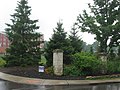
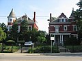
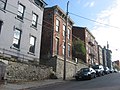
[ 3] Name on the Register [ 4] Image Date listed [ 5] Location Description 1 The Alameda Flats The Alameda Flats June 4, 2014 (# 14000293 3580-3586 Reading Rd. 39°08′50″N 84°29′20″W / 39.147222°N 84.488889°W / 39.147222; -84.488889 (The Alameda Flats ) 2 The Alexandra The Alexandra October 17, 1997 (# 97001223 921 E. William H. Taft Rd. 39°07′37″N 84°29′21″W / 39.126944°N 84.489167°W / 39.126944; -84.489167 (The Alexandra ) 3 Alms and Doepke Dry Goods Company Alms and Doepke Dry Goods Company March 3, 1980 (# 80003035 222 E. Central Parkway 39°06′29″N 84°30′37″W / 39.108056°N 84.510278°W / 39.108056; -84.510278 (Alms and Doepke Dry Goods Company ) 4 The Ambassador The Ambassador June 30, 2014 (# 14000356 722-724 Gholson Ave. 39°08′57″N 84°29′21″W / 39.149167°N 84.489167°W / 39.149167; -84.489167 (The Ambassador ) 5 John S. Baker House John S. Baker House June 6, 1979 (# 79001852 1887 Madison Rd. 39°07′45″N 84°28′04″W / 39.129167°N 84.467778°W / 39.129167; -84.467778 (John S. Baker House ) 6 Baldwin Piano Company Building Baldwin Piano Company Building February 23, 2016 (# 16000043 655 Eden Park Dr. 39°07′00″N 84°29′53″W / 39.116667°N 84.498056°W / 39.116667; -84.498056 (Baldwin Piano Company Building ) 7 Bates Building Bates Building August 24, 1979 (# 79002700 3819 Eastern Ave. 39°06′40″N 84°26′08″W / 39.111111°N 84.435556°W / 39.111111; -84.435556 (Bates Building ) 8 Bauer Apartments Bauer Apartments December 2, 1982 (# 82001465 2015-2017 Madison Rd. 39°07′55″N 84°27′44″W / 39.131944°N 84.462222°W / 39.131944; -84.462222 (Bauer Apartments ) 9 August Bepler House August Bepler House April 13, 1977 (# 77001062 805 Tusculum Ave. 39°06′59″N 84°25′31″W / 39.116389°N 84.425278°W / 39.116389; -84.425278 (August Bepler House ) 10 Bernheim House Bernheim House March 29, 1983 (# 83001977 195 Greenhills Rd. 39°07′55″N 84°26′35″W / 39.131944°N 84.443056°W / 39.131944; -84.443056 (Bernheim House ) 11 Bon Air Flats Bon Air Flats September 1, 2015 (# 15000562 615 Maple Ave. 39°08′31″N 84°29′37″W / 39.1419°N 84.4937°W / 39.1419; -84.4937 (Bon Air Flats ) 12 Ayres L. Bramble House Ayres L. Bramble House April 1, 1982 (# 82003576 4416 Homer Ave. 39°09′06″N 84°23′18″W / 39.151667°N 84.388333°W / 39.151667; -84.388333 (Ayres L. Bramble House ) 13 A. E. Burckhardt House A. E. Burckhardt House March 3, 1980 (# 80003038 400 Forest Ave. 39°08′47″N 84°29′58″W / 39.146389°N 84.499444°W / 39.146389; -84.499444 (A. E. Burckhardt House ) Demolished in October 2022. 14 Samuel Burdsal House Samuel Burdsal House June 10, 1982 (# 82003577 1342 Broadway St. 39°06′40″N 84°30′30″W / 39.111111°N 84.508333°W / 39.111111; -84.508333 (Samuel Burdsal House ) 15 C. H. Burroughs House C. H. Burroughs House March 3, 1980 (# 80003039 1010 Chapel St. 39°07′52″N 84°29′15″W / 39.131111°N 84.4875°W / 39.131111; -84.4875 (C. H. Burroughs House ) 16 Cincinnati Hebrew Day School Upload image May 28, 2025 (# 100011930 7855 Dawn Road 39°12′24″N 84°27′40″W / 39.2067°N 84.4610°W / 39.2067; -84.4610 (Cincinnati Hebrew Day School ) 17 Cincinnati Observatory Building Cincinnati Observatory Building March 3, 1980 (# 80003043 Observatory Pl. 39°08′21″N 84°25′21″W / 39.139111°N 84.422556°W / 39.139111; -84.422556 (Cincinnati Observatory Building ) 18 Cincinnati Tennis Club Cincinnati Tennis Club March 29, 1983 (# 83001979 Dexter and Wold Aves. 39°08′03″N 84°28′10″W / 39.134167°N 84.469444°W / 39.134167; -84.469444 (Cincinnati Tennis Club ) 19 Cincinnati Zoo Historic Structures Cincinnati Zoo Historic Structures February 27, 1987 (# 87000905 3400 Vine St. 39°08′39″N 84°30′31″W / 39.144167°N 84.508611°W / 39.144167; -84.508611 (Cincinnati Zoo Historic Structures ) 20 Clauder's Pharmacy Clauder's Pharmacy August 24, 1979 (# 79002696 4026 Eastern Ave. 39°06′31″N 84°25′56″W / 39.108611°N 84.432222°W / 39.108611; -84.432222 (Clauder's Pharmacy ) Demolished 21 Coca-Cola Bottling Corporation Coca-Cola Bottling Corporation July 2, 1987 (# 87000985 1507 Dana Ave. 39°08′46″N 84°28′42″W / 39.146111°N 84.478222°W / 39.146111; -84.478222 (Coca-Cola Bottling Corporation ) 22 Columbia Baptist Cemetery Columbia Baptist Cemetery August 24, 1979 (# 79002709 Northern side of Wilmer Rd. 39°06′22″N 84°25′45″W / 39.106111°N 84.429167°W / 39.106111; -84.429167 (Columbia Baptist Cemetery ) 23 Jacob D. Cox House Jacob D. Cox House April 14, 1975 (# 75001416 241-243 Gilman Ave. 39°07′19″N 84°30′19″W / 39.121944°N 84.505278°W / 39.121944; -84.505278 (Jacob D. Cox House ) 24 The Crescent The Crescent June 20, 2014 (# 14000336 3719 Reading Road 39°09′04″N 84°29′14″W / 39.151111°N 84.487222°W / 39.151111; -84.487222 (The Crescent ) 25 Cummins School Cummins School January 9, 1986 (# 86000014 824 William H. Taft Rd. 39°07′40″N 84°29′27″W / 39.127778°N 84.490833°W / 39.127778; -84.490833 (Cummins School ) 26 Stephen Decker Rowhouse Stephen Decker Rowhouse August 24, 1979 (# 79002693 531-541 Tusculum Ave. 39°06′56″N 84°26′00″W / 39.115556°N 84.433333°W / 39.115556; -84.433333 (Stephen Decker Rowhouse ) 27 A. M. Detmer House A. M. Detmer House March 3, 1980 (# 80003046 1520 Chapel St. 39°07′51″N 84°28′48″W / 39.130833°N 84.48°W / 39.130833; -84.48 (A. M. Detmer House ) 28 East Walnut Hills Firehouse East Walnut Hills Firehouse February 17, 1983 (# 83001980 Madison Rd. and Hackberry St. 39°07′48″N 84°28′28″W / 39.13°N 84.474444°W / 39.13; -84.474444 (East Walnut Hills Firehouse ) 29 Eastern Hills Young Men's Christian Association (YMCA) Eastern Hills Young Men's Christian Association (YMCA) December 13, 2016 (# 16000847 1228 E. McMillan St. 39°07′32″N 84°29′00″W / 39.125690°N 84.483326°W / 39.125690; -84.483326 (Eastern Hills Young Men's Christian Association (YMCA) ) 30 Eastwood Historic District Eastwood Historic District February 25, 2005 (# 05000093 Roughly along Eastwood, Collinwood, Overbrook, Madison and Duck Creek Rds. 39°09′48″N 84°24′39″W / 39.163333°N 84.410833°W / 39.163333; -84.410833 (Eastwood Historic District ) 31 Eckert Building Eckert Building September 29, 1983 (# 83001981 2600 Woodburn Ave. 39°07′38″N 84°28′42″W / 39.127222°N 84.478333°W / 39.127222; -84.478333 (Eckert Building ) 32 Eden Park Stand Pipe Eden Park Stand Pipe March 3, 1980 (# 80003048 Eden Park Dr. 39°07′02″N 84°29′25″W / 39.117222°N 84.490278°W / 39.117222; -84.490278 (Eden Park Stand Pipe ) 33 Eden Park Station No. 7 Eden Park Station No. 7 March 3, 1980 (# 80003049 1430 Martin Dr. 39°06′47″N 84°29′28″W / 39.113056°N 84.491111°W / 39.113056; -84.491111 (Eden Park Station No. 7 ) 34 Edgecliff Edgecliff March 3, 1980 (# 80003050 2220 Victory Parkway 39°07′18″N 84°29′02″W / 39.121667°N 84.483889°W / 39.121667; -84.483889 (Edgecliff ) Demolished 35 Edgecliff Area Historic Group Edgecliff Area Historic Group November 11, 1977 (# 77001063 2220 Victory Parkway 39°07′16″N 84°29′02″W / 39.121111°N 84.483889°W / 39.121111; -84.483889 (Edgecliff Area Historic Group ) 36 Elsinore Arch Elsinore Arch March 3, 1980 (# 80003052 1700 Gilbert Ave. 39°06′47″N 84°29′59″W / 39.113°N 84.499722°W / 39.113; -84.499722 (Elsinore Arch ) 37 Evanston Historic District Upload image June 23, 2022 (# 100007811 Montgomery Rd. between Brewster and Rutland Aves. 39°08′41″N 84°28′10″W / 39.1447°N 84.4694°W / 39.1447; -84.4694 (Evanston Historic District ) 38 Walter Field House Walter Field House March 3, 1980 (# 80003053 3725 Reading Rd. 39°09′05″N 84°29′11″W / 39.151389°N 84.486389°W / 39.151389; -84.486389 (Walter Field House ) Shingle Style residence built for businessman; now apartments 39 First Congregational-Unitarian Church First Congregational-Unitarian Church May 28, 1976 (# 76001434 2901 Reading Rd. 39°07′55″N 84°29′53″W / 39.131944°N 84.498056°W / 39.131944; -84.498056 (First Congregational-Unitarian Church ) 40 First Universalist Church First Universalist Church March 3, 1980 (# 80003055 2600 Essex Pl. 39°07′40″N 84°29′55″W / 39.127778°N 84.498611°W / 39.127778; -84.498611 (First Universalist Church ) 41 Ford Motor Company Cincinnati Plant Ford Motor Company Cincinnati Plant May 25, 1989 (# 89000460 660 Lincoln Ave. 39°07′58″N 84°29′36″W / 39.132778°N 84.493333°W / 39.132778; -84.493333 (Ford Motor Company Cincinnati Plant ) 42 Madam Fredin's Eden Park School and Neighboring Row House Madam Fredin's Eden Park School and Neighboring Row House November 29, 1979 (# 79001858 938-946 Morris St. and 922-932 Morris St. 39°07′07″N 84°29′40″W / 39.118611°N 84.494444°W / 39.118611; -84.494444 (Madam Fredin's Eden Park School and Neighboring Row House ) 43 Fulton-Presbyterian Cemetery Fulton-Presbyterian Cemetery August 24, 1979 (# 79002706 Carrel St. 39°06′24″N 84°25′59″W / 39.106667°N 84.433056°W / 39.106667; -84.433056 (Fulton-Presbyterian Cemetery ) 44 General Hospital Nurses' Home General Hospital Nurses' Home June 10, 2005 (# 05000581 311 Albert Sabin Way 39°08′20″N 84°30′09″W / 39.138889°N 84.5025°W / 39.138889; -84.5025 (General Hospital Nurses' Home ) 45 Stephen A. Gerrard Mansion Stephen A. Gerrard Mansion November 5, 1987 (# 87001940 748 Betula Ave. 39°09′39″N 84°29′09″W / 39.160833°N 84.485833°W / 39.160833; -84.485833 (Stephen A. Gerrard Mansion ) 46 Gilbert Row Gilbert Row May 13, 1982 (# 82003579 2152-2166 Gilbert Ave. 39°07′12″N 84°29′39″W / 39.12°N 84.494167°W / 39.12; -84.494167 (Gilbert Row ) 47 Gilbert-Sinton Historic District Gilbert-Sinton Historic District October 6, 1983 (# 83004306 Roughly bounded by Morris, Gilbert and Sinton Aves. 39°07′09″N 84°29′37″W / 39.119167°N 84.493611°W / 39.119167; -84.493611 (Gilbert-Sinton Historic District ) 48 Glencoe-Auburn Hotel and Glencoe-Auburn Place Row Houses Glencoe-Auburn Hotel and Glencoe-Auburn Place Row Houses December 10, 2003 (# 03001286 Glencoe Place, Leroy Court, View Court 39°07′22″N 84°30′37″W / 39.122778°N 84.510278°W / 39.122778; -84.510278 (Glencoe-Auburn Hotel and Glencoe-Auburn Place Row Houses ) 49 Grace Church Grace Church September 16, 1982 (# 82003581 3626 Reading Rd. 39°08′53″N 84°29′14″W / 39.148056°N 84.487222°W / 39.148056; -84.487222 (Grace Church ) Now known as St. Michael and All Angels Episcopal Church 50 Gruen Watch Company-Time Hill Gruen Watch Company-Time Hill February 29, 1996 (# 96000219 401 E. McMillan St. 39°07′33″N 84°30′06″W / 39.125833°N 84.501667°W / 39.125833; -84.501667 (Gruen Watch Company-Time Hill ) 51 Haddon Hall Haddon Hall July 22, 1982 (# 82003582 3418 Reading Rd. 39°08′30″N 84°29′32″W / 39.141667°N 84.492222°W / 39.141667; -84.492222 (Haddon Hall ) 52 Edward Hart House Upload image March 13, 2023 (# 100008694 818 Glenwood Ave. 39°08′52″N 84°29′18″W / 39.1479°N 84.4882°W / 39.1479; -84.4882 (Edward Hart House ) 53 George Hoadley Jr. House George Hoadley Jr. House March 9, 1990 (# 90000380 2337 Grandin Rd. 39°07′41″N 84°27′10″W / 39.128056°N 84.452778°W / 39.128056; -84.452778 (George Hoadley Jr. House ) 54 Holy Cross Monastery and Chapel Holy Cross Monastery and Chapel September 13, 1978 (# 78002078 1055 St. Paul Pl. 39°06′27″N 84°29′57″W / 39.1075°N 84.499167°W / 39.1075; -84.499167 (Holy Cross Monastery and Chapel ) 55 Hoodin Building Hoodin Building August 24, 1979 (# 79002708 3719-3725 Eastern Ave. 39°06′41″N 84°26′09″W / 39.111389°N 84.435833°W / 39.111389; -84.435833 (Hoodin Building ) 56 Houston House Houston House August 24, 1979 (# 79002704 3708 Mead Ave. 39°06′46″N 84°26′18″W / 39.112778°N 84.438333°W / 39.112778; -84.438333 (Houston House ) 57 Hyde Park Methodist Episcopal Church Hyde Park Methodist Episcopal Church January 7, 2009 (# 08001294 1345 Grace Ave. 39°08′12″N 84°25′56″W / 39.13657°N 84.43232°W / 39.13657; -84.43232 (Hyde Park Methodist Episcopal Church ) 58 Ida Street Viaduct Ida Street Viaduct November 28, 1980 (# 80003060 Ida St. between Monastery and Paradrome Sts. 39°06′32″N 84°29′57″W / 39.108889°N 84.499222°W / 39.108889; -84.499222 (Ida Street Viaduct ) 59 Immaculate Conception Church, School, and Rectory Immaculate Conception Church, School, and Rectory December 29, 1978 (# 78002079 Pavilion and Guido Sts. 39°06′26″N 84°29′46″W / 39.107222°N 84.496111°W / 39.107222; -84.496111 (Immaculate Conception Church, School, and Rectory ) 60 Kellogg House Kellogg House August 24, 1979 (# 79002702 3807 Eastern Ave. 39°06′41″N 84°26′09″W / 39.111389°N 84.435833°W / 39.111389; -84.435833 (Kellogg House ) 61 Kerper and Melbourne Terrace Apartments Upload image July 19, 2024 (# 100010530 3066–3092 Kerper Avenue and 3066–3084 Melbourne Terrace 39°08′14″N 84°29′12″W / 39.1372°N 84.4866°W / 39.1372; -84.4866 (Kerper and Melbourne Terrace Apartments ) 62 King Records Studio Buildings Upload image September 6, 2022 (# 100008067 1536-1540 Brewster Ave. 39°08′39″N 84°28′35″W / 39.1443°N 84.4763°W / 39.1443; -84.4763 (King Records Studio Buildings ) 63 Kestler Building Kestler Building August 24, 1979 (# 79002695 4024 Eastern Ave. 39°06′31″N 84°25′56″W / 39.108611°N 84.432222°W / 39.108611; -84.432222 (Kestler Building ) 64 The Kinsey The Kinsey December 18, 2013 (# 13000937 2415 Maplewood Ave. 39°07′31″N 84°30′18″W / 39.125139°N 84.505000°W / 39.125139; -84.505000 (The Kinsey ) 65 Theodore Krumberg Building Theodore Krumberg Building December 17, 1982 (# 82001467 1201 Main St. 39°06′32″N 84°30′42″W / 39.108889°N 84.511667°W / 39.108889; -84.511667 (Theodore Krumberg Building ) 66 La Tosca Flats La Tosca Flats February 5, 1999 (# 99000096 2700 Observatory Ave. 39°08′17″N 84°26′33″W / 39.138056°N 84.4425°W / 39.138056; -84.4425 (La Tosca Flats ) 67 La Ventura Apartments Upload image March 18, 2024 (# 100010054 700 Chalfonte Place 39°09′01″N 84°29′24″W / 39.1502°N 84.4900°W / 39.1502; -84.4900 (La Ventura Apartments ) 68 Landt Building Landt Building August 24, 1979 (# 79002703 3815-3817 Eastern Ave. 39°06′41″N 84°26′08″W / 39.111389°N 84.435556°W / 39.111389; -84.435556 (Landt Building ) 69 Langdon House Langdon House April 16, 1969 (# 69000143 3626 Eastern Ave. 39°06′49″N 84°26′14″W / 39.113611°N 84.437222°W / 39.113611; -84.437222 (Langdon House ) 70 Harry Milton Levy House Harry Milton Levy House January 30, 1998 (# 98000040 2383 Observatory Ave. 39°08′17″N 84°27′17″W / 39.138056°N 84.454722°W / 39.138056; -84.454722 (Harry Milton Levy House ) 71 Lillybanks Lillybanks July 7, 1983 (# 83001982 2386 Grandin Rd. 39°07′40″N 84°26′59″W / 39.127778°N 84.449722°W / 39.127778; -84.449722 (Lillybanks ) 72 LuNeack House LuNeack House August 24, 1979 (# 79002705 3718 Mead Ave. 39°06′45″N 84°26′18″W / 39.1125°N 84.438333°W / 39.1125; -84.438333 (LuNeack House ) 73 Frederick Lunkenheimer House Frederick Lunkenheimer House August 8, 1985 (# 85001690 2133 Luray 39°07′07″N 84°29′18″W / 39.118611°N 84.488333°W / 39.118611; -84.488333 (Frederick Lunkenheimer House ) 74 Madison and Woodburn Historic District Madison and Woodburn Historic District June 30, 1983 (# 83001983 Woodburn Ave. and Madison Rd. 39°07′45″N 84°28′36″W / 39.129167°N 84.476667°W / 39.129167; -84.476667 (Madison and Woodburn Historic District ) 75 Madison-Stewart Historic District Madison-Stewart Historic District May 29, 1975 (# 75001419 Junction of Madison and Stewart Sts. 39°09′36″N 84°23′53″W / 39.16°N 84.398056°W / 39.16; -84.398056 (Madison-Stewart Historic District ) 76 Manse Hotel and Manse Hotel Annex Manse Hotel and Manse Hotel Annex August 8, 2019 (# 100004232 916-926 and 1004 Chapel St. 39°07′53″N 84°29′12″W / 39.131389°N 84.486667°W / 39.131389; -84.486667 (Manse Hotel and Manse Hotel Annex ) 77 Mardot Antique Shop Mardot Antique Shop August 24, 1979 (# 79002698 3964 Eastern Ave. 39°06′32″N 84°25′57″W / 39.108889°N 84.4325°W / 39.108889; -84.4325 (Mardot Antique Shop ) 78 Martin House Martin House March 21, 1979 (# 79001859 6500 Beechmont Ave. 39°05′13″N 84°22′42″W / 39.086944°N 84.378333°W / 39.086944; -84.378333 (Martin House ) 79 David and Mary May House David and Mary May House August 22, 1996 (# 96000931 3723 Washington Ave. 39°09′07″N 84°29′40″W / 39.151944°N 84.494444°W / 39.151944; -84.494444 (David and Mary May House ) 80 S.C. Mayer House S.C. Mayer House March 3, 1980 (# 80003063 1614 Main St. 39°06′47″N 84°30′44″W / 39.113056°N 84.512222°W / 39.113056; -84.512222 (S.C. Mayer House ) 81 McKinley School McKinley School August 24, 1979 (# 79002697 3905 Eastern Ave. 39°06′35″N 84°26′03″W / 39.109722°N 84.434167°W / 39.109722; -84.434167 (McKinley School ) 82 Mecklenburg's Garden Mecklenburg's Garden November 7, 1976 (# 76001436 302 E. University Ave. 39°07′57″N 84°30′10″W / 39.1325°N 84.502778°W / 39.1325; -84.502778 (Mecklenburg's Garden ) 83 Mill & Dunn Historic District Mill & Dunn Historic District August 29, 2019 (# 100004315 100-139 Williams St., 119 Lock St., 200-328 Dunn St., 100-200 Mill St., and 209-327 Wyoming Ave. 39°13′26″N 84°27′10″W / 39.2239°N 84.4529°W / 39.2239; -84.4529 (Mill & Dunn Historic District ) 84 Mills' Row Mills' Row April 29, 1977 (# 77001065 2201-2209 Park Ave. 39°07′13″N 84°29′14″W / 39.120278°N 84.487222°W / 39.120278; -84.487222 (Mills' Row ) 85 Richard H. Mitchell House Richard H. Mitchell House March 3, 1980 (# 80003065 3 Burton Woods Lane 39°09′24″N 84°29′14″W / 39.156667°N 84.487222°W / 39.156667; -84.487222 (Richard H. Mitchell House ) 86 Bernard H. Moormann House Bernard H. Moormann House March 20, 1973 (# 73001462 1514 E. McMillan St. 39°07′31″N 84°28′38″W / 39.125278°N 84.477222°W / 39.125278; -84.477222 (Bernard H. Moormann House ) 87 Mount Adams Public School Mount Adams Public School November 24, 1980 (# 80003066 1125 St. Gregory St. 39°06′31″N 84°29′53″W / 39.108611°N 84.498056°W / 39.108611; -84.498056 (Mount Adams Public School ) 88 Mount Auburn Historic District Mount Auburn Historic District March 28, 1973 (# 73001464 Both sides of Auburn Ave. from Ringgold St. to Howard Taft Rd. 39°07′12″N 84°30′30″W / 39.12°N 84.508333°W / 39.12; -84.508333 (Mount Auburn Historic District ) 89 Norwell Residence Norwell Residence August 24, 1979 (# 79002707 506 Tusculum Ave. 39°06′53″N 84°26′00″W / 39.114722°N 84.433333°W / 39.114722; -84.433333 (Norwell Residence ) 90 Observatory Historic District Observatory Historic District September 20, 1978 (# 78002080 Observatory Pl. and Ave. 39°08′18″N 84°25′22″W / 39.138333°N 84.422778°W / 39.138333; -84.422778 (Observatory Historic District ) 91 Old St. Mary's Church, School and Rectory Old St. Mary's Church, School and Rectory March 13, 1976 (# 76001439 123 E. 13th St. 39°06′34″N 84°30′43″W / 39.109444°N 84.511944°W / 39.109444; -84.511944 (Old St. Mary's Church, School and Rectory ) 92 Over-the-Rhine Historic District Over-the-Rhine Historic District May 17, 1983 (# 83001985 Roughly bounded by Dorsey, Sycamore, Liberty, Reading, Central Parkway, McMicken Ave., and Vine Sts.; also 308-322, 500-550 Reading Rd., 222 W. 12th St., and 1208, 1416-1430, 1544, 1600, 1628, and 1900 Central Parkway 39°06′52″N 84°30′54″W / 39.114444°N 84.515°W / 39.114444; -84.515 (Over-the-Rhine Historic District ) Extends into western Cincinnati . Second set of addresses represents a boundary increase of June 13, 2014 . 93 Park Flats Park Flats September 8, 1983 (# 83001986 2378-2384 Park Ave. 39°07′32″N 84°29′10″W / 39.125556°N 84.486111°W / 39.125556; -84.486111 (Park Flats ) 94 Peeble's Corner Historic District Peeble's Corner Historic District November 14, 1985 (# 85002835 Roughly E. McMillan St. and Gilbert Ave. 39°07′33″N 84°29′24″W / 39.125972°N 84.49°W / 39.125972; -84.49 (Peeble's Corner Historic District ) 95 George Hunt Pendleton House George Hunt Pendleton House October 15, 1966 (# 66000611 559 E. Liberty St. 39°06′43″N 84°30′16″W / 39.111944°N 84.504444°W / 39.111944; -84.504444 (George Hunt Pendleton House ) 96 Peters-Kupferschmid House Peters-Kupferschmid House October 18, 1984 (# 84000134 2167 Grandin Rd. 39°07′50″N 84°27′31″W / 39.130556°N 84.458611°W / 39.130556; -84.458611 (Peters-Kupferschmid House ) Demolished 97 Pfleger Family Houses Pfleger Family Houses March 11, 1980 (# 80003072 216 and 218 Erkenbrecker Ave. 39°08′32″N 84°30′20″W / 39.142222°N 84.505556°W / 39.142222; -84.505556 (Pfleger Family Houses ) 98 Pilgrim Presbyterian Church Pilgrim Presbyterian Church July 18, 1980 (# 80003074 1222 Ida St. 39°06′36″N 84°29′56″W / 39.11°N 84.498889°W / 39.11; -84.498889 (Pilgrim Presbyterian Church ) 99 Ben Pitman House Ben Pitman House July 7, 1969 (# 69000144 1852 Columbia Parkway 39°07′15″N 84°28′53″W / 39.120833°N 84.481389°W / 39.120833; -84.481389 (Ben Pitman House ) 100 Poinciana Flats Poinciana Flats June 5, 2014 (# 14000294 3522 Reading Rd. 39°08′43″N 84°29′24″W / 39.145278°N 84.490000°W / 39.145278; -84.490000 (Poinciana Flats ) 101 Police Station No. 6 Police Station No. 6 May 18, 1981 (# 81000436 Delta Ave. and Columbia Parkway 39°07′02″N 84°26′23″W / 39.117222°N 84.439722°W / 39.117222; -84.439722 (Police Station No. 6 ) 102 Henry Powell House Henry Powell House March 3, 1980 (# 80003076 2209 Auburn Ave. 39°07′20″N 84°30′31″W / 39.122222°N 84.508611°W / 39.122222; -84.508611 (Henry Powell House ) 103 Procter and Collier-Beau Brummell Building Procter and Collier-Beau Brummell Building October 18, 1984 (# 84002714 440 E. McMillan St. 39°07′37″N 84°30′00″W / 39.126944°N 84.500000°W / 39.126944; -84.500000 (Procter and Collier-Beau Brummell Building ) 104 Prospect Hill Historic District Prospect Hill Historic District September 4, 1980 (# 80003078 Roughly bounded by Liberty Hill, Highland, Pueblo, Channing, and Sycamore Sts. 39°06′48″N 84°30′23″W / 39.113333°N 84.506389°W / 39.113333; -84.506389 (Prospect Hill Historic District ) 105 Ransley Apartment Building Ransley Apartment Building March 3, 1980 (# 80003079 2390 Kemper Lane 39°07′32″N 84°29′16″W / 39.125556°N 84.487778°W / 39.125556; -84.487778 (Ransley Apartment Building ) 106 Bernard Ratterman House Bernard Ratterman House September 30, 1982 (# 82003584 1349 Broadway 39°06′43″N 84°30′32″W / 39.111944°N 84.508889°W / 39.111944; -84.508889 (Bernard Ratterman House ) 107 Riverview House Apartments Riverview House Apartments June 20, 2023 (# 100009044 2538 Hackberry St. 39°07′34″N 84°28′31″W / 39.1260°N 84.4753°W / 39.1260; -84.4753 (Riverview House Apartments ) 108 L.B. Robb Drugstore L.B. Robb Drugstore August 24, 1979 (# 79002694 4030 Eastern Ave. 39°06′30″N 84°25′55″W / 39.108333°N 84.431944°W / 39.108333; -84.431944 (L.B. Robb Drugstore ) Demolished 109 Rookwood Pottery Rookwood Pottery December 5, 1972 (# 72001023 Celestial and Rookwood Pl. 39°06′25″N 84°30′02″W / 39.107°N 84.500667°W / 39.107; -84.500667 (Rookwood Pottery ) 110 St. Aloysius Orphanage St. Aloysius Orphanage September 27, 2012 (# 12000835 4721 Reading Rd. 39°10′17″N 84°28′09″W / 39.171389°N 84.469167°W / 39.171389; -84.469167 (St. Aloysius Orphanage ) 111 St. Francis De Sales Church Historic District St. Francis De Sales Church Historic District March 1, 1974 (# 74001512 Woodburn Ave. and Madison Rd. 39°07′48″N 84°28′36″W / 39.13°N 84.476667°W / 39.13; -84.476667 (St. Francis De Sales Church Historic District ) 112 St. Mark's Church and Rectory Upload image January 19, 2023 (# 100008544 3500 Montgomery Rd. 39°08′33″N 84°28′15″W / 39.1425°N 84.4709°W / 39.1425; -84.4709 (St. Mark's Church and Rectory ) 113 St. Paul Church Historic District St. Paul Church Historic District January 18, 1974 (# 74001513 Spring, 12th, and Pendleton Sts. 39°06′34″N 84°30′25″W / 39.1095°N 84.507°W / 39.1095; -84.507 (St. Paul Church Historic District ) 114 St. Rosa Church St. Rosa Church April 1, 1982 (# 82003587 2501 Eastern Ave. 39°07′25″N 84°27′42″W / 39.123611°N 84.461666°W / 39.123611; -84.461666 (St. Rosa Church ) 115 Robert F. Schulkers House Upload image December 6, 2024 (# 100011129 3168 Victoria Avenue 39°08′32″N 84°25′33″W / 39.1421°N 84.4257°W / 39.1421; -84.4257 (Robert F. Schulkers House ) 116 The Somerset Apartments The Somerset Apartments June 30, 2014 (# 14000355 802-814 Blair Ave. 39°08′29″N 84°29′33″W / 39.141250°N 84.492500°W / 39.141250; -84.492500 (The Somerset Apartments ) 117 The South Crescent Arms Upload image August 26, 2021 (# 100006851 3700 Reading Rd. 39°09′03″N 84°29′11″W / 39.1507°N 84.4865°W / 39.1507; -84.4865 (The South Crescent Arms ) 118 Spencer Town Hall Spencer Town Hall August 24, 1979 (# 79002701 3833 Eastern Ave. 39°06′39″N 84°26′06″W / 39.110833°N 84.435°W / 39.110833; -84.435 (Spencer Town Hall ) 119 Stites House Stites House August 24, 1979 (# 79002699 315 Stites Ave. 39°06′41″N 84°26′05″W / 39.111389°N 84.434722°W / 39.111389; -84.434722 (Stites House ) 120 Capt. Stone House Capt. Stone House March 3, 1980 (# 80003041 405 Oak St. 39°07′51″N 84°30′05″W / 39.130833°N 84.501389°W / 39.130833; -84.501389 (Capt. Stone House ) 121 Harriet Beecher Stowe House Harriet Beecher Stowe House November 10, 1970 (# 70000497 2950 Gilbert Ave. 39°07′59″N 84°29′16″W / 39.133056°N 84.487778°W / 39.133056; -84.487778 (Harriet Beecher Stowe House ) 122 Sycamore-13th Street Grouping Sycamore-13th Street Grouping June 1, 1982 (# 82003588 12th, 13th, and Sycamore Sts. 39°06′35″N 84°30′35″W / 39.109722°N 84.509722°W / 39.109722; -84.509722 (Sycamore-13th Street Grouping ) 123 William Howard Taft National Historic Site William Howard Taft National Historic Site October 15, 1966 (# 66000612 2038 Auburn Ave. 39°07′11″N 84°30′31″W / 39.119722°N 84.508611°W / 39.119722; -84.508611 (William Howard Taft National Historic Site ) 124 Twentieth Century Theatre Twentieth Century Theatre August 26, 1993 (# 93000879 3023-3025 Madison Rd. 39°09′03″N 84°25′59″W / 39.150833°N 84.433056°W / 39.150833; -84.433056 (Twentieth Century Theatre ) 125 United Colored American Cemetery Upload image August 22, 2022 (# 100008017 4732-4734 Duck Creek Rd. (at corner of 4805 Duck Creek Rd.) 39°09′55″N 84°24′51″W / 39.1652°N 84.4141°W / 39.1652; -84.4141 (United Colored American Cemetery ) 126 Verona Apartments Verona Apartments July 2, 2008 (# 08000625 2356 Park Ave. 39°07′28″N 84°29′11″W / 39.124372°N 84.486333°W / 39.124372; -84.486333 (Verona Apartments ) 127 Charlton Wallace House Charlton Wallace House January 30, 1976 (# 76001441 2563 Hackberry St. 39°07′37″N 84°28′36″W / 39.126944°N 84.476667°W / 39.126944; -84.476667 (Charlton Wallace House ) 128 Walnut Hills United Presbyterian Church Walnut Hills United Presbyterian Church March 3, 1980 (# 80003089 2601 Gilbert Ave. 39°07′40″N 84°29′23″W / 39.127778°N 84.489722°W / 39.127778; -84.489722 (Walnut Hills United Presbyterian Church ) 129 John Henry Weston House John Henry Weston House March 20, 2002 (# 02000218 1321 Michigan Ave. 39°08′10″N 84°26′33″W / 39.136111°N 84.4425°W / 39.136111; -84.4425 (John Henry Weston House ) 130 Wilson-Gibson House Wilson-Gibson House March 17, 1976 (# 76001444 425 Oak St. 39°07′49″N 84°30′01″W / 39.130278°N 84.500278°W / 39.130278; -84.500278 (Wilson-Gibson House ) 131 Windsor Public School Windsor Public School March 10, 2015 (# 15000095 937 Windsor St. 39°07′20″N 84°29′24″W / 39.122222°N 84.490000°W / 39.122222; -84.490000 (Windsor Public School ) 132 Isaac M. Wise Temple-Center Isaac M. Wise Temple-Center March 15, 2019 (# 100003527 3771 Reading Rd. 39°09′08″N 84°29′07″W / 39.152222°N 84.485278°W / 39.152222; -84.485278 (Isaac M. Wise Temple-Center ) 133 Withrow High School Withrow High School January 19, 1983 (# 83001987 2488 Madison Rd. 39°08′29″N 84°27′07″W / 39.141389°N 84.451944°W / 39.141389; -84.451944 (Withrow High School ) 134 Mary A. Wolfe House Mary A. Wolfe House March 3, 1980 (# 80003092 965 Burton Ave. 39°08′59″N 84°29′01″W / 39.149722°N 84.483611°W / 39.149722; -84.483611 (Mary A. Wolfe House ) Demolished in 2019. 135 Gorham A. Worth House Gorham A. Worth House April 11, 1973 (# 73001472 2316 Auburncrest Ave. 39°07′25″N 84°30′23″W / 39.123611°N 84.506389°W / 39.123611; -84.506389 (Gorham A. Worth House )