Oakley, Cincinnati

Last updated
Oakley
Oakley Square, Cincinnati.jpg
Oakley Square
Flag of Oakley, Cincinnati, Ohio.svg
Oakley-Cincinnati-map.jpg
Location within Cincinnati
Coordinates: 39°09′04″N84°26′00″W / 39.151183°N 84.433245°W / 39.151183; -84.433245
Country United States
State Ohio
County Hamilton
City Cincinnati
Elevation
600 ft (182.8 m)
Population
 (2020)
  Total11,761
Time zone UTC-5 (EST)
  Summer (DST) UTC-4 (EDT)
ZIP code
45209

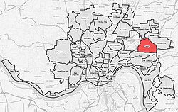
Oakley is one of the 52 neighborhoods of Cincinnati, Ohio. Located in the eastern part of the city, it borders Pleasant Ridge, Madisonville, and Hyde Park. Oakley is a primary thoroughfare and a major crosstown artery in Cincinnati, and contains multiple shopping centers. The population was 11,761 at the 2020 census. [1]

Contents

History

St. Cecila Catholic Church in 2019 St. Cecila Catholic Church Oakley 2019a.jpg
St. Cecila Catholic Church in 2019
Oakley Branch of the Public Library of Cincinnati and Hamilton County Oakley Library Cincinnati 2019.jpg
Oakley Branch of the Public Library of Cincinnati and Hamilton County
Typical residential street in the Oakley neighborhood Residential street in Oakley, Cincinnati.jpg
Typical residential street in the Oakley neighborhood

The village of Oakley was first established in 1852 when John William and Mary (Vogel) Schrimper opened Schrimpers Tavern, "The Four Mile House". The place was four miles from Cincinnati via "the big road" Madisonville Turnpike. The area was not named Oakley yet and was referred to as Four Mile. Once the Marietta and Cincinnati railroad was built alongside The Four Mile House in 1866, the train stop at the train depot was referred to as Schusterville, which was named after Colonel Paul Schuster, who owned 35 acres of land in that specific area. About the time Schuster's platting of the town, a farm owner named John Wilson laid off more of it on his farm adjoining it. On May 30th 1869, the Schuster and Wilson plats were recorded with Hamilton County as one under the name "Oakley on East Walnut Hills ". The town was named for the Reverend Maurice Oakley, early president of Xavier College, for whom both Wilson and Schuster had much admiration. The village was incorporated in 1898.

During the 1880s and 1890s the community began to grow and the Oakley Park Race Track, famous for thoroughbred racing, was opened in 1888. The race track closed in 1907 due to a state law prohibiting betting and a lack of attendance. The Cincinnati Milling Machine Company, often referred to as “the mill,” moved to Oakley in 1905 and library service began in 1910, when a deposit station opened in Barton's Drug Store at 3200 Madison Rd at the corner of Brazee Street.

Oakley was annexed to the city of Cincinnati in 1913. [2] In the same year, Aglamesis Bro's Ice Cream Parlor and Candy Shoppe opened to accommodate the growing population of workers at the Mill, as the Cincinnati Milling Machine Company was called.

The Geier Esplanade, commonly known as Oakley Square, was created when two parcels of land were acquired in 1927 and 1932 and were converted into green space. It is situated in the center of Oakley Square.

The Twentieth Century Theatre was built in 1941 and is a distinctive Oakley landmark with its 72-foot tower rising over the business district. The deteriorating theater was slated for demolition in the early 1990s, but was spared due to its historical significance and was renovated into a concert and special events venue.

Demographics

Population of Oakley 1900-2020
YearPop.±%
1900 1,791    
1910 4,438+147.8%
1920 10,150+128.7%
1930 13,211+30.2%
1940 13,794+4.4%
1950 15,504+12.4%
1960 15,052−2.9%
1970 14,781−1.8%
1980 12,801−13.4%
1990 12,351−3.5%
2000 11,244−9.0%
2010 10,308−8.3%
2020 11,761+14.1%
[ citation needed ]

As of the census of 2020, there were 11,761 people living in the neighborhood. There were 7,456 housing units. The racial makeup of the neighborhood was 82.0% White, 7.4% Black or African American, 0.2% Native American, 3.8% Asian, 0.0% Pacific Islander, 1.2% from some other race, and 5.5% from two or more races. 3.6% of the population were Hispanic or Latino of any race. [1]

There were 6,561 households, out of which 33.2% were families. 52.3% of all households were made up of individuals. [1]

11.2% of the neighborhood's population were under the age of 18, 76.0% were 18 to 64, and 12.8% were 65 years of age or older. 47.8% of the population were male and 52.2% were female. [1]

According to the U.S. Census American Community Survey, for the period 2016-2020 the estimated median annual income for a household in the neighborhood was $76,568. About 1.5% of family households were living below the poverty line. About 70.5% of adults had a bachelor's degree or higher. [1]

Economy

Oakley's business district, Oakley Square, lies along Madison Road. In addition to Oakley Square, Oakley contains two shopping centers. Hyde Park Plaza on the southern edge of the neighborhood is named for the neighborhood to the south, Hyde Park. The Center of Cincinnati on the north edge is part of continuing development on the south side of the I-71/Norwood Lateral/Ridge Road interchange. Both of these centers are urban infill and car oriented, located on the edge of Oakley and designed to serve multiple neighborhoods. Oakley Square, by contrast, is located in the center of Oakley along several bus routes, making it more pedestrian and transit oriented.

Culture

The neighborhood hosts Oakley After Hours, a monthly street festival, each month May through October.[ citation needed ]

Related Research Articles

<span class="mw-page-title-main">Hamilton County, Ohio</span> County in Ohio, United States

Hamilton County is located in the southwestern corner of the U.S. state of Ohio. As of the 2020 census, the population was 830,639, making it the third-most populous county in Ohio. The county seat and largest city is Cincinnati. The county is named for the first Secretary of the Treasury, Alexander Hamilton. Hamilton County is part of the Cincinnati-Middletown, OH-KY-IN Metropolitan Statistical Area.

<span class="mw-page-title-main">Guttenberg, Iowa</span> City in Iowa, United States

Guttenberg is a city in Clayton County, Iowa, United States, along the Mississippi River. The population was 1,817 at the time of the 2020 census, down from 1,987 at the 2000 census.

<span class="mw-page-title-main">Coralville, Iowa</span> City in Iowa, United States

Coralville is a city in Johnson County, Iowa, United States. It is a suburb of Iowa City and part of the Iowa City Metropolitan Statistical Area. The population was 22,318 at the 2020 census.

<span class="mw-page-title-main">Madisonville, Kentucky</span> City in Kentucky, United States

Madisonville is a home rule-class city in and the county seat of Hopkins County, Kentucky, United States, located along Interstate 69 in the state's Western Coal Fields region. The population was 19,591 at the 2010 census. Madisonville is a commercial center of the region and is home to Madisonville Community College.

<span class="mw-page-title-main">Independence, Kentucky</span> City in Kentucky, United States

Independence is a home rule-class city in Kenton County, Kentucky, United States. It is one of its county's two seats of government. The population was 28,676 at the time of the 2020 census. It is the third largest city in Northern Kentucky after Covington and Florence, and is part of the Cincinnati metropolitan area.

<span class="mw-page-title-main">Madison, Mississippi</span> City in Mississippi, United States

Madison is the 11th most populous city in Mississippi, located in Madison County, 13 miles north of the state capital, Jackson. The population was 27,747 at the 2020 census. It is part of the Jackson Metropolitan Statistical Area.

<span class="mw-page-title-main">Middlefield, New York</span> Town in New York, United States

Middlefield is a town in Otsego County, New York, United States. The population was 2,114 at the 2010 census.

<span class="mw-page-title-main">Fairfax, Ohio</span> Village in Ohio, United States

Fairfax is a village in Hamilton County, Ohio, United States. It is a suburb of Cincinnati. The population was 1,768 at the 2020 census.

<span class="mw-page-title-main">Mason, Ohio</span> City in Ohio, United States

Mason is a city in southwestern Warren County, Ohio, United States, approximately 22 miles (35 km) north of downtown Cincinnati. As of the 2020 census, Mason's population was 34,792. It is home to Kings Island amusement park and one of the largest tennis stadiums in the world, the Lindner Family Tennis Center, home of the Cincinnati Open, one of the world's top tennis tournaments for both men and women.

<span class="mw-page-title-main">Madisonville, Tennessee</span> City in Tennessee, United States

Madisonville is the county seat of Monroe County, Tennessee, United States. It is located in East Tennessee on the eastern border of the state. As of the 2020 census, the city's population was 5,132.

<span class="mw-page-title-main">Madisonville, Texas</span> City in Texas, United States

Madisonville is a city in Madison County, Texas, United States. The population was 4,420 at the 2020 census. It is the county seat of Madison County. Both the City of Madisonville and the County of Madison were named for U.S. President James Madison, the fourth chief executive.

<span class="mw-page-title-main">Colerain Township, Hamilton County, Ohio</span> Township in Ohio, United States

Colerain Township is one of the twelve townships of Hamilton County, Ohio, United States. The population of the township was 59,037 at the 2020 census. It is the second-largest township in Ohio by area, surpassed by Madison Township, Lake County, Ohio.

<span class="mw-page-title-main">Columbia Township, Hamilton County, Ohio</span> Township in Ohio, United States

Columbia Township is one of the twelve townships of Hamilton County, Ohio, United States. The 2020 census found 4,446 people in the township. Originally one of Ohio's largest townships by area at its inception in 1791, it gradually shrank to one of the smallest by the early 1950s.

<span class="mw-page-title-main">Pleasant Ridge, Cincinnati</span> Neighborhood of Cincinnati in Hamilton, Ohio, United States

Pleasant Ridge is one of the 52 neighborhoods of Cincinnati, Ohio. Annexed in 1911, the neighborhood is predominately residential. The population was 8,895 at the 2020 census.

<span class="mw-page-title-main">Hyde Park, Cincinnati</span> Neighborhood of Cincinnati in Ohio, United States

Hyde Park is one of the 52 neighborhoods of Cincinnati, Ohio. Originally established as a retreat for the city's wealthy, the neighborhood is predominately residential, with a central business district known as Hyde Park Square. The population was 14,193 at the 2020 census.

<span class="mw-page-title-main">East Walnut Hills, Cincinnati</span> Place in Ohio, United States

East Walnut Hills is one of the 52 neighborhoods of Cincinnati, Ohio. Established in 1867 and annexed in 1873, it is located in the eastern side of the city. The population was 4,103 at the 2020 census.

<span class="mw-page-title-main">Price Hill, Cincinnati</span> Neighborhoods of Cincinnati in Hamilton, Ohio, United States

Price Hill is a region of Cincinnati, Ohio consisting of three neighborhoods: East Price Hill, West Price Hill, and Lower Price Hill. The region is located in the western part of the city, neighbored by Sedamsville and Riverside to the south, Westwood and South Fairmount to the north, and Queensgate to the west. Originally one of the oldest suburbs of Cincinnati, the region is predominately Catholic, having been an ethnic enclave for both Irish and German Catholics. Price Hill's neighborhoods are residential communities, having a combined population of 36,271 at the 2020 census.

<span class="mw-page-title-main">Madisonville, Cincinnati</span> Neighborhood of Cincinnati in Ohio, United States

Madisonville is one of the 52 neighborhoods of Cincinnati, Ohio. Established in 1809 and annexed in 1911, it is located in the northeastern part of the city. The population was 17,898 at the 2020 census.

<span class="mw-page-title-main">Downtown Cincinnati</span> Neighborhood in Cincinnati, Ohio, United States

Downtown Cincinnati is the central business district of Cincinnati, Ohio, United States, as well the economic and symbiotic center of the Cincinnati metropolitan area. Originally the densely populated core of the city, the neighborhood was transformed into a commercial zone in the mid-20th century. The population was 5,835 at the 2020 census.

Madison Place is a census-designated place (CDP) in Hamilton County, Ohio, United States, adjacent to the city of Cincinnati. It was first listed as a CDP prior to the 2020 census. The population was 572 at the 2020 census.

References

  1. 1 2 3 4 5 "Oakley 2020 Statistical Neighborhood Approximation" (PDF). City of Cincinnati. Retrieved 29 December 2023.
  2. Federal Writers' Project (1943). Cincinnati, a Guide to the Queen City and Its Neighbors. p. 318. ISBN   9781623760519 . Retrieved 2013-05-04.