There are 278 properties and districts listed on the National Register in Cincinnati, including 12 National Historic Landmarks. Downtown Cincinnati includes 62 of these properties and districts, including 5 National Historic Landmarks; the city's remaining properties and districts are listed elsewhere.
This is a list of the National Register of Historic Places listings in Hamilton County, Ohio.
This is a list of the National Register of Historic Places listings in Butler County, Ohio.
This is a list of the National Register of Historic Places listings in Mahoning County, Ohio.
This is intended to be a complete list of the properties and districts on the National Register of Historic Places in Warren County, Ohio, United States. The locations of National Register properties and districts for which the latitude and longitude coordinates are included below, may be seen in an online map.
This is a list of the National Register of Historic Places listings in Washington County, Ohio.
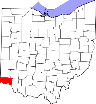
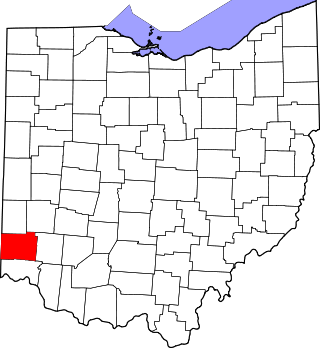
This is a list of the National Register of Historic Places listings in Allen County, Ohio.
This is a list of the National Register of Historic Places listings in Brown County, Ohio.
This is a list of the National Register of Historic Places listings in Mercer County, Ohio.
This is a list of the National Register of Historic Places listings in Akron, Ohio.
This is a list of the National Register of Historic Places listings in Cincinnati, Ohio.
This is a list of the National Register of Historic Places listings in Ohio County, West Virginia.
This is a list of the National Register of Historic Places listings in Jackson County, Ohio.
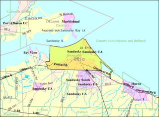
This is a list of the National Register of Historic Places listings in Sandusky, Ohio.
This is a list of the National Register of Historic Places listings in Noble County, Ohio.
This is a list of the National Register of Historic Places listings in Meigs County, Ohio.
This is a list of the National Register of Historic Places listings in Harrison County, Ohio.
This is a list of the National Register of Historic Places listings in Williams County, Ohio.
This is a list of the National Register of Historic Places listings in western Cincinnati, Ohio.
This is a list of the National Register of Historic Places listings in eastern Cincinnati, Ohio.
This is a list of the National Register of Historic Places in downtown Houston, Texas. It is intended to be a complete list of properties and districts listed on the National Register of Historic Places in the Downtown Houston neighborhood, defined as the area enclosed by Interstate 10, Interstate 45, and Interstate 69.
References
↑ The latitude and longitude information provided in this table was derived originally from the National Register Information System, which has been found to be fairly accurate for about 99% of listings. Some locations in this table may have been corrected to current GPS standards.
1 2 Numbers represent an alphabetical ordering by significant words. Various colorings, defined here, differentiate National Historic Landmarks and historic districts from other NRHP buildings, structures, sites or objects.
↑ The eight-digit number below each date is the number assigned to each location in the National Register Information System database, which can be viewed by clicking the number.
This page is based on this Wikipedia article Text is available under the CC BY-SA 4.0 license; additional terms may apply. Images, videos and audio are available under their respective licenses.