Camp Washington, Cincinnati | |
|---|---|
 The Crosley Building, original location of WLW studios | |
 Flag | |
 | |
| Country | United States |
| State | Ohio |
| City | Cincinnati |
| Population (2020) | |
• Total | 1,234 |
| Time zone | UTC-5 (EST) |
| • Summer (DST) | UTC-4 (EDT) |
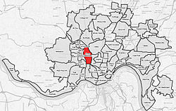
Camp Washington is one of the 52 neighborhoods of Cincinnati, Ohio. Located next to the Mill Creek, it is north of Queensgate, east of Fairmount, and west of Clifton and University Heights. The community is a crossing of 19th-century homes and industrial space [1] The population was 1,234 at the 2020 census. [2]
