Mill Creek Township, Hamilton County, Ohio

Last updated
An 1856 map of Hamilton County depicting Millcreek Township at its original size in blue. Map of Hamilton County, Ohio - exhibiting the various divisions and sub divisions of land with the name of the owners & number of acres in each tract together with the roads, canals, streams, towns LOC 2012591124.jpg
An 1856 map of Hamilton County depicting Millcreek Township at its original size in blue.

Millcreek Township (or Mill Creek Township) is a survey township in south-central Hamilton County, Ohio, that also existed as a civil township from 1810 until 1943. Once the most important township in the county, [1] it was largely absorbed by Cincinnati and its suburbs, nominally remaining as a paper township from 1943 until 1953. It was abolished when the rest of its unincorporated territory, consisting of Wesleyan Cemetery, became part of Cincinnati. As the original survey township covers a large portion of present-day Cincinnati, references to it are frequently encountered by genealogists. [2]

Contents

Name

Millcreek Township is named after Mill Creek, which runs through it. [3] Statewide, other Millcreek Townships are located in Coshocton, Union, and Williams counties.

History

In 1809, residents of Cincinnati Township and Springfield Township successfully petitioned the Hamilton County Board of County Commissioners to form a new township corresponding to fractional range two, township three of the Symmes Purchase, a total of 36 square miles (93 km2). Township trustees were first elected in February 1810. [3] [4]

On February 28, 1870, Cincinnati annexed Lick Run and Camp Washington. [5] By 1881, Cincinnati had annexed the village of Cumminsville (now Northside) within the township limits. [3] By 1904, Cincinnati had also annexed the villages of Winton Place (now Spring Grove Village) and Bond Hill. However, there was confusion because no action had been taken to also transfer them from Millcreek Township to Cincinnati Township, which was by then a paper township whose sole purpose was to exclude land from any real township. [6] By 1912, annexations by Cincinnati left Elmwood Place and Wesleyan Cemetery as the only unincorporated portions of the township, prompting an investigation into whether the township should be abolished. [7]

Norwood withdrew from the township around 1938 by forming its own paper township. [8] In 1939 and 1941, Cincinnati attempted to annex the 25-acre (10 ha), unincorporated enclave occupied by the historic Wesleyan Cemetery. However, burial lot owners and relatives of people buried at the cemetery successfully defeated the annexation over fears that the city would run a street through the cemetery. [1] [9] In 1943, St. Bernard and Elmwood Place (now a village) withdrew from the township as well, reducing it to only the cemetery and $517.35 in assets. [1] [4] [10]

Attorney General Thomas J. Herbert issued an opinion that the cemetery enclave should be considered part of Cincinnati and the township should be abolished. However, the matter was not settled: state law required the freeholders within a territory to vote on annexation, but no freeholder remained in the township to vote in favor. The township's one resident of voting age, the cemetery's sexton, did not own the cemetery; conversely, the Wesleyan Cemetery Association's board members did not reside at the cemetery. Meanwhile, the sexton could not simultaneously serve in all three trustee positions that state law requires of a functioning township government. The county also sought to avoid setting up a special polling place for the sexton, which would have required the appointment of six election officers. [10] [11]

In 1950, Cincinnati sued the Wesleyan Cemetery Association in Hamilton County Common Pleas Court to determine whether the city has jurisdiction over the cemetery. [4] Despite being in the middle of an urban area, the cemetery had no provisions for police or fire protection. In 1953, a bill introduced by State Representative Robert F. Reckman [8] to consider remnants of townships with no resident freeholders to be part of municipalities as if they had been annexed was approved by the Governor. [12] On October 20, 1953, the Clerk of Council of the City of Cincinnati issued a certificate and plat stating that that part of Wesleyan Cemetery that was a remnant of Mill Creek Township was then part of the City of Cincinnati. [13] Despite this action by the City, news articles refer to the cemetery as constituting nonfunctioning Millcreek Township as late as 1961. [14]

During the 1990s and 2000s, the cemetery passed from one caretaker to another amid controversy about mismanagement. The cemetery grew unkempt and attracted prostitutes and drug dealers. Attorney General Jim Petro stepped in, obtaining a ruling in Common Pleas Court that removed the caretaker and declared Wesleyan a public cemetery. Cincinnati unsuccessfully fought in court to avoid taking over management of the cemetery. [15]

Geography

The original territory of Millcreek Township was bounded by Cincinnati Township and Storrs Township to the south, Green Township to the west, Springfield Township to the north, and Columbia Township and Spencer Township to the east. [2] [16]

The following villages were at some point located in Millcreek Township: [3] [17]

Related Research Articles

<span class="mw-page-title-main">Fairfax, Ohio</span> Village in Ohio, United States

Fairfax is a village in Hamilton County, Ohio, United States. It is a suburb of Cincinnati. The population was 1,768 at the 2020 census.

<span class="mw-page-title-main">Reading, Ohio</span> City in Ohio, United States

Reading is a city in Hamilton County, Ohio, United States. The population was 10,600 at the 2020 census. It is an inner suburb of Cincinnati and is included as part of the Cincinnati metropolitan area.

<span class="mw-page-title-main">Loveland, Ohio</span> City in Hamilton, Clermont, and Warren counties in Ohio, United States

Loveland is a city in Hamilton, Clermont, and Warren counties in the southwestern part of the U.S. state of Ohio. The population was 13,307 at the 2020 census. Considered part of the Cincinnati metropolitan area, Loveland is located near exit 52 off Interstate 275, about 15 miles (24 km) northeast of the Cincinnati city limits. It borders Symmes, Miami and Hamilton townships and straddles the Little Miami River. Once a busy railroad town, Loveland is now a major stop along the Little Miami Scenic Trail.

<span class="mw-page-title-main">Columbia Township, Hamilton County, Ohio</span> Township in Ohio, United States

Columbia Township is one of the twelve townships of Hamilton County, Ohio, United States. The 2020 census found 4,446 people in the township. Originally one of Ohio's largest townships by area at its inception in 1791, it gradually shrank to one of the smallest by the early 1950s.

<span class="mw-page-title-main">Springfield Township, Hamilton County, Ohio</span> Township in Ohio, United States

Springfield Township is one of the twelve townships of Hamilton County, Ohio, United States. The population was 35,862 as of the 2020 census. Springfield Township is home to the largest private school in Ohio, the largest lake in Hamilton County, and the Cincinnati area's annual Greek Festival.
<span class="mw-page-title-main">Bond Hill, Cincinnati</span> Neighborhood of Cincinnati in Hamilton, Ohio, United States

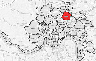
Bond Hill is one of the 52 neighborhoods of Cincinnati, Ohio. Founded as a railroad suburb and temperance community in 1870 in northeastern Millcreek Township, it is one of a number of neighborhoods lining the Mill Creek. The population was 7,002 at the 2020 census.

<span class="mw-page-title-main">Hamilton Township, Warren County, Ohio</span> Township in Ohio, United States

Hamilton Township is one of the eleven townships of Warren County, Ohio, United States. It is located in the south central portion of the county. The population was 30,587 at the 2020 census.

Covedale is a former village in Hamilton County, Ohio, United States. The main area of the village was annexed by the city of Cincinnati and is now a neighborhood of about 15,000 people in the western part of the city.

The term paper township refers to a civil township under Ohio law that nominally exists for certain purposes but does not act as a functioning unit of civil government. Such townships usually exist on paper as a legal fiction due to municipal annexation.

Ronald Reagan Cross County Highway, formerly and locally known as Cross County Highway, is a west-east freeway in Hamilton County, Ohio, United States. It stretches 16.4 miles (26.4 km) from southern Colerain Township to Montgomery, connecting many of Cincinnati's northern suburbs to Interstate 71 and Interstate 75. State Route 126 is routed over most of the highway, while the remainder is a county-maintained road.

<span class="mw-page-title-main">Columbia-Tusculum, Cincinnati</span> Neighborhood in Cincinnati

Columbia-Tusculum is one of the 52 neighborhoods of Cincinnati, Ohio. Founded in 1788 and annexed in 1871, it is the city's oldest neighborhood. The population was 1,523 at the 2020 census.

<span class="mw-page-title-main">Loveland High School (Ohio)</span> Coeducational high school in Loveland, , Ohio, United States

Loveland High School is a public high school located in Loveland, Ohio, United States, within Hamilton County. It is the only high school in the Loveland City School District, serving the communities of Loveland, Symmes Township, Goshen Township, and Miami Township. It offers a range of educational programs, including college preparatory and vocational.

<span class="mw-page-title-main">Wesleyan Cemetery, Cincinnati</span>

Wesleyan Cemetery is a prominent cemetery in Cincinnati, Ohio. It is the oldest continuously operating cemetery in Hamilton County, Ohio.

<span class="mw-page-title-main">Carthage, Cincinnati</span> Neighborhood of Cincinnati in Hamilton, Ohio, United States

Carthage is one of the 52 neighborhoods of Cincinnati, Ohio. Established in 1791 or 1792 and annexed in 1911, it is located in the northern part of the city's Mill Creek valley. The neighborhood is predominately residential, and is center of the city's Hispanic community. It shares a border with Elmwood Place, Ohio, which, with adjacent St. Bernard, Ohio, forms an enclave in the middle of Cincinnati. The population was 2,781 at the 2020 census.

<span class="mw-page-title-main">Interstate 75 in Ohio</span> Interstate Highway in Ohio, United States

Interstate 75 (I-75) runs from Cincinnati to Toledo by way of Dayton in the US state of Ohio. The highway enters the state running concurrently with I-71 from Kentucky on the Brent Spence Bridge over the Ohio River and into the Bluegrass region. I-75 continues along the Mill Creek Expressway northward to the Butler County line just north of I-275. From there, the freeway runs into the Miami Valley and then passes through the Great Black Swamp before crossing into Michigan.

<span class="mw-page-title-main">Storrs Township, Hamilton County, Ohio</span>

Storrs Township was a civil township in south-central Hamilton County, Ohio. It was established in 1835 and annexed to Cincinnati in 1870 but remained in nominal form until at least 1890 due to an oversight.

Mason City Schools is a city school district that primarily serves Mason and Deerfield Township in Warren County, Ohio, United States. As of 2018, the district has 10,627 students. Its high school, William Mason High School, is the largest in Ohio by enrollment.
<span class="mw-page-title-main">Spencer Township, Hamilton County, Ohio</span> Former township in Hamilton County, Ohio, United States

Spencer Township was a civil township in southeastern Hamilton County, Ohio. It was established in the early 1840s and annexed to Cincinnati in stages from 1855 to 1909.

Cincinnati Township is a paper township and former civil township in south-central Hamilton County, Ohio. Originally one of Ohio's largest townships by area at its inception in 1791, it was abolished in 1834 when the City of Cincinnati became coextensive with it through annexation. Since then, it has remained solely as a paper township.

References

  1. 1 2 3 "Township To Be Cemetery Only, Under Plan Of Withdrawal Of Two Cities—Millcreek Unit May Have To Vanish". The Cincinnati Enquirer. June 10, 1942. p. 10 via Newspapers.com.
  2. 1 2 "Map of Hamilton County, Ohio : exhibiting the various divisions and sub divisions of land with the name of the owners & number of acres in each tract together with the roads, canals, streams, towns &c. throughout the county".
  3. 1 2 3 4 Ford & Ford 1881, pp. 333–339.
  4. 1 2 3 "Who's Who In Cemetery? City Would Like To Know". The Cincinnati Enquirer. March 4, 1950. p. 12 via Newspapers.com.
  5. Maxwell, Sidney D. (1870). The suburbs of Cincinnati: sketches, historical and descriptive. Cincinnati: G.E. Stevens & Co. Preface via Wikimedia Commons.
  6. "Perplexed: Are County Officials By the Question of Township Locations of Annexed Villages". The Cincinnati Enquirer . April 7, 1904. p. 12 via Newspapers.com.
  7. "Ownership of $6,000 Depends on Whether Millcreek Township Has Gone Out of Existence". The Cincinnati Enquirer. February 15, 1912. p. 14 via Newspapers.com.
  8. 1 2 "Legal Action Sought On Millcreek Annexation". The Cincinnati Enquirer. January 16, 1953. p. 3 via Newspapers.com.
  9. "Reject City's Plans To Annex Two Areas". The Cincinnati Enquirer. October 26, 1939. p. 11 via Newspapers.com.
  10. 1 2 "Cemetery Is A Problem For Annexation Experts; Legal Advice Is Sought". The Cincinnati Enquirer. January 4, 1944. p. 5 via Newspapers.com.
  11. "Board To Tackle Riddle Of One-Voter Township". The Cincinnati Enquirer. July 31, 1942. p. 16 via Newspapers.com.
  12. "To enact supplemental section 503.131 of the Revised Code relative to defunct townships within the boundaries of a municipal corporation." 1953 Ohio Laws 344, File No. 169, Amended House Bill No. 46, passed July 9, 1953, approved July 15, 1953, effective October 14, 1953.
  13. Cincinnati, Ohio. Certificate and plat dated October 20, 1953. Recorded on January 28, 1954, with the Hamilton County, Ohio Recorder, in Plan Book 63, Pages 3 (plan) and 4 (certificate)
  14. Hale, Harry L. (March 26, 1961). "Clifton Heights Is Larger In Fancy Than In Fact". The Cincinnati Enquirer. p. 4D via Newspapers.com.
  15. Coolidge, Sharon (February 11, 2007). "The cemetery nobody wants". The Cincinnati Enquirer. pp. B1, B5 via Newspapers.com.
  16. LLC., Historic Map Works. "Outline Map, Atlas: Cincinnati and Hamilton County 1869, Ohio Historical Map". www.historicmapworks.com.
  17. Nelson & Runk 1894, p. 418–427.

Further reading