St. Bernard, Ohio | |
---|---|
Coordinates: 39°10′16″N84°30′02″W / 39.17111°N 84.50056°W | |
Country | United States |
State | Ohio |
County | Hamilton |
Area | |
• Total | 1.54 sq mi (4.00 km2) |
• Land | 1.53 sq mi (3.97 km2) |
• Water | 0.01 sq mi (0.02 km2) |
Elevation | 541 ft (165 m) |
Population (2020) | |
• Total | 4,070 |
• Density | 2,651.47/sq mi (1,023.97/km2) |
Time zone | UTC-5 (Eastern (EST)) |
• Summer (DST) | UTC-4 (EDT) |
FIPS code | 39-69470 [3] |
GNIS feature ID | 1086226 [2] |
Website | www |
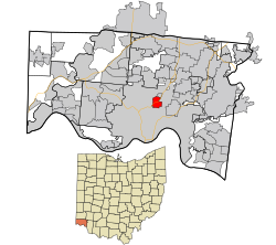
St. Bernard or Saint Bernard [2] is a village in Hamilton County, Ohio, United States. [4] It is an enclave and suburb of Cincinnati. The population was 4,070 at the 2020 census.
St. Bernard was laid out in 1851 at the intersection of Main Street (now Vine Street, Cincinnati), the Miami and Erie Canal, and the Cincinnati, Hamilton and Dayton Railway. [5] The town was originally built up chiefly by Germans. [6]
St. Bernard was incorporated as a village in 1878. [7]
St. Bernard along with Norwood and Elmwood Place, is an enclave surrounded by the city of Cincinnati.
According to the United States Census Bureau, the village has a total area of 1.56 square miles (4.04 km2), of which 1.55 square miles (4.01 km2) is land and 0.01 square miles (0.03 km2) is water. [8]
Census | Pop. | Note | %± |
---|---|---|---|
1880 | 1,022 | — | |
1890 | 1,770 | 73.2% | |
1900 | 3,384 | 91.2% | |
1910 | 5,002 | 47.8% | |
1920 | 6,312 | 26.2% | |
1930 | 7,487 | 18.6% | |
1940 | 7,387 | −1.3% | |
1950 | 7,066 | −4.3% | |
1960 | 6,778 | −4.1% | |
1970 | 6,131 | −9.5% | |
1980 | 5,396 | −12.0% | |
1990 | 5,344 | −1.0% | |
2000 | 4,924 | −7.9% | |
2010 | 4,368 | −11.3% | |
2020 | 4,070 | −6.8% | |
Sources: [3] [9] [10] [11] [12] [13] |
As of the census of 2020, there were 4,070 people living in the village, for a population density of 2,651.47 people per square mile (1,023.97/km2). There were 2,093 housing units. The racial makeup of the village was 70.6% White, 20.2% Black or African American, 0.3% Native American, 0.9% Asian, 0.1% Pacific Islander, 1.2% from some other race, and 6.6% from two or more races. 2.2% of the population were Hispanic or Latino of any race. [14]
There were 1,747 households, out of which 20.1% had children under the age of 18 living with them, 47.9% were married couples living together, 19.8% had a male householder with no spouse present, and 30.1% had a female householder with no spouse present. 35.3% of all households were made up of individuals, and 11.7% were someone living alone who was 65 years of age or older. The average household size was 2.31, and the average family size was 3.05. [14]
15.8% of the village's population were under the age of 18, 68.7% were 18 to 64, and 15.5% were 65 years of age or older. The median age was 46.7. For every 100 females, there were 94.0 males. [14]
According to the U.S. Census American Community Survey, for the period 2016-2020 the estimated median annual income for a household in the village was $68,373, and the median income for a family was $95,761. About 5.8% of the population were living below the poverty line, including 0.0% of those under age 18 and 8.4% of those age 65 or over. About 70.2% of the population were employed, and 25.9% had a bachelor's degree or higher. [14]
As of the census [15] of 2010, there were 4,368 people, 1,869 households, and 1,090 families living in the village. The population density was 2,818.1 inhabitants per square mile (1,088.1/km2). There were 2,128 housing units at an average density of 1,372.9 per square mile (530.1/km2). The racial makeup of the village was 80.0% White, 15.7% African American, 0.3% Native American, 0.7% Asian, 0.1% Pacific Islander, 0.9% from other races, and 2.3% from two or more races. Hispanic or Latino of any race were 1.9% of the population.
There were 1,869 households, of which 29.9% had children under the age of 18 living with them, 37.2% were married couples living together, 15.4% had a female householder with no husband present, 5.7% had a male householder with no wife present, and 41.7% were non-families. 36.2% of all households were made up of individuals, and 12.8% had someone living alone who was 65 years of age or older. The average household size was 2.33 and the average family size was 3.08.
The median age in the village was 38.2 years. 23.6% of residents were under the age of 18; 10% were between the ages of 18 and 24; 25.1% were from 25 to 44; 28.2% were from 45 to 64; and 13% were 65 years of age or older. The gender makeup of the village was 47.2% male and 52.8% female.
As of the census [3] of 2000, there were 4,924 people, 2,069 households, and 1,251 families living in the village. The population density was 3,196.1 inhabitants per square mile (1,234.0/km2). There were 2,195 housing units at an average density of 1,424.7 per square mile (550.1/km2). The racial makeup of the village was 91.41% White, 6.46% African American, 0.18% Native American, 0.63% Asian, 0.02% Pacific Islander, 0.43% from other races, and 0.87% from two or more races. Hispanic or Latino of any race were 0.65% of the population.
There were 2,069 households, out of which 29.5% had children under the age of 18 living with them, 41.0% were married couples living together, 14.4% had a female householder with no husband present, and 39.5% were non-families. 34.5% of all households were made up of individuals, and 14.5% had someone living alone who was 65 years of age or older. The average household size was 2.38 and the average family size was 3.09.
In the village, the population was spread out, with 25.4% under the age of 18, 9.5% from 18 to 24, 29.3% from 25 to 44, 20.3% from 45 to 64, and 15.5% who were 65 years of age or older. The median age was 36 years. For every 100 females there were 90.9 males. For every 100 females age 18 and over, there were 84.2 males.
The median income for a household in the village was $37,356, and the median income for a family was $45,366. Males had a median income of $35,095 versus $26,672 for females. The per capita income for the village was $18,036. About 7.3% of families and 8.7% of the population were below the poverty line, including 7.6% of those under age 18 and 11.8% of those age 65 or over.
St. Bernard has a joint public school district with the neighboring Village of Elmwood Place. The district is called St. Bernard-Elmwood Place Village Schools, and is separate from Cincinnati Public Schools. The district has one building for both the elementary and high school. The village is also home to two parochial schools; St. Clement Elementary and Roger Bacon High School.
St. Bernard is served by a branch of the Public Library of Cincinnati and Hamilton County. [16]
Elmwood is a village in southeast Cass County, Nebraska, United States. The population was 654 at the 2020 census.
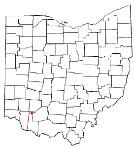
St. Martin is an unincorporated community and former village in Brown County, Ohio, United States. The community is served by the Fayetteville (45118) post office. The population was 200 at the 2020 census. In November 2011, voters chose to unincorporate St. Martin, and it now falls solely under the jurisdiction of Perry Township.
Neville is a village in Clermont County, Ohio, United States, along the Ohio River. The population was 87 at the 2020 census.
Addyston is a village in Miami Township, Hamilton County, Ohio, United States. Located along the Ohio River, it is a western suburb of the neighboring city of Cincinnati. The population was 927 at the 2020 census.
Amberley, locally known as Amberley Village, is a village in Hamilton County, Ohio, United States. The population was 3,840 at the 2020 census.
Cheviot is a city in west-central Hamilton County, Ohio, United States. It is a suburb of Cincinnati. The population was 8,658 at the 2020 census.
Cleves is a village in Miami Township, Hamilton County, Ohio, United States. Located along the Ohio River, it is a western suburb of Cincinnati. The population was 3,414 at the 2020 census.
Covedale is a census-designated place (CDP) in Green Township, Hamilton County, Ohio, United States. The population was 6,472 at the 2020 census. The CDP represents the part of the former village of Covedale that was not annexed by the city of Cincinnati in 1930.
Elmwood Place is a village in Hamilton County, Ohio, United States. The population was 2,087 at the 2020 census. Except for a small portion which touches neighboring St. Bernard, Elmwood Place is nearly surrounded by the city of Cincinnati.
Glendale is a village in Hamilton County, Ohio, United States. The population was 2,298 at the 2020 census. It is a northern suburb of Cincinnati, and is the site of the Glendale Historic District.
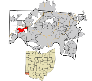
Grandview is a census-designated place (CDP) in Hamilton County, Ohio, United States. The population was 1,312 at the 2020 census.
Lockland is a village in Hamilton County, Ohio, United States. The population was 3,514 at the 2020 United States Census. Lockland is located in southwest Ohio, north of Cincinnati.
Mariemont is a village in eastern Hamilton County, Ohio, United States. The population was 3,518 at the 2020 census. A planned community in the Cincinnati metropolitan area, it includes two overlapping historic districts, the Village of Mariemont and Mariemont Historic District. In 2007, the Village of Mariemont was designated a National Historic Landmark.
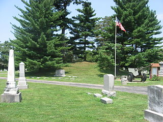
Newtown is a village in southeastern Hamilton County, Ohio, United States, near Cincinnati. The population was 2,702 at the 2020 census. Newtown was settled in 1792 and incorporated as a village in 1901.
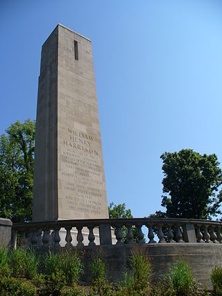
North Bend is a village in Miami Township, Hamilton County, Ohio, United States, along the Ohio River. It is a part of the Greater Cincinnati area. The population was 835 at the 2020 census.
Springdale is a city in Hamilton County, Ohio, United States. It is a suburb of Cincinnati. The population was 11,007 at the 2020 census.
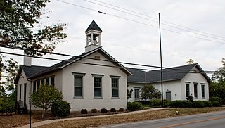
The Village of Indian Hill is a city in Hamilton County, Ohio, United States, and a suburb of the Greater Cincinnati area. The population was 6,087 at the 2020 census. Prior to 1970, Indian Hill was incorporated as a village, but under Ohio law became designated as a city once its population was verified as exceeding 5,000. The municipality then changed its name to add "Village" into the official name; legally it is "The City of The Village of Indian Hill". The Village of Indian Hill is served by the Indian Hill Exempted Village School District.
Bloomdale is a village in Wood County, Ohio, United States. The population was 665 at the 2020 census.
Elmwood is a village in Pierce County, Wisconsin, along the Eau Galle River. The population was 683 at the 2020 census, down from 817 at the 2010 census.
Sharonville is a city largely in Hamilton County in the U.S. state of Ohio. The population was 14,117 at the 2020 census.